Chest opened
+${chestReward.xp} XP
Explorer
NOUVEAU ×${chestReward.collectible.quantity}
tapez pour fermer
Chest locked

Open chests in the app

Around Us is built for your phone — chests unlock when you walk, explore and capture nearby places.

Enable Location

We need your location to show you interesting places around you

Discover nearby places

Find interesting locations and hidden gems around you

Precise directions

Get accurate directions and distances to places

Your location is never shared with other users. It's only used when you tap the location button.

Log in to your account

Start exploring — it's free

Trusted by 72,887 travelers worldwide

Continue with Google
Continue with Apple
or

We will send you a code to connect

By continuing, you accept our Terms and Conditions and our Privacy Policy

Check your inbox

We've sent a pincode in your inbox. Please enter the code below.

Hungo Pavi
Discussion Reviews Photo
1.5k Popularity

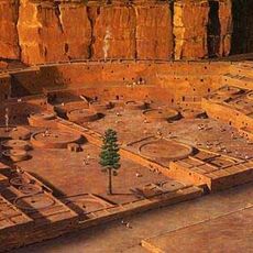
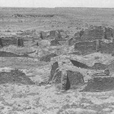
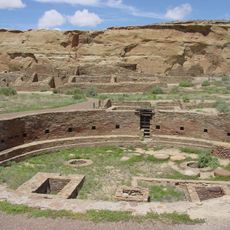
Hungo Pavi, Ancestral Puebloan archaeological site in Chaco Canyon, New Mexico.

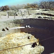
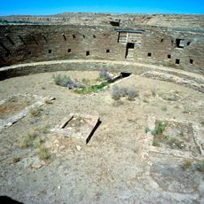
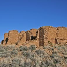
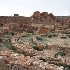
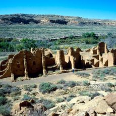
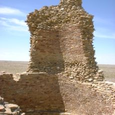
Hungo Pavi is an unexcavated great house containing roughly 150 rooms arranged in multiple stories around a central plaza and spanning about 872 feet in circumference. The visible walls show how the Ancestral Puebloans built with stacked stone in this dense residential configuration.

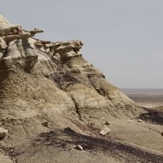
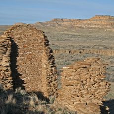
This great house was built by Ancestral Puebloans during the Classical Chacoan period and functioned as part of a broader trade and political network. The settlement thrived for several centuries before the region was eventually abandoned and structures became buried beneath sand and plants.

The large circular kiva at the center reveals how this place served as a gathering space for ceremonies and community life among the Puebloan people. You can still sense how the layout encouraged people to come together for shared activities.

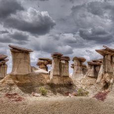
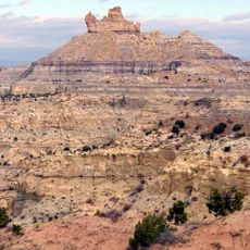
The ruins sit about two miles from the visitor center along the loop drive and take roughly thirty minutes to walk around on foot. The terrain is open and rolling, so wear sturdy shoes and bring water, especially during hotter times of day.

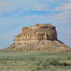
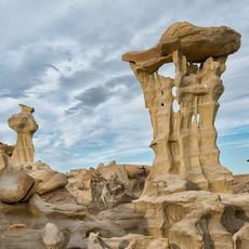
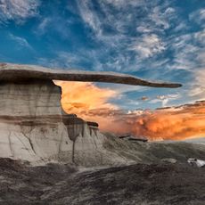
The structures remain largely covered by wind-blown sand and native plants, offering an authentic view of how archaeological sites appear before excavation begins. This unexcavated state gives you a genuine sense of how archaeologists encounter and study such places.

The community of curious travelers

AroundUs brings together thousands of curated places, local tips, and hidden gems, enriched daily by 60,000 contributors worldwide.

Start exploring
Location
GPS coordinates
36.05000,-107.93000
Latest update
December 14, 2025 14:45
Around this place
Chaco Culture National Historical Park
United States of America

Chaco Culture National Historical Park

3.8 km
Pueblo Bonito
United States of America

Pueblo Bonito

3.1 km
Bisti/De-Na-Zin Wilderness
United States of America

Bisti/De-Na-Zin Wilderness

33 km
Fort Wingate
United States of America

Fort Wingate

85.1 km
United States of America

Chetro Ketl

2.5 km
Trail of the Ancients Scenic Byway
United States of America

Trail of the Ancients Scenic Byway

3.8 km
Fajada Butte
United States of America

Fajada Butte

3.9 km
Kirtland Formation
United States of America

Kirtland Formation

82.4 km
Ah-shi-sle-pah Wilderness
United States of America

Ah-shi-sle-pah Wilderness

13 km
Salmon Ruins
United States of America

Salmon Ruins

73 km
Bluewater Lake State Park
United States of America

Bluewater Lake State Park

85.7 km
Casa Rinconada
United States of America

Casa Rinconada

2.8 km
Angel Peak Scenic Area
United States of America

Angel Peak Scenic Area

55.8 km
Una Vida
United States of America

Una Vida

2.4 km
Pueblo Alto
United States of America

Pueblo Alto

3.3 km
Pueblo del Arroyo
United States of America

Pueblo del Arroyo

3.5 km
United States of America

Apache Nugget Casino

61 km
Crow Canyon Archaeological District
United States of America

Crow Canyon Archaeological District

62.1 km
Kin Kletso
United States of America

Kin Kletso

4 km
Farmington Public Library
United States of America

Farmington Public Library

81.1 km
Kin Ya-ah
United States of America

Kin Ya-ah

44.8 km
Bowlin's Old Crater Trading Post
United States of America

Bowlin's Old Crater Trading Post

85.4 km
Farmington Historic Downtown Commercial District
United States of America

Farmington Historic Downtown Commercial District

79.5 km
Kin Bineola
United States of America

Kin Bineola

19.7 km
Roy T. Herman's Garage and Service Station
United States of America

Roy T. Herman's Garage and Service Station

77.4 km
Valley of Dreams
United States of America

Valley of Dreams

11.9 km
King of Wings
United States of America

King of Wings

14 km
Chaco Culture National Historical Park - Contiguous unit
United States of America

Chaco Culture National Historical Park - Contiguous unit

4 km
Show the full map
Reviews
Share your experience

No review yet

Discussions
Start a discussion...

No discussion yet

« Hungo Pavi - Ancestral Puebloan archaeological site in Chaco Canyon, New Mexico » is provided by Around Us (aroundus.com). Images and texts are derived from Wikimedia project under a Creative Commons license. You are allowed to copy, distribute, and modify copies of this page, under the conditions set by the license, as long as this note is clearly visible.

Discover hidden gems everywhere you go!

From secret cafés to breathtaking viewpoints, skip the crowded tourist spots and find places that match your style. Our app makes it easy with voice search, smart filtering, route optimization, and insider tips from travelers worldwide. Download now for the complete mobile experience.

Around Us App Screenshot

A unique approach to discovering new places

Le Figaro

All the places worth exploring

France Info

A tailor-made excursion in just a few clicks

20 Minutes

Around Us
Travel Guide & Maps
Download

Send to your phone

QR Code
1

Open the camera app on your mobile.

2

Point at the QR code with your camera. A notification will appear.

3

Tap the notification to open the link.