Ute Mountain Ute Reservation

Log in to your account

AroundUs is a community-driven map of interesting places, built by curious explorers like you. It grows with every review, story, and photo you share.
Connect to save your favorite spots, contribute locations, and create personalized routes.
Continue with Google
Continue with Apple
Continue with X
Continue with Facebook
Continue with email
By continuing, you accept our Terms and Conditions and our Privacy Policy
Create an account
Add to collection
Map
Suggest a change
Share

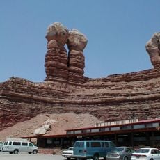
Ute Mountain Ute Reservation, Indigenous reservation in San Juan County, United States.

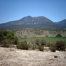
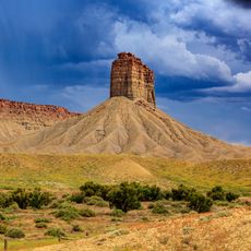
The Ute Mountain Ute Reservation is a tribal territory spanning over 550,000 acres across Colorado and New Mexico with elevations ranging between about 4,600 and 10,000 feet. The tribal headquarters in Towaoc, Colorado serves as the administrative center for the community living there.

The Weeminuche Band, original inhabitants of the Dolores River region in western Colorado, were relocated in the late 1800s and eventually established themselves in this reservation area. This relocation marked a turning point in the people's history.

Ute Mountain residents speak their own language and keep traditional hunting and gathering practices alive in their daily lives. These customs connect people to the land and its natural cycles.

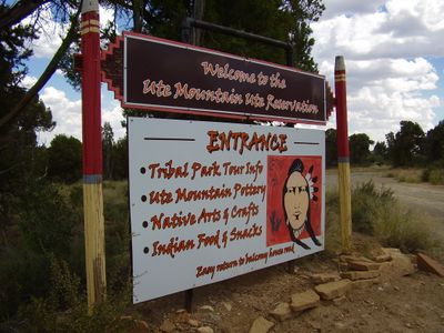
The territory is accessible only with permission, with visitors needing to check in at tribal office locations to explore the area. It is best to visit with local guides and learn about current conditions before going.

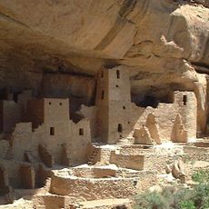
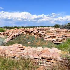
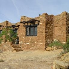
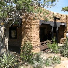
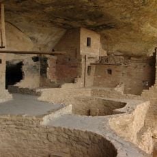
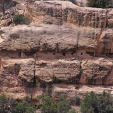
The adjoining Ute Mountain Tribal Park holds hundreds of preserved petroglyphs and remains of Ancestral Puebloan settlements that are explained by indigenous guides from the tribe itself. This approach allows visitors to learn the archaeological story directly from descendants of those who once lived on this land.

Location: San Juan County

GPS coordinates: 37.09317,-108.67819

Latest update: December 14, 2025 16:41

Photos
Around this place
Mesa Verde National Park
United States of America

Mesa Verde National Park

27.2 km
Four Corners Monument
United States of America

Four Corners Monument

34.3 km
Ute Mountain
United States of America

Ute Mountain

23.1 km
Comb Ridge
United States of America

Comb Ridge

93.5 km
Hesperus Mountain
United States of America

Hesperus Mountain

65.3 km
McPhee Reservoir
United States of America

McPhee Reservoir

54.7 km
Mancos State Park
United States of America

Mancos State Park

49.8 km
Lowry Pueblo
United States of America

Lowry Pueblo

58.7 km
Edge of the Cedars State Park Museum
United States of America

Edge of the Cedars State Park Museum

93.5 km
Anasazi Heritage Center
United States of America

Anasazi Heritage Center

44.2 km
Alkali Ridge
United States of America

Alkali Ridge

96.2 km
Chimney Rock
United States of America

Chimney Rock

4 km
Mesa Verde Administrative District
United States of America

Mesa Verde Administrative District

19.7 km
Chapin Mesa Archeological Museum
United States of America

Chapin Mesa Archeological Museum

19.7 km
Swallow's Nest
United States of America

Swallow's Nest

91.8 km
Canyons of the Ancients Visitor Center and Museum
United States of America

Canyons of the Ancients Visitor Center and Museum

44.2 km
Wrightsman House
United States of America

Wrightsman House

44.4 km
Balcony House
United States of America

Balcony House

20.4 km
House of Many Windows
United States of America

House of Many Windows

19.5 km
Lemuel H. Redd Jr. House
United States of America

Lemuel H. Redd Jr. House

80.6 km
Old Cortez High School
United States of America

Old Cortez High School

29.5 km
Montezuma Valley Irrigation Company Flume No. 6
United States of America

Montezuma Valley Irrigation Company Flume No. 6

32.3 km
Montezuma Valley National Bank and Store Building
United States of America

Montezuma Valley National Bank and Store Building

29.6 km
Mancos Theatre
United States of America

Mancos Theatre

44.4 km
Bluff Historic District
United States of America

Bluff Historic District

80.4 km
Bauer Bank Block
United States of America

Bauer Bank Block

44.4 km
Mancos High School
United States of America

Mancos High School

44.3 km
Joseph Frederick Adams House
United States of America

Joseph Frederick Adams House

80.2 km
Show the full map
Reviews

Visited this place? Tap the stars to rate it and share your experience / photos with the community! Try now! You can cancel it anytime.

« Ute Mountain Ute Reservation - Indigenous reservation in San Juan County, United States » is provided by Around Us (aroundus.com). Images and texts are derived from Wikimedia project under a Creative Commons license. You are allowed to copy, distribute, and modify copies of this page, under the conditions set by the license, as long as this note is clearly visible.

Discover hidden gems everywhere you go!

From secret cafés to breathtaking viewpoints, skip the crowded tourist spots and find places that match your style. Our app makes it easy with voice search, smart filtering, route optimization, and insider tips from travelers worldwide. Download now for the complete mobile experience.

Around Us App Screenshot

A unique approach to discovering new places

Le Figaro

All the places worth exploring

France Info

A tailor-made excursion in just a few clicks

20 Minutes