Chest opened
+${chestReward.xp} XP
Explorer
NOUVEAU ×${chestReward.collectible.quantity}
tapez pour fermer
Chest locked

Open chests in the app

Around Us is built for your phone — chests unlock when you walk, explore and capture nearby places.

Enable Location

We need your location to show you interesting places around you

Discover nearby places

Find interesting locations and hidden gems around you

Precise directions

Get accurate directions and distances to places

Your location is never shared with other users. It's only used when you tap the location button.

Log in to your account

Start exploring — it's free

Trusted by 72,885 travelers worldwide

Continue with Google
Continue with Apple
or

We will send you a code to connect

By continuing, you accept our Terms and Conditions and our Privacy Policy

Check your inbox

We've sent a pincode in your inbox. Please enter the code below.

Nebraska Territory
Discussion Reviews Photo
36.9k Popularity

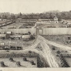
Nebraska Territory, U.S. Territory in Great Plains region, United States

The Nebraska Territory was a vast region in the middle of North America, stretching from the 40th parallel to British North America. It covered present-day Nebraska, Montana, North Dakota, South Dakota, and Wyoming, with Omaha serving as the territorial capital.

The territory was created in 1854 by the Kansas-Nebraska Act, allowing settlers to decide the slavery question through popular vote. This law sparked intense conflict that helped birth the Republican Party and weakened the Whig Party.

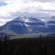
Native American peoples had established trade routes and settlements across these lands long before European Americans arrived. The rivers and plains shaped how different tribes moved through and used the territory.

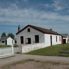
Today, visitors can explore this history through museums and historical sites scattered across the region. The main centers of information are located in the larger cities, particularly Omaha, which preserves records and artifacts from the territorial period.

This territory witnessed the violent "Bleeding Kansas" conflicts, where pro- and anti-slavery forces clashed over control of the region's future. These battles on the ground foreshadowed the larger Civil War that would follow.

The community of curious travelers

AroundUs brings together thousands of curated places, local tips, and hidden gems, enriched daily by 60,000 contributors worldwide.

Start exploring
Inception
1854
Capital city
Omaha
GPS coordinates
41.00000,-110.05000
Latest update
December 17, 2025 10:37
Around this place
King's Peak
United States of America

King's Peak

36.9 km
Fort Bridger
United States of America

Fort Bridger

45.5 km
High Uintas Wilderness
United States of America

High Uintas Wilderness

47.6 km
Flaming Gorge Reservoir
United States of America

Flaming Gorge Reservoir

45.6 km
Flaming Gorge Dam
United States of America

Flaming Gorge Dam

53.7 km
Flaming Gorge National Recreation Area
United States of America

Flaming Gorge National Recreation Area

53.7 km
Wasatch-Cache National Forest
United States of America

Wasatch-Cache National Forest

39.4 km
Red Fleet State Park
United States of America

Red Fleet State Park

69.8 km
Lone Rock
United States of America

Lone Rock

38.2 km
Steinaker State Park
United States of America

Steinaker State Park

69.3 km
Upper Stillwater Reservoir
United States of America

Upper Stillwater Reservoir

72.9 km
Fort Supply
United States of America

Fort Supply

37.5 km
Piedmont Charcoal Kilns
United States of America

Piedmont Charcoal Kilns

53.6 km
Granger Stage Station State Historic Site
United States of America

Granger Stage Station State Historic Site

66.1 km
Mount Agassiz
United States of America

Mount Agassiz

72.7 km
Ute Mountain Fire Tower
United States of America

Ute Mountain Fire Tower

25.9 km
United States of America

South Kings Peak

38 km
Mount Emmons
United States of America

Mount Emmons

38.5 km
ERT Bridge over Black's Fork
United States of America

ERT Bridge over Black's Fork

44.1 km
Swett Ranch
United States of America

Swett Ranch

49.2 km
Mount Powell
United States of America

Mount Powell

38.8 km
St. Paul's Episcopal Church and Lodge
United States of America

St. Paul's Episcopal Church and Lodge

74.7 km
Gibson-Sowards House
United States of America

Gibson-Sowards House

70.6 km
Vernal Tithing Office
United States of America

Vernal Tithing Office

74.7 km
Badlands Bowling Bar and Grill
United States of America

Badlands Bowling Bar and Grill

38.9 km
Moonshine Arch
United States of America

Moonshine Arch

65.2 km
Kweeyahgut Peak
United States of America

Kweeyahgut Peak

60.1 km
Howe Flume
United States of America

Howe Flume

68.5 km
Show the full map
Reviews
Share your experience

No review yet

Discussions
Start a discussion...

No discussion yet

« Nebraska Territory - U.S. Territory in Great Plains region, United States » is provided by Around Us (aroundus.com). Images and texts are derived from Wikimedia project under a Creative Commons license. You are allowed to copy, distribute, and modify copies of this page, under the conditions set by the license, as long as this note is clearly visible.

Discover hidden gems everywhere you go!

From secret cafés to breathtaking viewpoints, skip the crowded tourist spots and find places that match your style. Our app makes it easy with voice search, smart filtering, route optimization, and insider tips from travelers worldwide. Download now for the complete mobile experience.

Around Us App Screenshot

A unique approach to discovering new places

Le Figaro

All the places worth exploring

France Info

A tailor-made excursion in just a few clicks

20 Minutes

Around Us
Travel Guide & Maps
Download

Send to your phone

QR Code
1

Open the camera app on your mobile.

2

Point at the QR code with your camera. A notification will appear.

3

Tap the notification to open the link.