Columbia County

Log in to your account

AroundUs is a community-driven map of interesting places, built by curious explorers like you. It grows with every review, story, and photo you share.
Connect to save your favorite spots, contribute locations, and create personalized routes.
By continuing, you accept our Terms and Conditions and our Privacy Policy
Add to collection
Map
Suggest a change
Share

Columbia County, County administrative division in Washington, United States

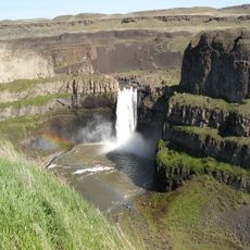
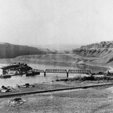
Columbia County is an administrative division in southeastern Washington with broad plains dominated by farming operations and rural settlements. The landscape stretches between river valleys and elevated terrain, creating a patchwork of agricultural land and small towns.

The territory was established as an independent county in 1875, carved from a larger regional division during westward expansion. This separation enabled local governance and reflected the growing need for administrative organization in rural areas.

Local farmers and ranchers shape daily life through seasonal agricultural practices that define the region's rhythm and community gatherings. These traditions connect residents to the land and to each other across generations.

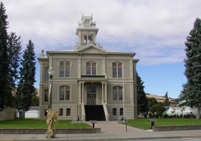
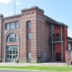
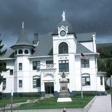
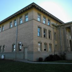
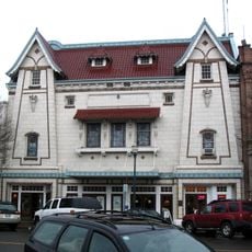
Most county services operate from the seat of government, where court buildings and administrative offices handle local affairs. Visitors should expect a rural setting with services spread across several small towns, requiring a car to navigate the region.

Extensive wheat fields blanket the area and shift color with the seasons, creating visual patterns that are striking when viewed from higher elevations. This agricultural feature gives the region a distinctive appearance that changes throughout the year.

GPS coordinates: 46.29477,-117.91747

Latest update: December 7, 2025 19:30

Photos
Around this place
Show the full map
Palouse Falls
United States of America

Palouse Falls

47.3 km
Marmes Rockshelter
United States of America

Marmes Rockshelter

41.8 km
Fort Walla Walla
United States of America

Fort Walla Walla

43.7 km
Palouse Falls State Park
United States of America

Palouse Falls State Park

47.6 km
Lower Granite Dam
United States of America

Lower Granite Dam

55.4 km
Little Goose Dam
United States of America

Little Goose Dam

33.6 km
Wenaha–Tucannon Wilderness
United States of America

Wenaha–Tucannon Wilderness

36.2 km
Lower Monumental Dam
United States of America

Lower Monumental Dam

56.1 km
Jubilee Lake
United States of America

Jubilee Lake

51.7 km
Snake River Bridge
United States of America

Snake River Bridge

40.2 km
Borleske Stadium
United States of America

Borleske Stadium

40.3 km
Wenaha Wildlife Area
United States of America

Wenaha Wildlife Area

53.1 km
Joso High Bridge
United States of America

Joso High Bridge

40.9 km
Kirkman House
United States of America

Kirkman House

41 km
Riparia Bridge
United States of America

Riparia Bridge

33.9 km
Electric Light Works Building
United States of America

Electric Light Works Building

41.7 km
Langdon Lake
United States of America

Langdon Lake

59 km
Interior Grain Tramway
United States of America

Interior Grain Tramway

58.2 km
Garfield County Courthouse
United States of America

Garfield County Courthouse

31.5 km
Indian Timothy Memorial Bridge
United States of America

Indian Timothy Memorial Bridge

55.7 km
Grande Ronde River Bridge
United States of America

Grande Ronde River Bridge

58.5 km
Bank of Starbuck
United States of America

Bank of Starbuck

29.7 km
Preston Hall
United States of America

Preston Hall

18.4 km
Lyons Ferry State Park
United States of America

Lyons Ferry State Park

43.1 km
Hoodoo Ridge Lookout
United States of America

Hoodoo Ridge Lookout

45.3 km
Walla Walla Valley Traction Company Car Barn
United States of America

Walla Walla Valley Traction Company Car Barn

42.2 km
Children's Museum of Walla Walla
United States of America

Children's Museum of Walla Walla

43.2 km
Liberty Theatre
United States of America

Liberty Theatre

41.1 km
Show the full map
Reviews

Visited this place? Tap the stars to rate it and share your experience / photos with the community! Try now! You can cancel it anytime.

« Columbia County - County administrative division in Washington, United States » is provided by Around Us (aroundus.com). Images and texts are derived from Wikimedia project under a Creative Commons license. You are allowed to copy, distribute, and modify copies of this page, under the conditions set by the license, as long as this note is clearly visible.

Discover hidden gems everywhere you go!

From secret cafés to breathtaking viewpoints, skip the crowded tourist spots and find places that match your style. Our app makes it easy with voice search, smart filtering, route optimization, and insider tips from travelers worldwide. Download now for the complete mobile experience.

Around Us App Screenshot

A unique approach to discovering new places

Le Figaro

All the places worth exploring

France Info

A tailor-made excursion in just a few clicks

20 Minutes