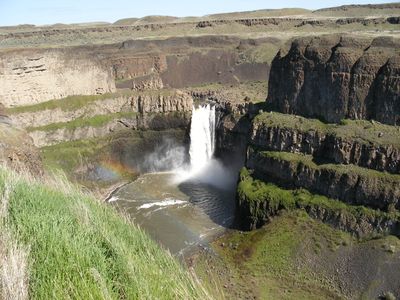
Palouse Falls State Park, State park with 200-foot waterfall in Washtucna, US.
Palouse Falls is a waterfall where the Palouse River drops through a narrow cataract, plunging about 200 feet into a basin ringed by distinctive columnar basalt rock formations. The landscape around it shows the raw geological forces that shaped this part of Washington.
The falls took shape during the Ice Age Floods more than 13,000 years ago and remain one of the last active waterfalls from that era. Those ancient flood events carved the landscape we see today.
The falls take their name from the Palouse people who inhabited the region long ago. Visitors can experience how the waterfall has become a symbol of regional pride, especially since local students pushed for it to be named Washington's official state waterfall.
Three viewpoints around the park give you different angles to see the waterfall: one near the parking area, an interpretive walking path, and the elevated Fryxell Overlook. Wear sturdy shoes and dress for changing weather, as conditions can shift significantly throughout the year.
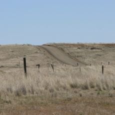
The park sits in a remote location with no cell phone service, creating a genuine escape from the digital world. This isolation means visitors can focus entirely on the natural landscape without distraction.
The community of curious travelers
AroundUs brings together thousands of curated places, local tips, and hidden gems, enriched daily by 60,000 contributors worldwide.