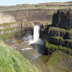
Palouse Falls, Waterfall in Franklin County, United States.
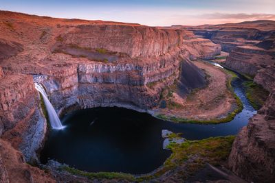
Palouse Falls is a waterfall in Franklin County, Washington, where the river drops 198 feet (60 meters) into a narrow canyon carved from dark basalt rock. The water forms a single vertical sheet that crashes into a shallow pool surrounded by steep walls rising on all sides.
The canyon formed around 13,000 years ago when massive ice age floods from glacial Lake Missoula broke through and carved deep channels into the Columbia River Basalt. These repeated floods shaped the current gorge and left the tall walls that frame the river today.
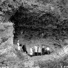
The name Aput Aput, meaning Falling Water, comes from the Palouse people who lived near the river and knew this drop well before settlers arrived. Today the site draws photographers who wait for morning light to catch the spray rising from the pool below.
The park offers paved paths leading to several overlook points above the canyon where you can see the drop clearly without a steep climb. Restrooms and picnic tables are open year-round, though summer afternoons can get very hot in this part of eastern Washington.
In 2014, a group of elementary school students ran a campaign to make this the official state waterfall of Washington. The students wrote letters to lawmakers and convinced them to support the proposal.
The community of curious travelers
AroundUs brings together thousands of curated places, local tips, and hidden gems, enriched daily by 60,000 contributors worldwide.