Franklin County

Log in to your account

AroundUs is a community-driven map of interesting places, built by curious explorers like you. It grows with every review, story, and photo you share.
Connect to save your favorite spots, contribute locations, and create personalized routes.
By continuing, you accept our Terms and Conditions and our Privacy Policy
Add to collection
Map
Suggest a change
Share

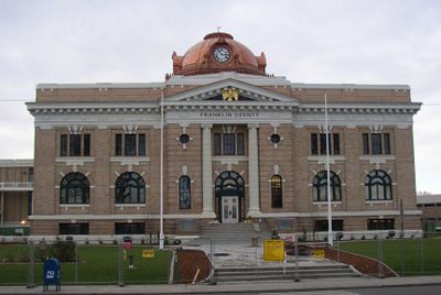
Franklin County, Administrative division in Washington State, US

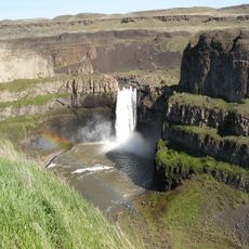
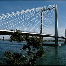
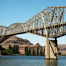
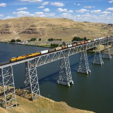
Franklin County extends across eastern Washington, defined by farmland and river boundaries where the Columbia River and Snake River meet the terrain. The landscape combines agricultural areas with natural features that form the county's borders.

The county was established in 1883 and named after Benjamin Franklin, a founding figure in American history. Its growth during the 20th century was driven largely by agricultural expansion that transformed the region.

The county maintains close ties with local farming communities through regular meetings and agricultural support programs that shape daily life. These connections show how central farming remains to the region's identity.

Visitors can drive through the region to see farmland and natural features that are easily accessible throughout the area. The best time to explore is from spring through fall, when weather is mild and fields are in active use.

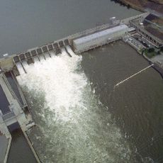
The area contains an extensive network of irrigation channels that transforms the dry landscape into productive farmland. These engineered water systems allow intensive farming in a region that is naturally quite arid.

Location: Washington

Inception: 1883

Capital city: Pasco

Shares border with: Adams County, Whitman County, Walla Walla County, Columbia County, Benton County, Grant County

Website: http://co.franklin.wa.us

GPS coordinates: 46.54000,-118.90000

Latest update: December 7, 2025 10:06

Photos
Around this place
Show the full map
Pacific Northwest National Laboratory
United States of America

Pacific Northwest National Laboratory

36.2 km
Palouse Falls
United States of America

Palouse Falls

53.5 km
Gold Coast Historic District
United States of America

Gold Coast Historic District

39.1 km
Marmes Rockshelter
United States of America

Marmes Rockshelter

54 km
Palouse Falls State Park
United States of America

Palouse Falls State Park

53.6 km
Ice Harbor Dam
United States of America

Ice Harbor Dam

32.4 km
Cable Bridge
United States of America

Cable Bridge

39.1 km
Columbia Plateau State Park Trail
United States of America

Columbia Plateau State Park Trail

28.9 km
Blue Bridge
United States of America

Blue Bridge

39.5 km
Columbia River Washington Temple
United States of America

Columbia River Washington Temple

45.2 km
Sacajawea State Park
United States of America

Sacajawea State Park

39.4 km
Juniper Dunes Wilderness
United States of America

Juniper Dunes Wilderness

16.9 km
Bateman Island
United States of America

Bateman Island

41.3 km
Lower Monumental Dam
United States of America

Lower Monumental Dam

27.9 km
Clover Island
United States of America

Clover Island

39.4 km
Snake River Bridge
United States of America

Snake River Bridge

52.4 km
Interstate 182 Bridge
United States of America

Interstate 182 Bridge

40.6 km
REACH Museum
United States of America

REACH Museum

41.7 km
Badger Mountain Centennial Preserve
United States of America

Badger Mountain Centennial Preserve

46.7 km
Joso High Bridge
United States of America

Joso High Bridge

51.8 km
Columbia River Exhibition of History, Science, and Technology
United States of America

Columbia River Exhibition of History, Science, and Technology

41.2 km
Clover Island Light
United States of America

Clover Island Light

39.4 km
Lyons Ferry State Park
United States of America

Lyons Ferry State Park

53.6 km
Franklin County Courthouse
United States of America

Franklin County Courthouse

36.9 km
2800 Polar Way
United States of America

2800 Polar Way

38.5 km
USS Triton Submarine
United States of America

USS Triton Submarine

35.5 km
West Richland Golf Course
United States of America

West Richland Golf Course

42.5 km
Richland Theater
United States of America

Richland Theater

41.2 km
Show the full map
Reviews

Visited this place? Tap the stars to rate it and share your experience / photos with the community! Try now! You can cancel it anytime.

Administrative divisions
« Franklin County - Administrative division in Washington State, US » is provided by Around Us (aroundus.com). Images and texts are derived from Wikimedia project under a Creative Commons license. You are allowed to copy, distribute, and modify copies of this page, under the conditions set by the license, as long as this note is clearly visible.

Discover hidden gems everywhere you go!

From secret cafés to breathtaking viewpoints, skip the crowded tourist spots and find places that match your style. Our app makes it easy with voice search, smart filtering, route optimization, and insider tips from travelers worldwide. Download now for the complete mobile experience.

Around Us App Screenshot

A unique approach to discovering new places

Le Figaro

All the places worth exploring

France Info

A tailor-made excursion in just a few clicks

20 Minutes