Enable Location

We need your location to show you interesting places around you

Discover nearby places

Find interesting locations and hidden gems around you

Precise directions

Get accurate directions and distances to places

Your location is never shared with other users. It's only used when you tap the location button.

Tobacco Root Mountains

Log in to your account

Start exploring — it's free

Trusted by 68,046 travelers worldwide

Continue with Google
Continue with Apple
or

We will send you a code to connect

By continuing, you accept our Terms and Conditions and our Privacy Policy

Check your inbox

We've sent a pincode in your inbox. Please enter the code below.

Tobacco Root Mountains
Discussion Reviews 1 Photos
14.7k Popularity

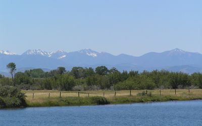
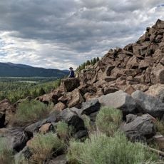
Tobacco Root Mountains, Mountain range in southwestern Montana, United States.

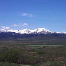
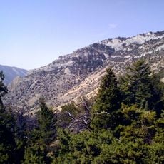
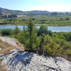
The Tobacco Root Mountains form a mountain range in southwestern Montana with numerous peaks and alpine lakes connected by hiking trails. The terrain alternates between open slopes, forests, and clear mountain lakes that are visible from the surrounding valleys.

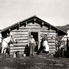
The region attracted treasure seekers during the gold rush of the 1800s who searched for gold deposits in the mountains. These activities left marks on the landscape and shaped early settlement in the surrounding valleys.

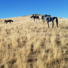
Shoshone and Bannock peoples used these mountains as hunting grounds for generations and gathered plants here for daily needs. The landscape still shows signs of this long connection between people and the land.

The best time for hiking is from late spring through early fall, when trails are free from snow and easy to walk. Visitors should prepare for changeable mountain weather and arrive properly equipped.

The mountains owe their name to the plant roots that native peoples used as a tobacco substitute, yet the original naming story has faded from common knowledge. This linguistic connection links oral history with modern geography.

The community of curious travelers

AroundUs brings together thousands of curated places, local tips, and hidden gems, enriched daily by 60,000 contributors worldwide.

Start exploring
Location
GPS coordinates
45.56000,-111.98000
Latest update
December 7, 2025 20:20
Around this place
Our Lady of the Rockies
United States of America

Our Lady of the Rockies

60.9 km
Lewis and Clark Caverns
United States of America

Lewis and Clark Caverns

30.9 km
Missouri Headwaters State Park
United States of America

Missouri Headwaters State Park

54.9 km
Columbia Gardens
United States of America

Columbia Gardens

62.3 km
Madison Buffalo Jump State Park
United States of America

Madison Buffalo Jump State Park

48 km
Lee Metcalf Wilderness
United States of America

Lee Metcalf Wilderness

63.1 km
Big Sky Resort
United States of America

Big Sky Resort

55.3 km
Beaverhead Rock
United States of America

Beaverhead Rock

42.1 km
Doncaster Round Barn
United States of America

Doncaster Round Barn

26 km
Virginia City Historic District
United States of America

Virginia City Historic District

30.1 km
Lewis & Clark Caverns State Park

Lewis & Clark Caverns State Park

31.9 km
Mount Jefferson
United States of America

Mount Jefferson

5.3 km
Socialist Hall
United States of America

Socialist Hall

63.6 km
Crail Ranch Buildings
United States of America

Crail Ranch Buildings

62.5 km
St. Mary of the Assumption Church
United States of America

St. Mary of the Assumption Church

25 km
Martin Barrett House
United States of America

Martin Barrett House

64.6 km
Adams Block
United States of America

Adams Block

49.9 km
Ferris-Hermsmeyer-Fenton Ranch
United States of America

Ferris-Hermsmeyer-Fenton Ranch

23.3 km
Ringing Rocks
United States of America

Ringing Rocks

47.2 km
Lewis and Clark Caverns State Park
United States of America

Lewis and Clark Caverns State Park

31.8 km
Nevada City Museum Entrance & Music Hall
United States of America

Nevada City Museum Entrance & Music Hall

28.2 km
Ling Rock - Ferry Crossing Headwaters State Park
United States of America

Ling Rock - Ferry Crossing Headwaters State Park

56.3 km
Star Theatre
United States of America

Star Theatre

35.7 km
Bleu Horses
United States of America

Bleu Horses

55.4 km
Ruby Theatre
United States of America

Ruby Theatre

49 km
Cave Visitor Center
United States of America

Cave Visitor Center

32.2 km
Beaverhead Rock State Park
United States of America

Beaverhead Rock State Park

42.1 km
Lewis and Clark Caverns Historic District
United States of America

Lewis and Clark Caverns Historic District

32.2 km
Show the full map
Reviews
Share your experience

No review yet

Discussions
Start a discussion...

No discussion yet

« Tobacco Root Mountains - Mountain range in southwestern Montana, United States » is provided by Around Us (aroundus.com). Images and texts are derived from Wikimedia project under a Creative Commons license. You are allowed to copy, distribute, and modify copies of this page, under the conditions set by the license, as long as this note is clearly visible.

Discover hidden gems everywhere you go!

From secret cafés to breathtaking viewpoints, skip the crowded tourist spots and find places that match your style. Our app makes it easy with voice search, smart filtering, route optimization, and insider tips from travelers worldwide. Download now for the complete mobile experience.

Around Us App Screenshot

A unique approach to discovering new places

Le Figaro

All the places worth exploring

France Info

A tailor-made excursion in just a few clicks

20 Minutes

Around Us
Travel Guide & Maps
Download

Send to your phone

QR Code
1

Open the camera app on your mobile.

2

Point at the QR code with your camera. A notification will appear.

3

Tap the notification to open the link.