Deer Lodge County

Log in to your account

AroundUs is a community-driven map of interesting places, built by curious explorers like you. It grows with every review, story, and photo you share.
Connect to save your favorite spots, contribute locations, and create personalized routes.
Continue with Google
Continue with Apple
Continue with X
Continue with Facebook
Continue with email
By continuing, you accept our Terms and Conditions and our Privacy Policy
Create an account
Add to collection
Map
Suggest a change
Share

Deer Lodge County, County in Montana, United States.

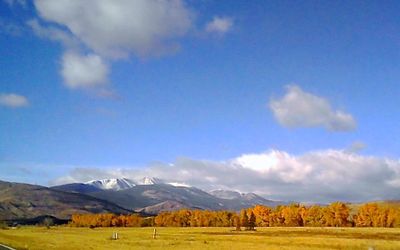
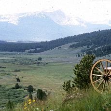
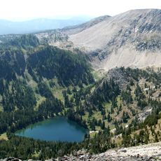
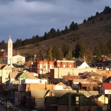
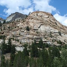
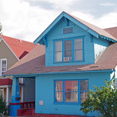
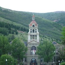
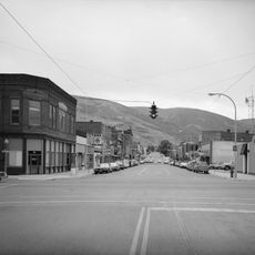
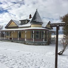
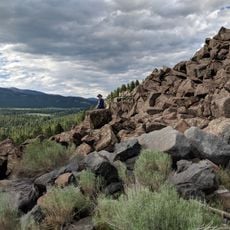
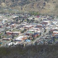
Deer Lodge County is located in southwestern Montana and covers roughly 1,900 square kilometers of mountainous terrain with lakes and forests. The area includes several small towns and communities scattered throughout this landscape.

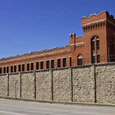
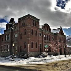
The county was established in 1865 as one of Montana's original administrative divisions. It later merged with the city of Anaconda in 1977 to create a unified government structure.

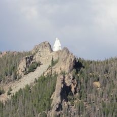
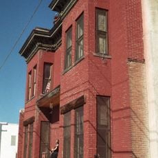
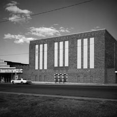
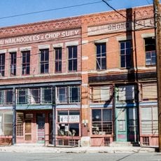
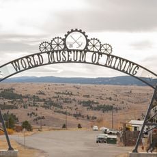
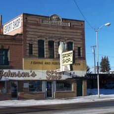
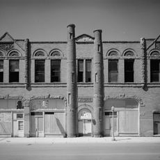
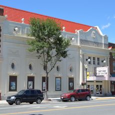
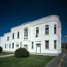
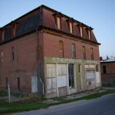
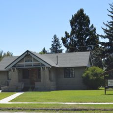
The county reflects a blend of mining heritage and rural mountain culture that shapes how residents use the landscape today. Visitors notice this influence in local businesses, community gathering places, and the way people interact with the outdoors.

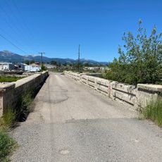
Several highways connect the different areas of the county, with Interstate 90 serving as a main route through the region. A car is the best way to explore the county and reach its lakes, towns, and surrounding areas.

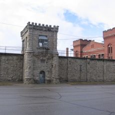
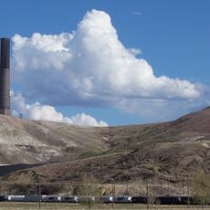
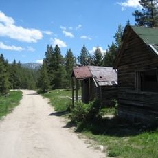
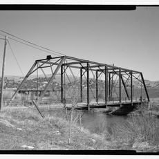
The area was shaped by copper mining for many decades, and traces of this industry remain visible in the landscape and old mine sites. This mining legacy continues to influence how residents connect with the region's history.

Location: Montana

Inception: 1865

Capital city: Anaconda

Shares border with: Powell County, Beaverhead County, Granite County, Silver Bow County, Ravalli County, Jefferson County

Website: http://anacondadeerlodge.mt.gov

GPS coordinates: 46.12062,-112.98746

Latest update: December 14, 2025 20:25

Photos
Around this place
Our Lady of the Rockies
United States of America

Our Lady of the Rockies

43.9 km
Montana State Prison
United States of America

Montana State Prison

32.5 km
Anaconda Smelter Stack
United States of America

Anaconda Smelter Stack

5.8 km
Dumas Brothel
United States of America

Dumas Brothel

37.1 km
Big Hole National Battlefield
United States of America

Big Hole National Battlefield

73.2 km
Columbia Gardens
United States of America

Columbia Gardens

42.4 km
Anaconda-Pintler Wilderness
United States of America

Anaconda-Pintler Wilderness

41.6 km
Washoe Theater
United States of America

Washoe Theater

2.8 km
Mai Wah Museum
United States of America

Mai Wah Museum

37.3 km
Butte-Anaconda Historic District
United States of America

Butte-Anaconda Historic District

32.8 km
World Museum of Mining
United States of America

World Museum of Mining

34.9 km
Frontier Montana Museum
United States of America

Frontier Montana Museum

35.9 km
Socialist Hall
United States of America

Socialist Hall

39.3 km
Ancient Order of Hibernians Hall
United States of America

Ancient Order of Hibernians Hall

3.2 km
Lost Creek State Park
United States of America

Lost Creek State Park

9.3 km
Rialto Theatre
United States of America

Rialto Theatre

36.7 km
Burton K. Wheeler House
United States of America

Burton K. Wheeler House

38.3 km
Anaconda City Hall
United States of America

Anaconda City Hall

3.2 km
Deer Lodge County Courthouse
United States of America

Deer Lodge County Courthouse

2.5 km
Butte, Anaconda and Pacific Railway Historic District
United States of America

Butte, Anaconda and Pacific Railway Historic District

20.9 km
Philipsburg Historic District (Philipsburg, Montana)
United States of America

Philipsburg Historic District (Philipsburg, Montana)

33.5 km
Anaconda Commercial Historic District
United States of America

Anaconda Commercial Historic District

3.1 km
Deer Lodge American Women's League Chapter House
United States of America

Deer Lodge American Women's League Chapter House

36.8 km
M.E. Doe House
United States of America

M.E. Doe House

33 km
Ringing Rocks
United States of America

Ringing Rocks

61.1 km
Conley Street Bridge
United States of America

Conley Street Bridge

35.7 km
Granite State Park
United States of America

Granite State Park

29.5 km
Garrison Bridge
United States of America

Garrison Bridge

46.5 km
Show the full map
Reviews

Visited this place? Tap the stars to rate it and share your experience / photos with the community! Try now! You can cancel it anytime.

Administrative divisions
« Deer Lodge County - County in Montana, United States » is provided by Around Us (aroundus.com). Images and texts are derived from Wikimedia project under a Creative Commons license. You are allowed to copy, distribute, and modify copies of this page, under the conditions set by the license, as long as this note is clearly visible.

Discover hidden gems everywhere you go!

From secret cafés to breathtaking viewpoints, skip the crowded tourist spots and find places that match your style. Our app makes it easy with voice search, smart filtering, route optimization, and insider tips from travelers worldwide. Download now for the complete mobile experience.

Around Us App Screenshot

A unique approach to discovering new places

Le Figaro

All the places worth exploring

France Info

A tailor-made excursion in just a few clicks

20 Minutes