Chest opened
+${chestReward.xp} XP
Explorer
NOUVEAU ×${chestReward.collectible.quantity}
tapez pour fermer
Chest locked

Open chests in the app

Around Us is built for your phone — chests unlock when you walk, explore and capture nearby places.

Enable Location

We need your location to show you interesting places around you

Discover nearby places

Find interesting locations and hidden gems around you

Precise directions

Get accurate directions and distances to places

Your location is never shared with other users. It's only used when you tap the location button.

Spokane River

Log in to your account

Start exploring — it's free

Trusted by 72,981 travelers worldwide

Continue with Google
Continue with Apple
or

We will send you a code to connect

By continuing, you accept our Terms and Conditions and our Privacy Policy

Check your inbox

We've sent a pincode in your inbox. Please enter the code below.

Spokane River
Discussion Reviews 1 Photos
17.5k Popularity

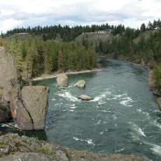
Spokane River, River system across northern Idaho and eastern Washington, United States.

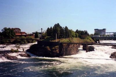
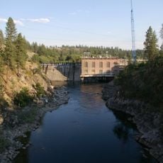
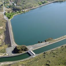
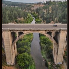
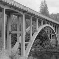
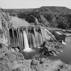
The Spokane River is a waterway that flows approximately 111 miles from a large lake in Idaho through eastern Washington until it meets another major river. The river moves through a mix of woodland and open areas, with several constructed waterfall features along its path.

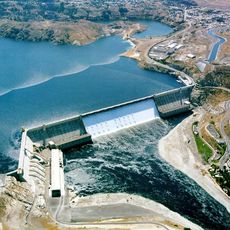
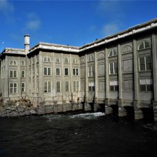
Indigenous groups established communities along the riverbanks long before Europeans arrived in the region. Early 19th-century explorers documented the area, eventually leading to settlement expansion and the construction of dams that changed the water flow.

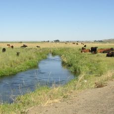
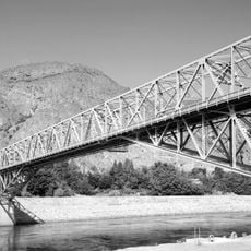
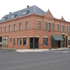
The river serves as a gathering place for people who fish, paddle, and walk its banks regularly. Local parks line the water, connecting neighborhoods and providing space where residents spend their free time.

The water is accessible from many points along its path for fishing, paddling, or walking. Wearing sturdy footwear makes sense since the banks vary in texture and slope depending on the section.

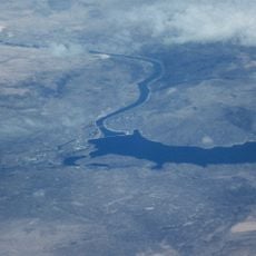
The water feeds a massive underground aquifer that supplies drinking water to hundreds of thousands of people across the region. This hidden role reveals how the river supports communities far beyond what visitors typically notice on its surface.

The community of curious travelers

AroundUs brings together thousands of curated places, local tips, and hidden gems, enriched daily by 60,000 contributors worldwide.

Start exploring
Location
Location
GPS coordinates
47.89390,-118.33400
Latest update
December 7, 2025 19:24
Around this place
Grand Coulee Dam
United States of America

Grand Coulee Dam

48.8 km
Banks Lake
United States of America

Banks Lake

63.2 km
Franklin D. Roosevelt Lake
United States of America

Franklin D. Roosevelt Lake

48.7 km
Joe Albi Stadium
United States of America

Joe Albi Stadium

67 km
Steamboat Rock State Park
United States of America

Steamboat Rock State Park

59.8 km
Riverside State Park
United States of America

Riverside State Park

61.6 km
Crab Creek
United States of America

Crab Creek

68.6 km
Patsy Clark Mansion
United States of America

Patsy Clark Mansion

71.7 km
Northwest Museum of Arts and Culture
United States of America

Northwest Museum of Arts and Culture

71.5 km
Fort George Wright
United States of America

Fort George Wright

68.7 km
Fort Spokane
United States of America

Fort Spokane

3 km
Nine Mile Dam
United States of America

Nine Mile Dam

60.3 km
Wonderland Family Fun Center
United States of America

Wonderland Family Fun Center

70.7 km
North Dam
United States of America

North Dam

51.2 km
Grand Coulee Bridge
United States of America

Grand Coulee Bridge

49 km
Mary Queen of Heaven Roman Catholic Church
United States of America

Mary Queen of Heaven Roman Catholic Church

71.1 km
Garland Theater
United States of America

Garland Theater

71.5 km
Little Falls Hydroelectric Power Plant
United States of America

Little Falls Hydroelectric Power Plant

31.9 km
Grace Baptist Church
United States of America

Grace Baptist Church

72 km
Sunset Boulevard Bridge
United States of America

Sunset Boulevard Bridge

71.7 km
Spokane River Bridge at Long Lake Dam
United States of America

Spokane River Bridge at Long Lake Dam

36.6 km
Harrington Bank Block & Opera House
United States of America

Harrington Bank Block & Opera House

46.5 km
Amman
United States of America

Amman

72.3 km
John A. Finch Memorial Nurses Home
United States of America

John A. Finch Memorial Nurses Home

70.6 km
Spokane Public Library - North Monroe Branch
United States of America

Spokane Public Library - North Monroe Branch

72.1 km
Campbell House
United States of America

Campbell House

71.4 km
Long Lake Dam
United States of America

Long Lake Dam

37.4 km
BiMart Arena - Cheney Rodeo
United States of America

BiMart Arena - Cheney Rodeo

70.6 km
Show the full map
Reviews
Share your experience

No review yet

Discussions
Start a discussion...

No discussion yet

« Spokane River - River system across northern Idaho and eastern Washington, United States » is provided by Around Us (aroundus.com). Images and texts are derived from Wikimedia project under a Creative Commons license. You are allowed to copy, distribute, and modify copies of this page, under the conditions set by the license, as long as this note is clearly visible.

Discover hidden gems everywhere you go!

From secret cafés to breathtaking viewpoints, skip the crowded tourist spots and find places that match your style. Our app makes it easy with voice search, smart filtering, route optimization, and insider tips from travelers worldwide. Download now for the complete mobile experience.

Around Us App Screenshot

A unique approach to discovering new places

Le Figaro

All the places worth exploring

France Info

A tailor-made excursion in just a few clicks

20 Minutes

Around Us
Travel Guide & Maps
Download

Send to your phone

QR Code
1

Open the camera app on your mobile.

2

Point at the QR code with your camera. A notification will appear.

3

Tap the notification to open the link.