Enable Location

We need your location to show you interesting places around you

Discover nearby places

Find interesting locations and hidden gems around you

Precise directions

Get accurate directions and distances to places

Your location is never shared with other users. It's only used when you tap the location button.

Hound's Tooth

Log in to your account

Start exploring — it's free

Trusted by 61,810 travelers worldwide

Continue with Google
Continue with Apple
or

We will send you a code to connect

By continuing, you accept our Terms and Conditions and our Privacy Policy

Check your inbox

We've sent a pincode in your inbox. Please enter the code below.

Hound's Tooth

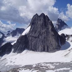
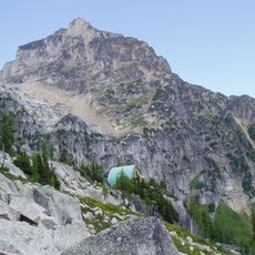
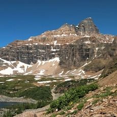
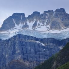
Hound's Tooth, Mountain summit in Area G, British Columbia, Canada.

Description

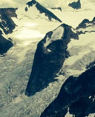
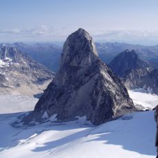
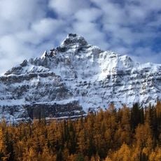
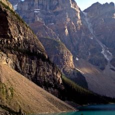
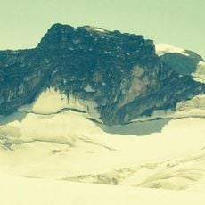
Hound's Tooth is a mountain in Area G of the Purcell Mountains in British Columbia, reaching 2,824 meters in elevation. The summit forms a sharp granite pinnacle that rises from the northeast ridge of Marmolata Mountain.

History

Conrad Kain made the first recorded ascent of this peak in 1930, bringing it into British Columbia's climbing history. This early achievement marked the start of its recognition as an important alpine destination.

Culture

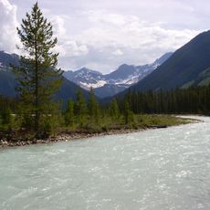
The peak draws mountaineers who value the rugged high-altitude landscape of the Purcell Mountains. Climbers who reach this point share a deep connection to wilderness and overcoming natural challenges.

Practical

Visitors should prepare for extremely cold conditions, with temperatures below -20 degrees Celsius in winter and wind chill factors that can drop below -30 degrees Celsius. Getting there requires extensive mountaineering gear and high-altitude climbing experience.

Did you know?

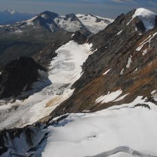
The peak emerges as a nunatak, an isolated summit rising through surrounding glaciers. Its surface consists of rough, fractured granite that stands out sharply against the frozen landscapes around it.

Location
Area G (Forster Creek/Mount Assiniboine)
Elevation above the sea
2,824 m
GPS coordinates
50.72440,-116.77510
Latest update
December 14, 2025 20:29

AroundUs brings together thousands of curated places, local tips, and hidden gems, enriched daily by 60,000 contributors worldwide. Discover all places nearby (Area G (Forster Creek/Mount Assiniboine)).

« Hound's Tooth - Mountain summit in Area G, British Columbia, Canada » is provided by Around Us (aroundus.com). Images and texts are derived from Wikimedia project under a Creative Commons license. You are allowed to copy, distribute, and modify copies of this page, under the conditions set by the license, as long as this note is clearly visible.

Discover hidden gems everywhere you go!

From secret cafés to breathtaking viewpoints, skip the crowded tourist spots and find places that match your style. Our app makes it easy with voice search, smart filtering, route optimization, and insider tips from travelers worldwide. Download now for the complete mobile experience.

Around Us App Screenshot

A unique approach to discovering new places

Le Figaro

All the places worth exploring

France Info

A tailor-made excursion in just a few clicks

20 Minutes

Around Us
Travel Guide & Maps
Download

Send to your phone

QR Code
1

Open the camera app on your mobile.

2

Point at the QR code with your camera. A notification will appear.

3

Tap the notification to open the link.