Chest opened
+${chestReward.xp} XP
Explorer
NOUVEAU ×${chestReward.collectible.quantity}
tapez pour fermer
Chest locked

Open chests in the app

Around Us is built for your phone — chests unlock when you walk, explore and capture nearby places.

Enable Location

We need your location to show you interesting places around you

Discover nearby places

Find interesting locations and hidden gems around you

Precise directions

Get accurate directions and distances to places

Your location is never shared with other users. It's only used when you tap the location button.

Troy

Log in to your account

Start exploring — it's free

Trusted by 72,880 travelers worldwide

Continue with Google
Continue with Apple
or

We will send you a code to connect

By continuing, you accept our Terms and Conditions and our Privacy Policy

Check your inbox

We've sent a pincode in your inbox. Please enter the code below.

Discussion Reviews 1 Photos
17.4k Popularity

Troy, city in Lincoln County, Montana, USA

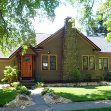
Troy is a small city in Lincoln County, Missouri, serving as the county seat. It sits near St. Louis and features historic Main Street buildings, several parks with walking trails and open spaces, and local services for residents and visitors.

The area was originally a camp for the Sac and Fox tribes before European settlers arrived in the late 1700s. Woods Fort was built for protection and served under Lt. Zachary Taylor during the War of 1812, after which the settlement was formally named Troy in 1819.

The name Troy references the ancient Greek city, passed through Troy, New York to this settlement. Walking the streets today, you see wooden and stone buildings that connect residents and visitors to the town's long past.

Troy is located near St. Louis and is easily accessible by car. The city has parks with walking trails, a town hall for services and information, restaurants along Main Street, and a small-town layout that is easy to navigate on foot.

Lt. Zachary Taylor, who later became US President, used Woods Fort as his headquarters during the War of 1812. This connection to a future president is a surprising piece of local history that often goes unnoticed by visitors.

The community of curious travelers

AroundUs brings together thousands of curated places, local tips, and hidden gems, enriched daily by 60,000 contributors worldwide.

Start exploring
Location
Elevation above the sea
579 m
GPS coordinates
48.46000,-115.89111
Latest update
February 17, 2026 00:40
Around this place
Silverwood Theme Park
United States of America

Silverwood Theme Park

86.1 km
Lake Koocanusa
Canada

Lake Koocanusa

96.7 km
Corkscrew
United States of America

Corkscrew

86.4 km
Farragut State Park
United States of America

Farragut State Park

75.1 km
Libby Dam
United States of America

Libby Dam

43.3 km
Kootenai Falls
United States of America

Kootenai Falls

9.5 km
Tremors
United States of America

Tremors

86.6 km
Idaho Panhandle National Forests
United States of America

Idaho Panhandle National Forests

86.2 km
Kootenai National Wildlife Refuge
United States of America

Kootenai National Wildlife Refuge

47.1 km
Snowshoe Peak
United States of America

Snowshoe Peak

30.3 km
Moyie River Canyon Bridge
United States of America

Moyie River Canyon Bridge

36.8 km
Cabinet Gorge Dam
United States of America

Cabinet Gorge Dam

43.5 km
Round Lake State Park
United States of America

Round Lake State Park

64.4 km
Lost Trail National Wildlife Refuge
United States of America

Lost Trail National Wildlife Refuge

80.3 km
Theodore Roosevelt Memorial Bridge
United States of America

Theodore Roosevelt Memorial Bridge

1.2 km
Boulder Beach Water Park
United States of America

Boulder Beach Water Park

85.7 km
Kootenai Falls Swinging Bridge
United States of America

Kootenai Falls Swinging Bridge

8.9 km
Farmers and Merchants State Bank
United States of America

Farmers and Merchants State Bank

77.4 km
Ant Flat Ranger Station
United States of America

Ant Flat Ranger Station

80.3 km
Cabinet National Forest
United States of America

Cabinet National Forest

51.8 km
Eureka Community Hall
United States of America

Eureka Community Hall

47.8 km
Dover Church
United States of America

Dover Church

57.8 km
Boundary County Courthouse
United States of America

Boundary County Courthouse

40.7 km
Amanda Nesbitt House
United States of America

Amanda Nesbitt House

52.9 km
Sandpoint Federal Building
United States of America

Sandpoint Federal Building

52.8 km
Russell and Pearl Soderling House
United States of America

Russell and Pearl Soderling House

40.7 km
Bull River Guard Station
United States of America

Bull River Guard Station

40.2 km
Star Peak Lookout
United States of America

Star Peak Lookout

41 km
Show the full map
Reviews
Share your experience

No review yet

Discussions
Start a discussion...

No discussion yet

« Troy - city in Lincoln County, Montana, USA » is provided by Around Us (aroundus.com). Images and texts are derived from Wikimedia project under a Creative Commons license. You are allowed to copy, distribute, and modify copies of this page, under the conditions set by the license, as long as this note is clearly visible.

Discover hidden gems everywhere you go!

From secret cafés to breathtaking viewpoints, skip the crowded tourist spots and find places that match your style. Our app makes it easy with voice search, smart filtering, route optimization, and insider tips from travelers worldwide. Download now for the complete mobile experience.

Around Us App Screenshot

A unique approach to discovering new places

Le Figaro

All the places worth exploring

France Info

A tailor-made excursion in just a few clicks

20 Minutes

Around Us
Travel Guide & Maps
Download

Send to your phone

QR Code
1

Open the camera app on your mobile.

2

Point at the QR code with your camera. A notification will appear.

3

Tap the notification to open the link.