Enable Location

We need your location to show you interesting places around you

Discover nearby places

Find interesting locations and hidden gems around you

Precise directions

Get accurate directions and distances to places

Your location is never shared with other users. It's only used when you tap the location button.

Log in to your account

Start exploring — it's free

Trusted by 63,173 travelers worldwide

Continue with Google
Continue with Apple
or

We will send you a code to connect

By continuing, you accept our Terms and Conditions and our Privacy Policy

Check your inbox

We've sent a pincode in your inbox. Please enter the code below.

Cook Peak
Discussion Reviews Photo
1.3k Popularity

Cook Peak, Mountain summit in Yellowstone National Park, Wyoming, US

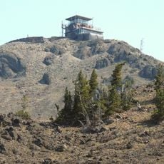
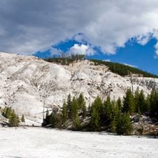
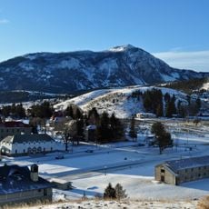
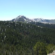
Cook Peak is a mountain summit within the Washburn Range in Yellowstone National Park, characterized by steep slopes and exposed rock faces at higher elevations. The peak rises to 2,973 meters and offers expansive views across the surrounding landscape on clear days.

The mountain was assigned different names during early surveys, first called Thompson Peak, then Storm Peak, before being officially named Cook Peak in 1922. These name changes reflect the gradual mapping and exploration history of the Yellowstone region.

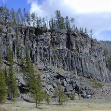
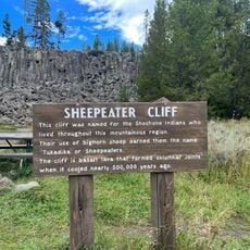
The peak serves as a reference point for geologists studying the volcanic formations and geological layers within Yellowstone National Park's northern region.

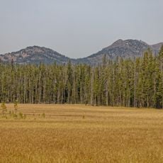
Hikers can reach the summit via established trails primarily during summer months when snow has melted and conditions are more stable. Starting early in the day is advisable, as weather at higher elevations can change quickly.

From this summit, visitors can observe multiple thermal springs and geysers spread across the park, which become distinctly visible from this elevation. This vantage point allows travelers to witness the geothermal activity of the park from an unusual perspective.

The community of curious travelers

AroundUs brings together thousands of curated places, local tips, and hidden gems, enriched daily by 60,000 contributors worldwide.

Start exploring
Location
GPS coordinates
44.84271,-110.57521
Latest update
December 14, 2025 18:06
Around this place
Yellowstone National Park
United States of America

Yellowstone National Park

27.7 km
Grand Canyon of the Yellowstone
United States of America

Grand Canyon of the Yellowstone

15.3 km
Yellowstone Falls
United States of America

Yellowstone Falls

15.2 km
Mount Washburn
United States of America

Mount Washburn

12.2 km
Artist Point Overlook
United States of America

Artist Point Overlook

15.5 km
Obsidian Cliff
United States of America

Obsidian Cliff

12.3 km
Uncle Tom's Trail
United States of America

Uncle Tom's Trail

15.5 km
Sheepeater Cliff
United States of America

Sheepeater Cliff

12.8 km
Roaring Mountain
United States of America

Roaring Mountain

14.1 km
Bunsen Peak
United States of America

Bunsen Peak

14.4 km
United States of America

Golden Gate Canyon

15.7 km
Hedges Peak
United States of America

Hedges Peak

10.5 km
Osprey Falls
United States of America

Osprey Falls

12.7 km
Inspiration Point
United States of America

Inspiration Point

15.6 km
Virginia Cascades
United States of America

Virginia Cascades

15.5 km
Obsidian Cliff Kiosk
United States of America

Obsidian Cliff Kiosk

12.3 km
Dunraven Peak
United States of America

Dunraven Peak

10.7 km
Upper Falls of the Yellowstone River
United States of America

Upper Falls of the Yellowstone River

15.7 km
Crystal Falls
United States of America

Crystal Falls

15.2 km
Gardner River Bridge
United States of America

Gardner River Bridge

15.2 km
Canyon Visitor Education Center
United States of America

Canyon Visitor Education Center

13.7 km
Museum of the National Park Ranger
United States of America

Museum of the National Park Ranger

15.1 km
Lower Falls of the Yellowstone River
United States of America

Lower Falls of the Yellowstone River

15.2 km
Indian Creek Campground
United States of America

Indian Creek Campground

13.6 km
Tower Fall Campground
United States of America

Tower Fall Campground

15.5 km
Norris Campground
United States of America

Norris Campground

14.9 km
Mount Washburn Lookout
United States of America

Mount Washburn Lookout

12.2 km
Canyon Campground
United States of America

Canyon Campground

13.7 km
Show the full map
Reviews
Share your experience

No review yet

Discussions
Start a discussion...

No discussion yet

« Cook Peak - Mountain summit in Yellowstone National Park, Wyoming, US » is provided by Around Us (aroundus.com). Images and texts are derived from Wikimedia project under a Creative Commons license. You are allowed to copy, distribute, and modify copies of this page, under the conditions set by the license, as long as this note is clearly visible.

Discover hidden gems everywhere you go!

From secret cafés to breathtaking viewpoints, skip the crowded tourist spots and find places that match your style. Our app makes it easy with voice search, smart filtering, route optimization, and insider tips from travelers worldwide. Download now for the complete mobile experience.

Around Us App Screenshot

A unique approach to discovering new places

Le Figaro

All the places worth exploring

France Info

A tailor-made excursion in just a few clicks

20 Minutes

Around Us
Travel Guide & Maps
Download

Send to your phone

QR Code
1

Open the camera app on your mobile.

2

Point at the QR code with your camera. A notification will appear.

3

Tap the notification to open the link.