Chest opened
+${chestReward.xp} XP
Explorer
NOUVEAU ×${chestReward.collectible.quantity}
tapez pour fermer
Chest locked

Open chests in the app

Around Us is built for your phone — chests unlock when you walk, explore and capture nearby places.

Enable Location

We need your location to show you interesting places around you

Discover nearby places

Find interesting locations and hidden gems around you

Precise directions

Get accurate directions and distances to places

Your location is never shared with other users. It's only used when you tap the location button.

Log in to your account

Start exploring — it's free

Trusted by 72,887 travelers worldwide

Continue with Google
Continue with Apple
or

We will send you a code to connect

By continuing, you accept our Terms and Conditions and our Privacy Policy

Check your inbox

We've sent a pincode in your inbox. Please enter the code below.

Wind River Basin
Discussion Reviews Photo
4.9k Popularity

Wind River Basin, Intermontane basin in central Wyoming, US

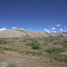
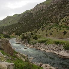
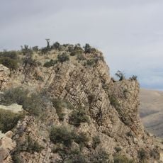
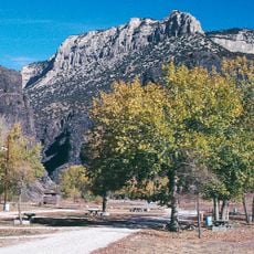
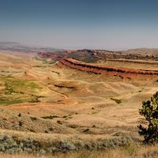
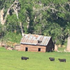
The Wind River Basin is a broad, low-lying area in central Wyoming, enclosed by mountain ranges including the Wind River Range to the southwest and the Owl Creek Mountains to the north. The floor of the basin is relatively flat and open, crossed by the Wind River, which gives the area its name.

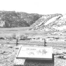
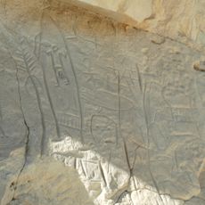
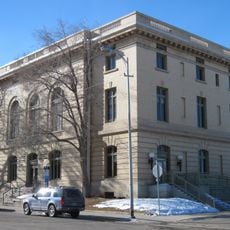
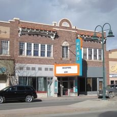
The basin was home to Shoshone peoples for centuries before trappers and settlers passed through in the 1800s. In 1884, the first commercial oil production in Wyoming began at Dallas Dome, inside the basin, which set the region on a path tied to the petroleum industry.

The Wind River Reservation covers large parts of the basin and is home to the Eastern Shoshone and the Northern Arapaho nations. Their presence shapes land use and place names across the area, and visitors will notice this influence throughout the region.

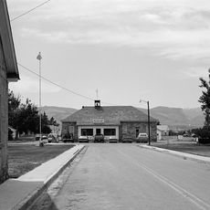
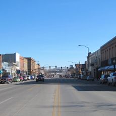
The basin covers a large area in a sparsely populated part of Wyoming, where towns can be far apart and services are limited. Filling up on gas and carrying water before heading out is a good idea, as weather can change fast and roads in some areas are unpaved.

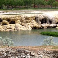
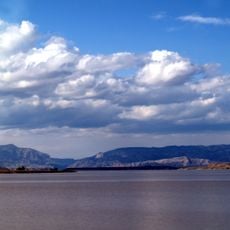
The flat ground of the basin sits above layers of ancient marine sediment, showing that this inland region was once covered by a shallow sea. Fossils of sea creatures have been found deep in these layers, far from any ocean today.

The community of curious travelers

AroundUs brings together thousands of curated places, local tips, and hidden gems, enriched daily by 60,000 contributors worldwide.

Start exploring
Location
GPS coordinates
43.10000,-107.80000
Latest update
March 3, 2026 10:07
Around this place
Independence Rock
United States of America

Independence Rock

86.9 km
Devil's Gate
United States of America

Devil's Gate

87 km
Martin's Cove
United States of America

Martin's Cove

85.3 km
Hot Springs State Park
United States of America

Hot Springs State Park

69.7 km
Wind River Canyon
United States of America

Wind River Canyon

56 km
Wyoming Dinosaur Center
United States of America

Wyoming Dinosaur Center

68.6 km
Boysen Reservoir
United States of America

Boysen Reservoir

46.6 km
Fort Washakie
United States of America

Fort Washakie

88.6 km
Phosphoria Formation
United States of America

Phosphoria Formation

23.3 km
Tom Sun Ranch
United States of America

Tom Sun Ranch

87.2 km
Boysen State Park
United States of America

Boysen State Park

46.7 km
Red Canyon
United States of America

Red Canyon

84.7 km
Jackson Park Town Site Addition Brick Row
United States of America

Jackson Park Town Site Addition Brick Row

81.9 km
Castle Gardens Petroglyph Site
United States of America

Castle Gardens Petroglyph Site

24.3 km
CQA Four Mile Bridge
United States of America

CQA Four Mile Bridge

64.6 km
BMU Bridge over Wind River
United States of America

BMU Bridge over Wind River

73.9 km
EFP Bridge over Owl Creek
United States of America

EFP Bridge over Owl Creek

81.4 km
Alex Halone House
United States of America

Alex Halone House

68.6 km
Shoshone-Episcopal Mission
United States of America

Shoshone-Episcopal Mission

90.8 km
Downtown Thermopolis Historic District
United States of America

Downtown Thermopolis Historic District

69.3 km
C. H. King Company and First National Bank of Shoshoni
United States of America

C. H. King Company and First National Bank of Shoshoni

29.2 km
United States Post Office and Courthouse
United States of America

United States Post Office and Courthouse

81.4 km
Lander Downtown Historic District
United States of America

Lander Downtown Historic District

81.5 km
Ainsworth House
United States of America

Ainsworth House

86.9 km
Grand Theatre
United States of America

Grand Theatre

81.4 km
Steamboat Geyser
United States of America

Steamboat Geyser

90.9 km
Acme Theatre
United States of America

Acme Theatre

48.5 km
Thermopolis Swinging Bridge
United States of America

Thermopolis Swinging Bridge

69.6 km
Show the full map
Reviews
Share your experience

No review yet

Discussions
Start a discussion...

No discussion yet

« Wind River Basin - Intermontane basin in central Wyoming, US » is provided by Around Us (aroundus.com). Images and texts are derived from Wikimedia project under a Creative Commons license. You are allowed to copy, distribute, and modify copies of this page, under the conditions set by the license, as long as this note is clearly visible.

Discover hidden gems everywhere you go!

From secret cafés to breathtaking viewpoints, skip the crowded tourist spots and find places that match your style. Our app makes it easy with voice search, smart filtering, route optimization, and insider tips from travelers worldwide. Download now for the complete mobile experience.

Around Us App Screenshot

A unique approach to discovering new places

Le Figaro

All the places worth exploring

France Info

A tailor-made excursion in just a few clicks

20 Minutes

Around Us
Travel Guide & Maps
Download

Send to your phone

QR Code
1

Open the camera app on your mobile.

2

Point at the QR code with your camera. A notification will appear.

3

Tap the notification to open the link.