Chest opened
+${chestReward.xp} XP
Explorer
NOUVEAU ×${chestReward.collectible.quantity}
tapez pour fermer
Chest locked

Open chests in the app

Around Us is built for your phone — chests unlock when you walk, explore and capture nearby places.

Enable Location

We need your location to show you interesting places around you

Discover nearby places

Find interesting locations and hidden gems around you

Precise directions

Get accurate directions and distances to places

Your location is never shared with other users. It's only used when you tap the location button.

Hole-in-the-Wall

Log in to your account

Start exploring — it's free

Trusted by 72,954 travelers worldwide

Continue with Google
Continue with Apple
or

We will send you a code to connect

By continuing, you accept our Terms and Conditions and our Privacy Policy

Check your inbox

We've sent a pincode in your inbox. Please enter the code below.

Hole-in-the-Wall
Discussion Reviews 1 Photos
70.7k Popularity

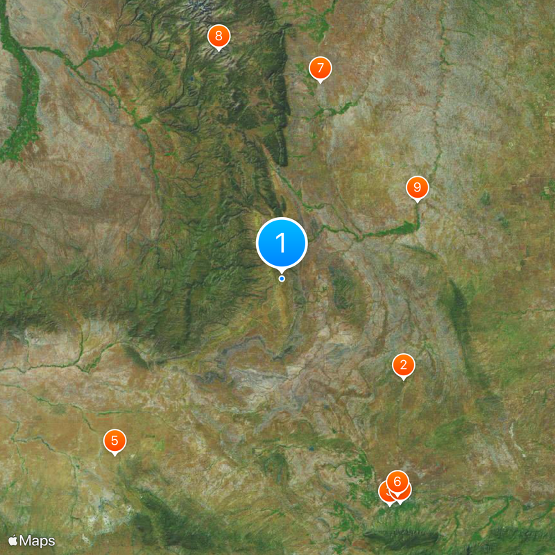
Hole-in-the-Wall, Mountain pass in Johnson County, Wyoming, US.

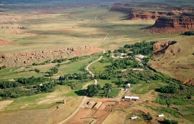
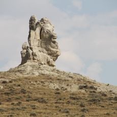
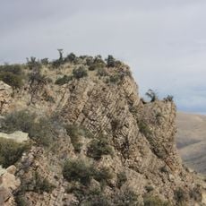
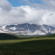
Hole-in-the-Wall is a mountain pass in Johnson County, Wyoming, framed by steep red sandstone cliffs and narrow canyons. The pass sits remote in the Big Horn Mountains and offers tight access through high rock walls.

From the late 1860s until around 1910, the pass served as a secure hideout for several outlaw groups. Butch Cassidy and the Wild Bunch used the hard-to-reach terrain for their operations.

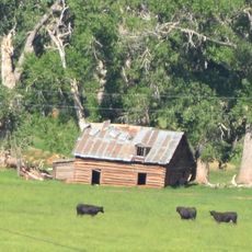
The pass takes its name from a narrow opening in the red rock walls that allowed riders to slip through unnoticed. Today, only foundation stones and a few weathered timbers mark where fugitive outlaws gathered in their cabins.

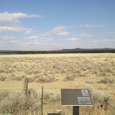
A dirt road leads to the starting point, from which a roughly half-mile (800 meters) trail runs through the canyon. The terrain is uneven and requires sturdy footwear and some time to explore the remote surroundings.

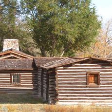
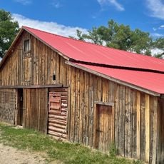
The original log cabin that served as a meeting point for the gangs was later moved to Cody and reconstructed at the Old Trail Town Museum. Visitors now find only traces of the old settlement and the distinctive rock formations at the original site.

The community of curious travelers

AroundUs brings together thousands of curated places, local tips, and hidden gems, enriched daily by 60,000 contributors worldwide.

Start exploring
Location
GPS coordinates
43.54500,-106.83500
Latest update
December 13, 2025 17:43
Around this place
Teapot Rock
United States of America

Teapot Rock

54.8 km
Fort Caspar
United States of America

Fort Caspar

87.4 km
Natrona County High School
United States of America

Natrona County High School

88.4 km
Phosphoria Formation
United States of America

Phosphoria Formation

84.3 km
National Historic Trails Interpretive Center
United States of America

National Historic Trails Interpretive Center

85.7 km
TA Ranch Historic District
United States of America

TA Ranch Historic District

69.2 km
United States of America

Bighorn Peak

81.9 km
Cantonment Reno
United States of America

Cantonment Reno

53.9 km
Masonic Temple
United States of America

Masonic Temple

87.7 km
Casper Downtown Historic District
United States of America

Casper Downtown Historic District

87.9 km
AJX Bridge over South Fork and Powder River
United States of America

AJX Bridge over South Fork and Powder River

22.5 km
United States of America

Church of Saint Anthony

88.4 km
Midwest Oil Company Hotel
United States of America

Midwest Oil Company Hotel

88.3 km
United States of America

Darton Peak

84.3 km
EDZ Irigary Bridge
United States of America

EDZ Irigary Bridge

70.3 km
Elks Lodge No. 1353
United States of America

Elks Lodge No. 1353

88.4 km
Odd Fellows Building
United States of America

Odd Fellows Building

87.6 km
James T. Saban Lookout
United States of America

James T. Saban Lookout

73.5 km
Roosevelt School
United States of America

Roosevelt School

86.2 km
Ohio Oil Company Building
United States of America

Ohio Oil Company Building

87.7 km
North Casper Clubhouse
United States of America

North Casper Clubhouse

87.1 km
Consolidated Royalty Building
United States of America

Consolidated Royalty Building

87.9 km
Ainsworth House
United States of America

Ainsworth House

47.7 km
Ewing T. Kerr Federal Building and U.S. Courthouse
United States of America

Ewing T. Kerr Federal Building and U.S. Courthouse

87.9 km
Tribune Building (Casper, Wyoming)
United States of America

Tribune Building (Casper, Wyoming)

87.9 km
Casper Motor Company-Natrona Motor Company
United States of America

Casper Motor Company-Natrona Motor Company

87.8 km
South Wolcott Street Historic District
United States of America

South Wolcott Street Historic District

88.8 km
America Stadium Theatre
United States of America

America Stadium Theatre

87.8 km
Show the full map
Reviews
Share your experience

No review yet

Discussions
Start a discussion...

No discussion yet

« Hole-in-the-Wall - Mountain pass in Johnson County, Wyoming, US » is provided by Around Us (aroundus.com). Images and texts are derived from Wikimedia project under a Creative Commons license. You are allowed to copy, distribute, and modify copies of this page, under the conditions set by the license, as long as this note is clearly visible.

Discover hidden gems everywhere you go!

From secret cafés to breathtaking viewpoints, skip the crowded tourist spots and find places that match your style. Our app makes it easy with voice search, smart filtering, route optimization, and insider tips from travelers worldwide. Download now for the complete mobile experience.

Around Us App Screenshot

A unique approach to discovering new places

Le Figaro

All the places worth exploring

France Info

A tailor-made excursion in just a few clicks

20 Minutes

Around Us
Travel Guide & Maps
Download

Send to your phone

QR Code
1

Open the camera app on your mobile.

2

Point at the QR code with your camera. A notification will appear.

3

Tap the notification to open the link.