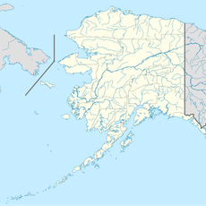
Choquette Hot Springs Provincial Park, Provincial park in Stikine Region, Canada.
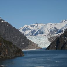
Choquette Hot Springs Provincial Park lies on the east bank of the Stikine River, just north of its confluence with the Choquette River. Its official feature, Stikine River Hot Springs, is a group of more than 15 springs issuing from granitic rock at the base of the valley wall and from mud beyond the valley floor. Many sit in the tidal zone and are submerged at high tide; at least four remain above high water and beaver-pond flooding.
Choquette Hot Springs Provincial Park was established on January 25, 2001, to protect Stikine River Hot Springs, the largest hot springs on the Canadian side of the lower Stikine River. The park lies in the traditional territory of the Tahltan First Nation, about 120 kilometres south of Telegraph Creek.
The park lies in the traditional territory of the Tahltan First Nation, about 120 kilometres south of the Tahltan community of Telegraph Creek. The hot springs themselves are officially named Stikine River Hot Springs, not Choquette, and the Tahltan name for the site is not recorded in the sources.
The park is accessible only by boat along the Stikine River or by helicopter, which means planning ahead is essential. The remote location and limited transportation options mean that visits require coordination and advance arrangements.
Despite the park's name, the springs are officially called Stikine River Hot Springs. More than 15 vents issue from granitic rock and mud at the valley wall, and many sit within the tidal zone, submerged at high tide; only about four stay above the high-water line and beaver-pond flooding. The water is odourless and tasteless, with low mineral content.
The community of curious travelers
AroundUs brings together thousands of curated places, local tips, and hidden gems, enriched daily by 92,643 contributors worldwide.