Kugluk/Bloody Falls Territorial Park, Territorial park and national historic site in Kitikmeot Region, Canada
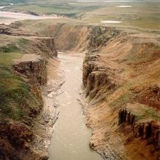
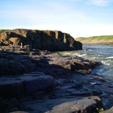
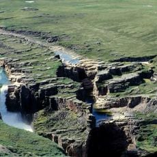
Kugluk/Bloody Falls Territorial Park is a protected area along the Coppermine River in the Kitikmeot Region. The river creates narrow rapids and churning whirlpools at this location, forming the park's central natural feature.
In 1771, Samuel Hearne's Chipewyan guides killed a group of Copper Inuit camped at the falls, an event known as the Bloody Falls massacre. The site was designated a national historic site in 1978. Archaeological evidence shows the area was used for caribou hunting and fishing for thousands of years before the massacre.
The falls and river remain a fishing and hunting ground for Inuit from Kugluktuk, who travel there by motorboat, all-terrain vehicle or on foot. The campsite below the falls is called Onoagahiovik in Inuinnaqtun, and a portage trail has been built for canoeists on the Coppermine River.
From Kugluktuk the falls are about 15 km southwest: roughly 45 minutes by motorboat, two hours by all-terrain vehicle, or a four- to five-hour walk. Canoeists on the Coppermine can camp at Onoagahiovik just below the falls, reached by a purpose-built portage trail; a comfort station stands in the park.
The black-tipped groundsel (Senecio lugens) grows in the park; John Richardson named it in 1821 while travelling the Coppermine River with John Franklin, and the Latin lugens, "to mourn", is meant to commemorate the massacre. Researchers have recorded 207 vascular plant taxa here, and swallows nest in large numbers in the cliffs around the falls.
The community of curious travelers
AroundUs brings together thousands of curated places, local tips, and hidden gems, enriched daily by 92,676 contributors worldwide.