Chest opened
+${chestReward.xp} XP
Explorer
NOUVEAU ×${chestReward.collectible.quantity}
tapez pour fermer
Chest locked

Open chests in the app

Around Us is built for your phone — chests unlock when you walk, explore and capture nearby places.

Enable Location

We need your location to show you interesting places around you

Discover nearby places

Find interesting locations and hidden gems around you

Precise directions

Get accurate directions and distances to places

Your location is never shared with other users. It's only used when you tap the location button.

Log in to your account

Start exploring — it's free

Trusted by 72,888 travelers worldwide

Continue with Google
Continue with Apple
or

We will send you a code to connect

By continuing, you accept our Terms and Conditions and our Privacy Policy

Check your inbox

We've sent a pincode in your inbox. Please enter the code below.

Discussion Reviews Photo
4.7k Popularity

Red Hills, Physiographic division in south-central Kansas, United States.

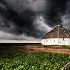
Red Hills is a physiographic region in south-central Kansas marked by rolling terrain dotted with flat-topped mesas, buttes, and deep canyons. The area spans across Clark, Comanche, and Barber counties and features distinctive red-colored rock formations that rise above the surrounding plains.

The red sediments here were deposited during the Permian Period when this area was part of a closed basin within the Pangaean supercontinent. Over time, weathering and erosion of these ancient rock layers created the distinctive landscape visible today.

Native Americans named this area Medicine Hills, and the nearby Medicine River reflects this historical connection to the landscape.

The Gypsum Hills Scenic Byway runs 42 miles from Coldwater to Medicine Lodge along US Highway 160 and provides constant views of this landscape. Allow time to drive the route in your own vehicle and stop at various viewpoints along the way.

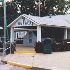
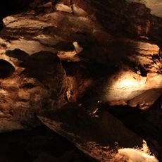
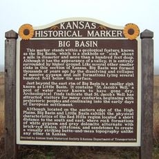
The dissolving of gypsum deposits created numerous sinkholes throughout the area, including Big Basin which spans about 1 mile across. These natural depressions are distinctive features that shape both the appearance and water drainage of the landscape.

The community of curious travelers

AroundUs brings together thousands of curated places, local tips, and hidden gems, enriched daily by 60,000 contributors worldwide.

Start exploring
Location
Elevation above the sea
612 m
GPS coordinates
37.34170,-99.07960
Latest update
December 10, 2025 20:05
Around this place
Big Well
United States of America

Big Well

34.9 km
Alabaster Caverns State Park
United States of America

Alabaster Caverns State Park

71.9 km
Brenham
United States of America

Brenham

27.8 km
Big Basin Prairie Preserve
United States of America

Big Basin Prairie Preserve

82.1 km
Fort Dodge
United States of America

Fort Dodge

87 km
Carrie Nation House
United States of America

Carrie Nation House

44.8 km
Medicine Lodge Peace Treaty Site
United States of America

Medicine Lodge Peace Treaty Site

46.2 km
Fromme-Birney Round Barn
United States of America

Fromme-Birney Round Barn

43.1 km
Ingersoll Tile Elevator
United States of America

Ingersoll Tile Elevator

86.2 km
Central National Bank
United States of America

Central National Bank

70.2 km
Immaculate Heart of Mary Catholic Church
United States of America

Immaculate Heart of Mary Catholic Church

69.9 km
Stafford Reformed Presbyterian Church
United States of America

Stafford Reformed Presbyterian Church

80.8 km
Gano Grain Elevator and Scale House
United States of America

Gano Grain Elevator and Scale House

72.3 km
Hotel Roberts
United States of America

Hotel Roberts

45 km
Protection High School
United States of America

Protection High School

39 km
Cherokee Friends Church
United States of America

Cherokee Friends Church

91.6 km
S.P. Gebhart House
United States of America

S.P. Gebhart House

45.2 km
Stockgrowers State Bank
United States of America

Stockgrowers State Bank

63.4 km
Farmers National Bank
United States of America

Farmers National Bank

81 km
Stein House
United States of America

Stein House

62.9 km
Stafford First United Methodist Church
United States of America

Stafford First United Methodist Church

81 km
Girl Scout Little House
United States of America

Girl Scout Little House

63.6 km
Pratt County Courthouse
United States of America

Pratt County Courthouse

45.2 km
Ashland Grade School
United States of America

Ashland Grade School

63.3 km
Earl H. Ellis VFW Post No. 1362
United States of America

Earl H. Ellis VFW Post No. 1362

45.7 km
Harper County Courthouse
United States of America

Harper County Courthouse

74.7 km
Comanche County Courthouse
United States of America

Comanche County Courthouse

23.3 km
St. Mary's Catholic Church
United States of America

St. Mary's Catholic Church

87.1 km
Show the full map
Reviews
Share your experience

No review yet

Discussions
Start a discussion...

No discussion yet

« Red Hills - Physiographic division in south-central Kansas, United States » is provided by Around Us (aroundus.com). Images and texts are derived from Wikimedia project under a Creative Commons license. You are allowed to copy, distribute, and modify copies of this page, under the conditions set by the license, as long as this note is clearly visible.

Discover hidden gems everywhere you go!

From secret cafés to breathtaking viewpoints, skip the crowded tourist spots and find places that match your style. Our app makes it easy with voice search, smart filtering, route optimization, and insider tips from travelers worldwide. Download now for the complete mobile experience.

Around Us App Screenshot

A unique approach to discovering new places

Le Figaro

All the places worth exploring

France Info

A tailor-made excursion in just a few clicks

20 Minutes

Around Us
Travel Guide & Maps
Download

Send to your phone

QR Code
1

Open the camera app on your mobile.

2

Point at the QR code with your camera. A notification will appear.

3

Tap the notification to open the link.