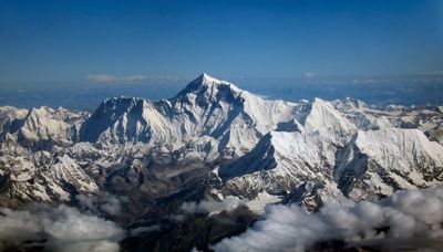
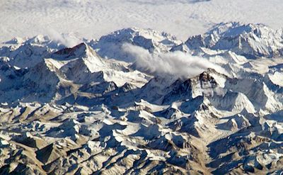
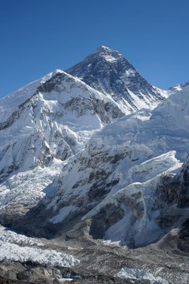
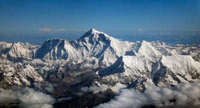
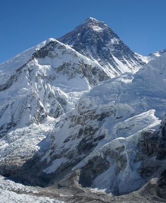
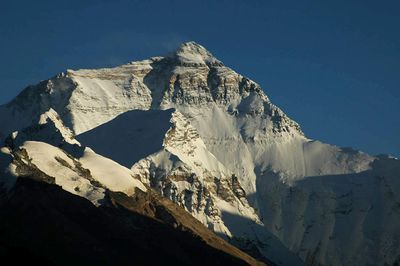
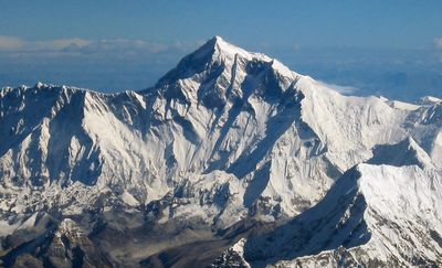
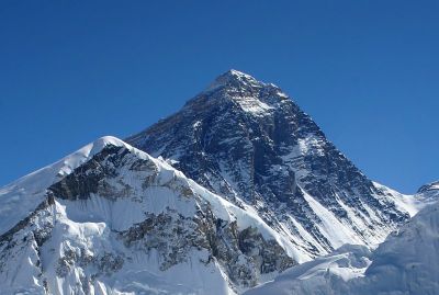
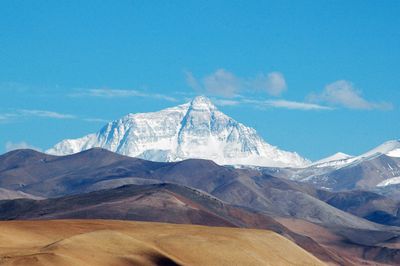
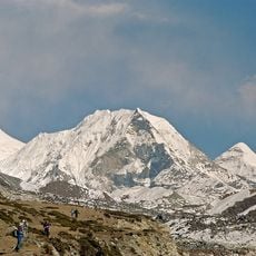
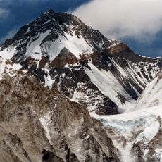
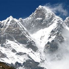
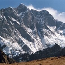
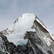
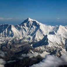
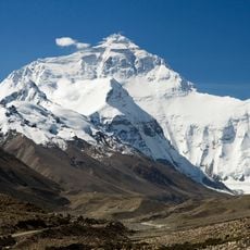
Mount Everest, Mountain peak in Himalayas, Nepal and China.
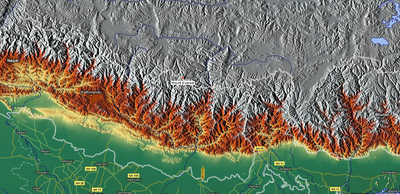
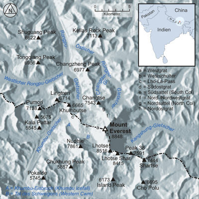
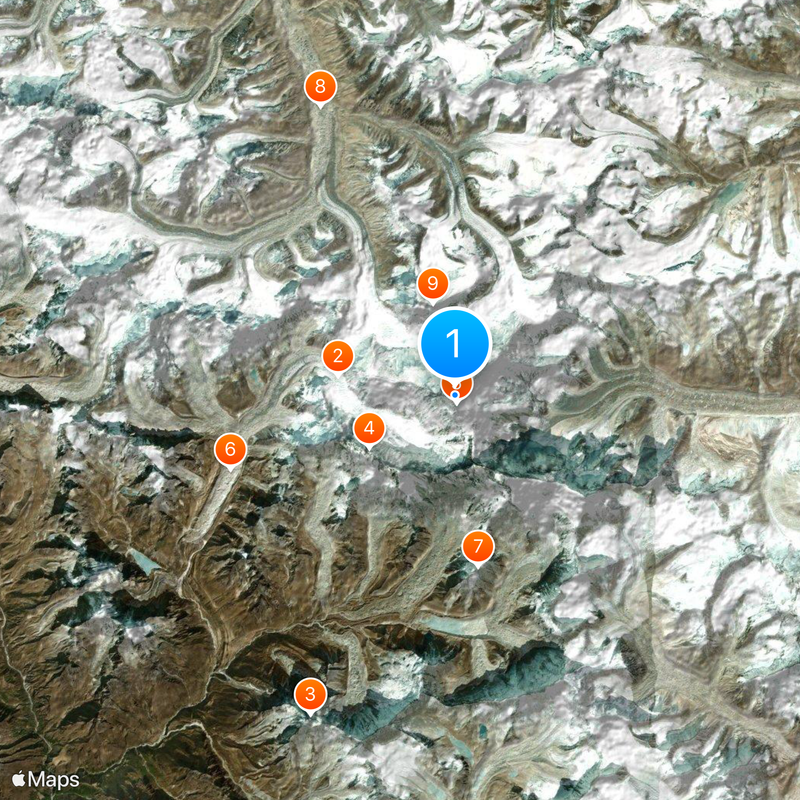
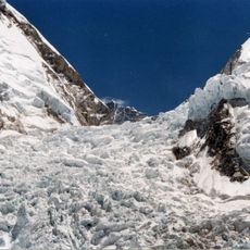
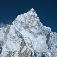
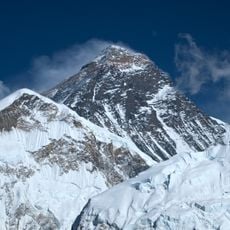
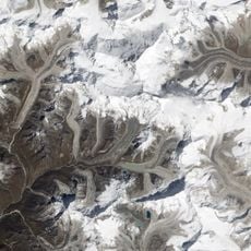
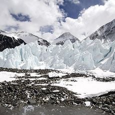
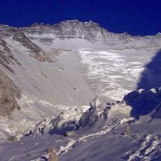
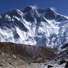
This summit reaches an elevation of 29,032 feet (8,848.86 meters), standing as Earth's highest point, characterized by extensive glacier systems and precipitous rock walls forming its three-sided pyramid shape, with the Khumbu Glacier on the south and Rongbuk Glacier to the north.
The Survey of India identified this peak as the world's highest point in 1852, resulting in its naming after surveyor Sir George Everest in 1865. Edmund Hillary and Tenzing Norgay became the first humans to successfully reach the summit in 1953 via the south route.
Local communities regard this summit with profound religious reverence, calling it Chomolungma in Tibetan, meaning "Goddess Mother of the World", and Sagarmatha in Sanskrit, translating to "Peak of Heaven", with both Buddhist and Hindu traditions honoring the mountain as sacred for centuries.
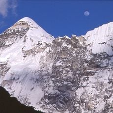
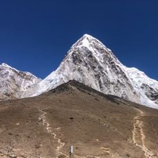
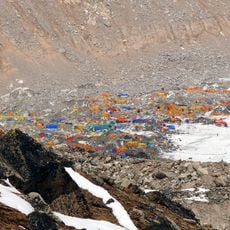
Climbers typically select between two primary routes: the southeast ridge from Nepal or the northeast ridge from Tibet, with most preferring the technically easier southeast path. The climbing season runs from April through May, when weather windows permit ascents.
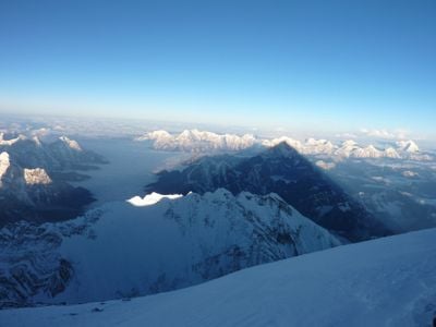
The summit zone experiences atmospheric pressure at only one-third of sea level, with temperatures dropping to minus 76 degrees Fahrenheit (minus 60 degrees Celsius) during January. Geological studies reveal the summit consists of marine limestone layers that once formed part of an ancient seabed.
Location: Solukhumbu District
Location: Tibet Autonomous Region
Elevation above the sea: 8,850 m
Made from material: rock, ice
Part of: Himalayas, Seven Summits, eight-thousander, ultra-prominent peak
Address: Mt Everest
GPS coordinates: 27.98806,86.92521
Latest update: December 14, 2025 18:04
Photo license: CC BY-SA 3.0
Photo license: CC0
From the highest peaks to coastal cliffs, this collection brings together geographically significant observation points across all continents. The locations offer views of mountain ranges, waterfalls, deserts, oceans, and notable architectural structures. The selection includes the Great Wall near...
The Earth offers a wide range of geological shapes shaped over millions of years by weather and the movements of the land. In Northern Ireland, thousands of basalt columns stand along the coast, leftover from an ancient eruption. In Arizona, the Colorado River carved out a canyon more than 400 miles...
Khumbu Icefall
5.2 km
Nuptse
4.4 km
South Summit
346 m
Imja Tse
7.6 km
Changtse
4.2 km
Lhotse Shar
3.7 km
Lhotse Middle
5.4 km
Lingtren
8.3 km
Lhotse Shar Glacier
3 km
Khartaphu
9.9 km
Cho Polu
9.5 km
Western Cwm
2.8 km
Kala Patthar
9.6 km
Shar Tse
7.1 km
North Face
1.2 km
Everest Base Camp
7.6 km
Hillary Peak
3.6 km
Lo-tzu-sha Feng
4.9 km
Nuptse Glacier
8.3 km
Lhotse Glacier
7.6 km
Lhotse Shar / Imja Glacier
9.9 km
Everest Base Camp monument
7.7 km
Chukhung Ri
8.3 km
Scenic viewpoint
9 km
Scenic viewpoint
9.5 km
Everest viewpoint
9.6 km
Everest viewpoint
9.4 km
Scenic viewpoint
8.8 kmVisited this place? Tap the stars to rate it and share your experience / photos with the community! Try now! You can cancel it anytime.
Discover hidden gems everywhere you go!
From secret cafés to breathtaking viewpoints, skip the crowded tourist spots and find places that match your style. Our app makes it easy with voice search, smart filtering, route optimization, and insider tips from travelers worldwide. Download now for the complete mobile experience.
A unique approach to discovering new places❞
— Le Figaro
All the places worth exploring❞
— France Info
A tailor-made excursion in just a few clicks❞
— 20 Minutes