Ma Shi Chau, Tidal island in Tai Po District, Hong Kong
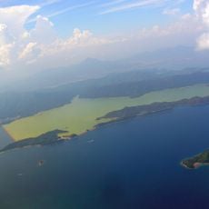
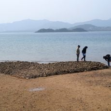
Ma Shi Chau is a tidal island in Tolo Harbour, Tai Po District, Hong Kong, connected to the nearby island of Yim Tin Tsai by a natural sandbar that appears at low tide. The island is rocky and mostly undeveloped, with exposed rock formations along its shores and a landscape shaped by the sea.
Ma Shi Chau appeared on maps as No Kot Chau from 1928 to 1936 and has been labelled Ma Shi Chau since 1937. On 9 April 1999 the government grouped it with Yeung Chau, Centre Island and an unnamed islet as the Ma Shi Chau Special Area, protecting its tombolo and Permian sedimentary rock.
Ma Shi Chau is part of the Hong Kong Geopark and draws school groups who come to study the rock formations up close along the shore. The tidal path connecting it to Yim Tin Tsai is itself a place where visitors can watch the sea slowly cover and uncover the land.
Access to the island depends on the tide, so it is worth checking the tide times before visiting to make sure the sandbar is passable. Sturdy footwear is a good idea since the path can be wet and uneven underfoot.
The rocks found on Ma Shi Chau date from the Permian period, around 270 million years ago, making them among the oldest exposed rock layers anywhere in Hong Kong. In some spots, fossilized sea creatures are visible directly in the rock face without any special equipment.
The community of curious travelers
AroundUs brings together thousands of curated places, local tips, and hidden gems, enriched daily by 94,111 contributors worldwide.