Enable Location

We need your location to show you interesting places around you

Discover nearby places

Find interesting locations and hidden gems around you

Precise directions

Get accurate directions and distances to places

Your location is never shared with other users. It's only used when you tap the location button.

Luz-Saint-Sauveur

Log in to your account

Start exploring — it's free

Trusted by 61,907 travelers worldwide

Continue with Google
Continue with Apple
or

We will send you a code to connect

By continuing, you accept our Terms and Conditions and our Privacy Policy

Check your inbox

We've sent a pincode in your inbox. Please enter the code below.

Luz-Saint-Sauveur, Mountain commune in Hautes-Pyrénées, France.

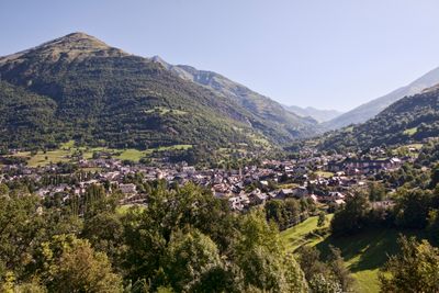
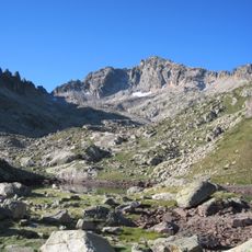
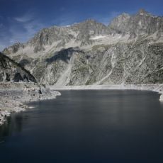
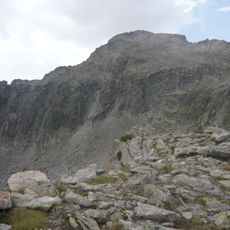
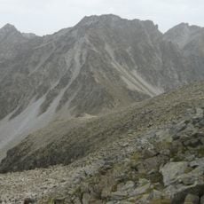
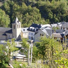
Luz-Saint-Sauveur is a mountain village at 711 meters elevation in the Pyrenees, positioned where three valleys meet and branch toward Gavarnie, Barèges, and Luz-Ardiden. The settlement sits within dramatic terrain that makes it a natural hub for hikers and outdoor enthusiasts exploring the surrounding peaks.

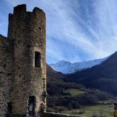
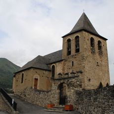
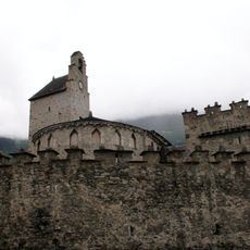
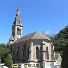
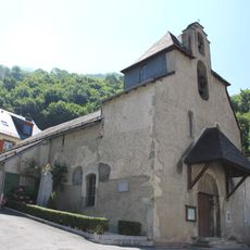
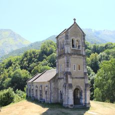
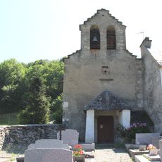
The settlement developed as a place of refuge, with the fortified Church of Saint-André built in the 12th century serving as protection during conflicts between France and Spain. This sacred site sat at the heart of local life and sheltered people through troubled times.

The commune holds traditional mountain festivals throughout the year where locals and visitors gather for folk music, dancing, and regional food celebrations in the town square. These events are woven into the everyday rhythm of community life here.

Bus services link the village regularly to Lourdes and Tarbes, with extra winter shuttles reaching nearby ski resorts and thermal springs. Good transportation connections make it straightforward to explore the surrounding valleys and mountain destinations.

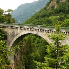
The Pont Napoléon arches 47 meters above the Gave de Gavarnie river, showcasing remarkable 19th-century engineering skill carved into the mountain landscape. This slender stone bridge remains frequently overlooked by visitors despite being one of the area's most distinctive architectural feats from that era.

The community of curious travelers

AroundUs brings together thousands of curated places, local tips, and hidden gems, enriched daily by 60,000 contributors worldwide.

Start exploring
Elevation above the sea
1,751 m
Shares border with
Esquièze-Sère, Sassis, Sazos, Cauterets, Gavarnie-Gèdre, Aragnouet, Barèges, Betpouey, Viella, Esterre
Address
65120 Luz-Saint-Sauveur, France
Phone
Website
GPS coordinates
42.87211,-0.00434
Latest update
December 20, 2025 00:15
« Luz-Saint-Sauveur - Mountain commune in Hautes-Pyrénées, France » is provided by Around Us (aroundus.com). Images and texts are derived from Wikimedia project under a Creative Commons license. You are allowed to copy, distribute, and modify copies of this page, under the conditions set by the license, as long as this note is clearly visible.

Discover hidden gems everywhere you go!

From secret cafés to breathtaking viewpoints, skip the crowded tourist spots and find places that match your style. Our app makes it easy with voice search, smart filtering, route optimization, and insider tips from travelers worldwide. Download now for the complete mobile experience.

Around Us App Screenshot

A unique approach to discovering new places

Le Figaro

All the places worth exploring

France Info

A tailor-made excursion in just a few clicks

20 Minutes

Around Us
Travel Guide & Maps
Download

Send to your phone

QR Code
1

Open the camera app on your mobile.

2

Point at the QR code with your camera. A notification will appear.

3

Tap the notification to open the link.