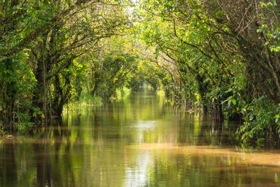
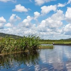
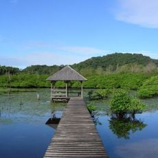
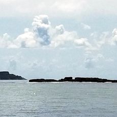
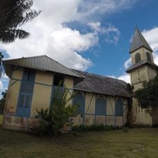
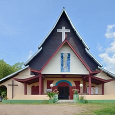
Canal de Kaw, Water channel near Kaw village, French Guiana.
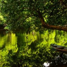
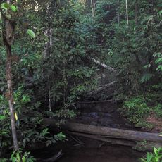
The Canal de Kaw is a waterway in French Guiana that winds through wetlands, linking the Approuague River to the Atlantic Ocean. The channel cuts through dense tropical forest where mangroves and trees grow directly from the water's edge.
Indigenous peoples inhabited this waterway for centuries before the region experienced colonial development in the 1700s. The canal became part of the landscape as Europeans began to reshape the surrounding areas through agricultural activity.
Local residents maintain traditional fishing practices in the canal waters, supporting their families through sustainable harvesting methods passed down through generations.
The best way to explore this waterway is through organized boat tours that depart from nearby communities. Visitors should prepare for changing weather and take precautions against insects.
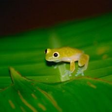
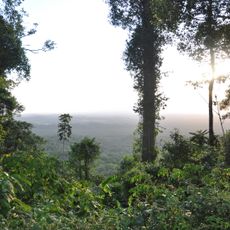
The area is home to caimans and rare bird species that visitors often spot during boat journeys through the waterway. This wildlife presence reflects the region's role as a refuge for tropical animals.
Location: French Guiana
GPS coordinates: 4.50417,-52.02111
Latest update: December 6, 2025 19:07
French Guiana is a region where tropical rainforests meet rivers and coastal areas. The landscape brings together South American nature with French history. You can visit nature reserves where birds and turtles live, explore colonial ruins, and see ancient rock carvings made by indigenous peoples....
Cayenne's Prison
59 km
Cabo Orange National Park
56.5 km
Kaw-Roura Marshes National Nature Reserve
15.8 km
Habitation Loyola
51.9 km
Prefecture hotel of French Guiana
59.3 km
Pont du Larivot
59.1 km
Jardin botanique de Cayenne
58.7 km
Fort Diamant
47.9 km
Salines de Montjoly
54.6 km
Montagne d'Argent
38.2 km
Réserve naturelle nationale de l'île du Grand Connétable
36.9 km
Maison-Musée de Félix Éboué
59.1 km
Trésor Regional Nature Reserve
31 km
Habitation Vidal
50.5 km
Réserve naturelle nationale du mont Grand Matoury
55.1 kmWindmill of Remire-Montjoly
51.7 km
Serpent de Pascaud
48.4 km
Église Saint-Dominique de Roura
41.9 km
Roches gravées de la Montagne Favard
2.5 km
Immeuble Delabergerie
59.1 km
Lavoir de Cayenne
59.1 km
Plage Bourda
55.9 km
Église Sainte-Thérèse de Montjoly
53.1 km
Église Saint-Étienne de Régina
24.5 km
Église Hmong de Cacao
50.5 km
Sentier Molokoï
49.9 km
Marais de Kaw
16.8 km
Immeuble, 122 avenue du Général-de-Gaulle, 40 boulevard Jubelin
59.1 kmVisited this place? Tap the stars to rate it and share your experience / photos with the community! Try now! You can cancel it anytime.
Discover hidden gems everywhere you go!
From secret cafés to breathtaking viewpoints, skip the crowded tourist spots and find places that match your style. Our app makes it easy with voice search, smart filtering, route optimization, and insider tips from travelers worldwide. Download now for the complete mobile experience.
A unique approach to discovering new places❞
— Le Figaro
All the places worth exploring❞
— France Info
A tailor-made excursion in just a few clicks❞
— 20 Minutes