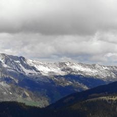
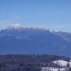
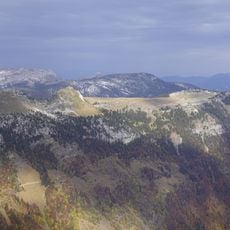
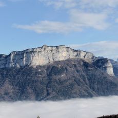
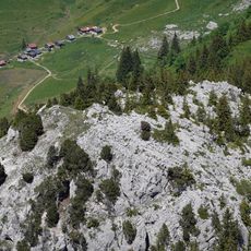
Pointe de la Queblette, Alpine summit in La Balme-de-Thuy, France.
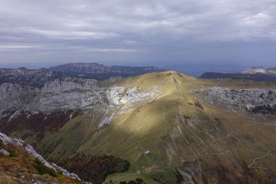
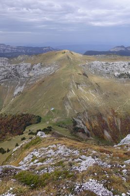
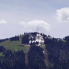
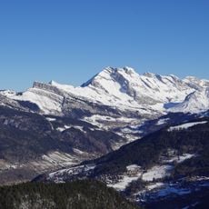
Pointe de la Queblette is an Alpine summit featuring a distinctive ridge formation between two mountain ranges. The peak rises to a height where the tree line ends, offering open ridgeline slopes with wide views across the surrounding valleys and peaks.
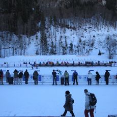
The mountain routes around this summit served as escape and supply paths for French resistance groups during World War II. The high passes provided safe passages away from German occupation checkpoints.
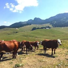
Shepherds graze their herds on the high meadows surrounding the summit during summer months. This traditional farming practice has shaped the landscape and remains visible in the open spaces above the tree line.
The hike climbs steeply through open meadows and across exposed ridge sections, taking most of a day from the valley floor. Sturdy footwear and weather-appropriate gear are essential, as conditions at this altitude can change rapidly.
The ridge displays a striking linear pattern created by the different erosion rates of alternating limestone layers. This geological detail gives the peak its distinctive appearance from certain vantage points.
Location: La Balme-de-Thuy
Location: Glières-Val-de-Borne
Location: Thônes
Elevation above the sea: 1,915 m
GPS coordinates: 45.93701,6.33388
Latest update: December 14, 2025 20:24
Le Parmelan
7.5 km
Monument national à la Résistance du plateau des Glières
3.1 km
Sylvie Becaert Biathlon Stadium
7.6 km
Site de Morette
5.6 km
Abbaye d'Entremont
4.6 km
Mont Lachat
1.7 km
Montagne de Sous-Dine
7.5 km
Télécabine de Beauregard
7.8 km
Église Saint-Maurice de Thônes
6.2 km
Église Notre-Dame-de-Tous-les-Saints d'Entremont
4.6 km
Pont Romain des Clefs
8.2 km
Église Notre-Dame-de-l'Assomption du Grand-Bornand
7.3 km
Maison du patrimoine bornandin
7.6 km
Montagne des Auges
3.6 km
Mont Teret
6.2 km
Vieille église
5.5 km
Montagne Des Frêtes
4.5 km
Cascade de Morette
5.3 km
Home of the Plateau of Glières
3 km
Nécropole nationale de Morette
5.6 km
Maison du patrimoine bornandin
7.6 km
Chapelle de Charvex
7.9 km
Scenic viewpoint
7.4 km
Chapelle Notre-Dame-de-la-Pitié-et-Saint-Claude des Contamines
5.8 km
Chapelle Notre-Dame de la Rivière
4.8 km
Chapelle Saint-François-de-Sales du Regard
3.9 km
Chalets de Mayse
8.2 km
Chapelle Saint-Claude de Forgeassoud
4.9 kmVisited this place? Tap the stars to rate it and share your experience / photos with the community! Try now! You can cancel it anytime.
Discover hidden gems everywhere you go!
From secret cafés to breathtaking viewpoints, skip the crowded tourist spots and find places that match your style. Our app makes it easy with voice search, smart filtering, route optimization, and insider tips from travelers worldwide. Download now for the complete mobile experience.
A unique approach to discovering new places❞
— Le Figaro
All the places worth exploring❞
— France Info
A tailor-made excursion in just a few clicks❞
— 20 Minutes