Enable Location

We need your location to show you interesting places around you

Discover nearby places

Find interesting locations and hidden gems around you

Precise directions

Get accurate directions and distances to places

Your location is never shared with other users. It's only used when you tap the location button.

Potaro-Siparuni

Log in to your account

Start exploring — it's free

Trusted by 64,793 travelers worldwide

Continue with Google
Continue with Apple
or

We will send you a code to connect

By continuing, you accept our Terms and Conditions and our Privacy Policy

Check your inbox

We've sent a pincode in your inbox. Please enter the code below.

Discussion Reviews 1 Photos
7.9k Popularity

Potaro-Siparuni, Administrative region in south-central Guyana.

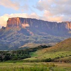
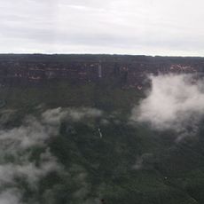
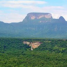
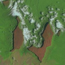
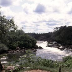
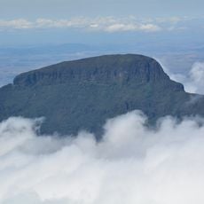
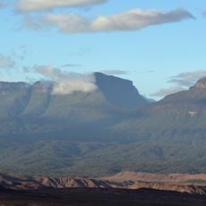
Potaro-Siparuni is an administrative region in south-central Guyana, named after the two rivers that run through it: the Potaro and the Siparuni. The terrain combines dense rainforest with highland plateaus and a network of rivers that shape most of the landscape.

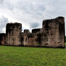
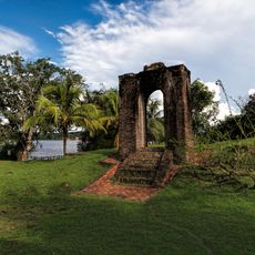
The region drew gold prospectors during the 19th century, which led to the founding of early settlements such as Mahdia. Potaro-Siparuni was formally established as an administrative region after Guyana gained independence in 1966.

The Patamona, an indigenous group, live in small villages scattered across the highlands, where traditional farming and craft-making are part of daily life. Their language belongs to the Cariban family and remains in active use within their communities today.

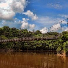
The main way to reach the region is by air, as road connections in this part of Guyana are limited. Those planning to explore inland areas should expect long travel times and consider hiring local guides, since trails through the forest are not clearly marked.

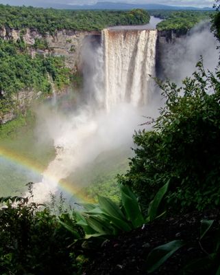
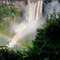
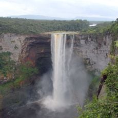
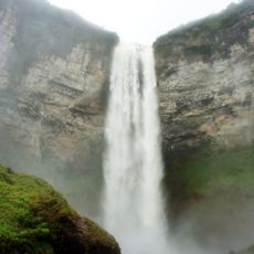
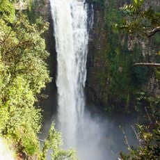
Kaieteur Falls, located within this region, drops over a sandstone ledge into a gorge with a free fall of around 740 feet (226 meters). What surprises many visitors is the remoteness of the site: there is no road to it, and the only access is by small aircraft.

The community of curious travelers

AroundUs brings together thousands of curated places, local tips, and hidden gems, enriched daily by 60,000 contributors worldwide.

Start exploring
Location
Location
Location
Capital city
Mahdia
Shares border with
Upper Demerara-Berbice, Cuyuni-Mazaruni, East Berbice-Corentyne, Upper Takutu-Upper Essequibo, Roraima
GPS coordinates
4.76970,-59.26539
Latest update
March 3, 2026 08:20
Reviews
Share your experience

No review yet

Discussions
Start a discussion...

No discussion yet

« Potaro-Siparuni - Administrative region in south-central Guyana » is provided by Around Us (aroundus.com). Images and texts are derived from Wikimedia project under a Creative Commons license. You are allowed to copy, distribute, and modify copies of this page, under the conditions set by the license, as long as this note is clearly visible.

Discover hidden gems everywhere you go!

From secret cafés to breathtaking viewpoints, skip the crowded tourist spots and find places that match your style. Our app makes it easy with voice search, smart filtering, route optimization, and insider tips from travelers worldwide. Download now for the complete mobile experience.

Around Us App Screenshot

A unique approach to discovering new places

Le Figaro

All the places worth exploring

France Info

A tailor-made excursion in just a few clicks

20 Minutes

Around Us
Travel Guide & Maps
Download

Send to your phone

QR Code
1

Open the camera app on your mobile.

2

Point at the QR code with your camera. A notification will appear.

3

Tap the notification to open the link.