Guyana

Log in to your account

AroundUs is a community-driven map of interesting places, built by curious explorers like you. It grows with every review, story, and photo you share.
Connect to save your favorite spots, contribute locations, and create personalized routes.
Continue with Google
Continue with Apple
Continue with X
Continue with Facebook
Continue with email
By continuing, you accept our Terms and Conditions and our Privacy Policy
Create an account
Add to collection
Map
Suggest a change
Share

Guyana, Sovereign state in northeastern South America.

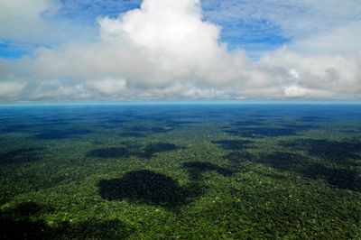
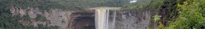
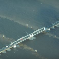
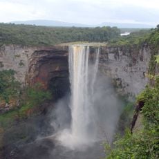
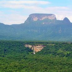
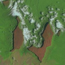
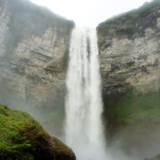
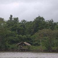
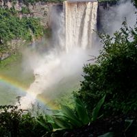
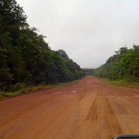
Guyana is a South American state on the northeastern coast of the continent, covering 214,969 square kilometers with tropical rainforest in the interior, savanna landscapes to the south, and agricultural coastal plains. The Pakaraima Mountains rise in the west where Kaieteur Falls drops 741 feet (226 meters), and three major river systems—Essequibo, Demerara, and Berbice—cross the territory.

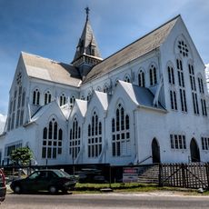
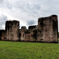
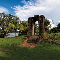
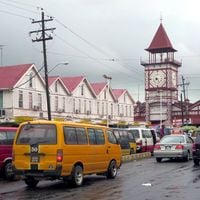
Spanish explorers reached the coast in the late 15th century, but the Dutch established the first permanent European settlements starting in 1580. Britain took control during the Napoleonic Wars and formalized rule in 1814, with slavery ending in 1834 and Indian indentured laborers working sugar plantations between 1838 and 1917 before political independence arrived on May 26, 1966.

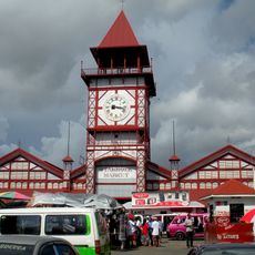
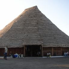
People speak English in everyday life, while Hindi, Urdu, and different Creole languages can be heard in many families. African drum dances, Indian musical traditions, and chutney soca shape celebrations and gatherings throughout the country.

Cheddi Jagan International Airport near Georgetown receives direct flights from New York, Miami, Toronto, Panama, and several Caribbean islands, with visitors requiring a visa or electronic travel authorization depending on nationality. Dry months from February to April and from August to November offer better conditions for rainforest trips, while US dollars are widely accepted alongside the Guyanese dollar.

As the only English-speaking country in South America, road traffic follows left-side driving, a legacy of British colonial rule. The land hosts more than 800 bird species, including the rare Hoatzin with prehistoric features such as claws on the wings of young birds.

Location: Rest of Region 10

Inception: 1966

Capital city: Georgetown

Part of: South America, Caribbean

Shares border with: Brazil, Suriname, Venezuela

Address: Guyana

Website: https://parliament.gov.gy

GPS coordinates: 4.84171,-58.64169

Latest update: December 17, 2025 14:58

Photos
Travel destinations: Albania, Georgia, Southern Italy, Central Asia

This collection brings together around 30 travel destinations that sit outside the usual tourist routes. You will find cities, natural regions, and historical sites where tourism still operates on a human scale. What these places share: you can travel here without encountering the overcrowding that...

Reviews

Visited this place? Tap the stars to rate it and share your experience / photos with the community! Try now! You can cancel it anytime.

« Guyana - Sovereign state in northeastern South America » is provided by Around Us (aroundus.com). Images and texts are derived from Wikimedia project under a Creative Commons license. You are allowed to copy, distribute, and modify copies of this page, under the conditions set by the license, as long as this note is clearly visible.

Discover hidden gems everywhere you go!

From secret cafés to breathtaking viewpoints, skip the crowded tourist spots and find places that match your style. Our app makes it easy with voice search, smart filtering, route optimization, and insider tips from travelers worldwide. Download now for the complete mobile experience.

Around Us App Screenshot

A unique approach to discovering new places

Le Figaro

All the places worth exploring

France Info

A tailor-made excursion in just a few clicks

20 Minutes