Enable Location

We need your location to show you interesting places around you

Discover nearby places

Find interesting locations and hidden gems around you

Precise directions

Get accurate directions and distances to places

Your location is never shared with other users. It's only used when you tap the location button.

Upper Takutu-Upper Essequibo

Log in to your account

Start exploring — it's free

Trusted by 62,832 travelers worldwide

Continue with Google
Continue with Apple
or

We will send you a code to connect

By continuing, you accept our Terms and Conditions and our Privacy Policy

Check your inbox

We've sent a pincode in your inbox. Please enter the code below.

Upper Takutu-Upper Essequibo, Administrative region in southern Guyana

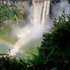
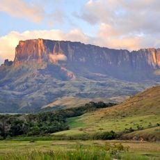
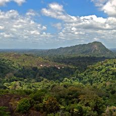
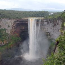
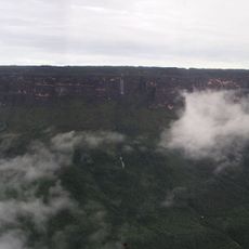
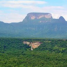
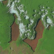
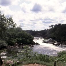
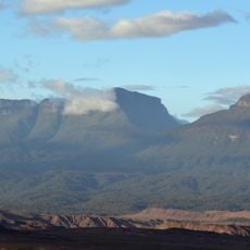
Upper Takutu-Upper Essequibo is a region in southern Guyana covering about 57,750 square kilometers (22,300 square miles). It features rainforests, mangrove swamps, and the expansive Rupununi savannah near the Brazilian border.

The region witnessed the Rupununi Rebellion in January 1969, when inhabitants attempted to establish an independent government. The movement ended without external support and the area returned to national administration.

The Wapichan indigenous communities live throughout this territory and maintain their traditional ways of life. They actively work to protect their ancestral lands from mining and industrial expansion.

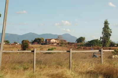
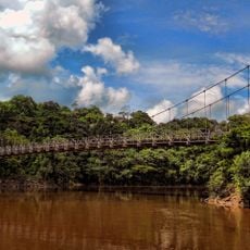
Lethem serves as the administrative center and main hub for connections to various settlements through roads and river transportation. Reaching this remote area takes planning and patience, as access is limited and travel times can be long.

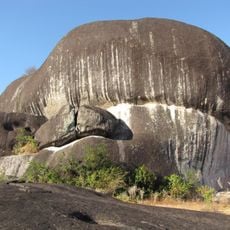
The territory contains multiple ecosystems supporting rare animal species and is affected by an ongoing territorial claim between Guyana and Venezuela. This geopolitical situation shapes the region's development and identity in important ways.

The community of curious travelers

AroundUs brings together thousands of curated places, local tips, and hidden gems, enriched daily by 60,000 contributors worldwide.

Start exploring
Location
Location
Location
Capital city
Lethem
Shares border with
East Berbice-Corentyne, Potaro-Siparuni, Roraima, Pará
GPS coordinates
2.90100,-58.93517
Latest update
December 10, 2025 16:01
« Upper Takutu-Upper Essequibo - Administrative region in southern Guyana » is provided by Around Us (aroundus.com). Images and texts are derived from Wikimedia project under a Creative Commons license. You are allowed to copy, distribute, and modify copies of this page, under the conditions set by the license, as long as this note is clearly visible.

Discover hidden gems everywhere you go!

From secret cafés to breathtaking viewpoints, skip the crowded tourist spots and find places that match your style. Our app makes it easy with voice search, smart filtering, route optimization, and insider tips from travelers worldwide. Download now for the complete mobile experience.

Around Us App Screenshot

A unique approach to discovering new places

Le Figaro

All the places worth exploring

France Info

A tailor-made excursion in just a few clicks

20 Minutes

Around Us
Travel Guide & Maps
Download

Send to your phone

QR Code
1

Open the camera app on your mobile.

2

Point at the QR code with your camera. A notification will appear.

3

Tap the notification to open the link.