Enable Location

We need your location to show you interesting places around you

Discover nearby places

Find interesting locations and hidden gems around you

Precise directions

Get accurate directions and distances to places

Your location is never shared with other users. It's only used when you tap the location button.

Kerala backwaters

Log in to your account

Start exploring — it's free

Trusted by 61,816 travelers worldwide

Continue with Google
Continue with Apple
or

We will send you a code to connect

By continuing, you accept our Terms and Conditions and our Privacy Policy

Check your inbox

We've sent a pincode in your inbox. Please enter the code below.

Kerala backwaters

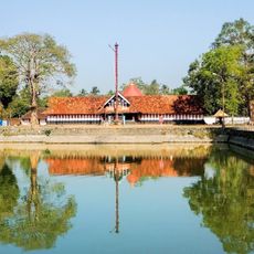
Kerala backwaters, Water Heritage Site and Ramsar site in Kerala, India

Description

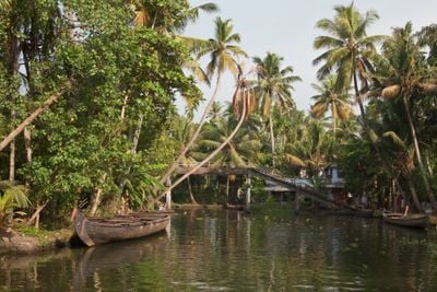
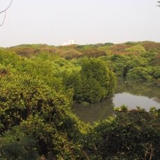
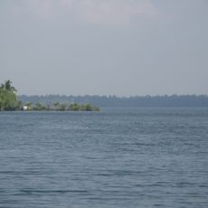
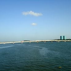
The Kerala backwaters form a 900-kilometer network of interconnected waterways running parallel to the Arabian Sea coast. Palm trees line the shores while narrow channels wind through rice paddies and small villages where traditional wooden boats carry daily traffic.

History

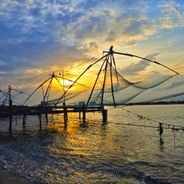
The waterways served for centuries as main trade routes between inland regions and coastal ports for spices, rice, and coconut products. European traders used these channels from the 15th century onward to gain direct access to the spice-growing areas of the interior.

Culture

The Kuttanad region relies on traditional rice cultivation below sea level, with embankments and canals protecting the land from flooding. Villagers use flat-bottomed boats for daily transport between homes, temples, and markets along the banks.

Practical

The dry season from October through March offers the best conditions for exploring by houseboat or ferry. Visitors should bring light clothing and sun protection, as the waterways provide little shade and humidity remains high.

Did you know?

Some houseboats feature traditional kitchens where cooks prepare freshly caught fish and local rice directly during the journey. The widest sections near Vembanad allow for annual snake boat races where up to 100 rowers power a single long vessel.

Location
Address
A C Road, Pallathuruthy Bridge, near St.Thomas Church, Pallathuruthy, Alappuzha, Kainakary South, Kerala 688501, India
GPS coordinates
9.86348,76.35940
Latest update
February 3, 2026 13:10

AroundUs brings together thousands of curated places, local tips, and hidden gems, enriched daily by 60,000 contributors worldwide. Discover all places nearby (Kerala).

What to do in Kerala: backwaters, sandy beaches, and Hindu temples

Kerala stretches along the southwest coast of India, between the Arabian Sea and the Western Ghats. This area has sandy beaches, inland canals lined with palm trees, hills with tea plantations, and forests where elephants and tigers hide. Visitors take boat trips on the backwaters, walk through the...

« Kerala backwaters - Water Heritage Site and Ramsar site in Kerala, India » is provided by Around Us (aroundus.com). Images and texts are derived from Wikimedia project under a Creative Commons license. You are allowed to copy, distribute, and modify copies of this page, under the conditions set by the license, as long as this note is clearly visible.

Discover hidden gems everywhere you go!

From secret cafés to breathtaking viewpoints, skip the crowded tourist spots and find places that match your style. Our app makes it easy with voice search, smart filtering, route optimization, and insider tips from travelers worldwide. Download now for the complete mobile experience.

Around Us App Screenshot

A unique approach to discovering new places

Le Figaro

All the places worth exploring

France Info

A tailor-made excursion in just a few clicks

20 Minutes

Around Us
Travel Guide & Maps
Download

Send to your phone

QR Code
1

Open the camera app on your mobile.

2

Point at the QR code with your camera. A notification will appear.

3

Tap the notification to open the link.