Enable Location

We need your location to show you interesting places around you

Discover nearby places

Find interesting locations and hidden gems around you

Precise directions

Get accurate directions and distances to places

Your location is never shared with other users. It's only used when you tap the location button.

Malda district

Log in to your account

Start exploring — it's free

Trusted by 62,532 travelers worldwide

Continue with Google
Continue with Apple
or

We will send you a code to connect

By continuing, you accept our Terms and Conditions and our Privacy Policy

Check your inbox

We've sent a pincode in your inbox. Please enter the code below.

Malda district, Administrative district in West Bengal, India

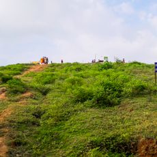
Malda is an administrative territory in West Bengal that stretches along the Mahananda River and its tributaries. The landscape consists of mango groves, rice paddies, and jute fields scattered between small towns and villages.

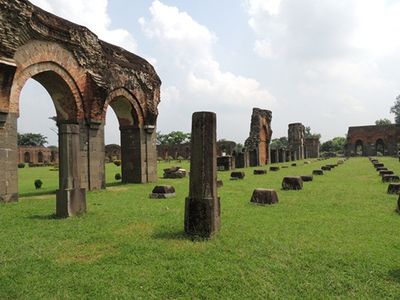
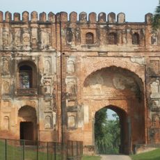
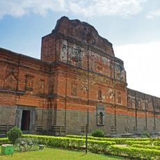
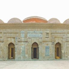
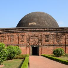
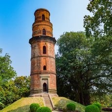
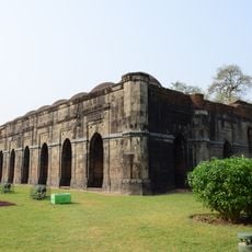
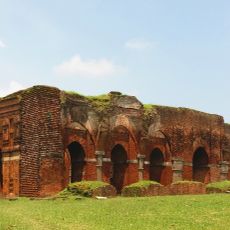
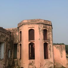
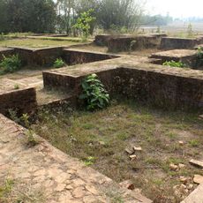
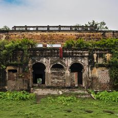
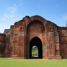
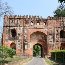
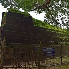
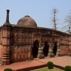
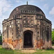
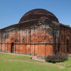
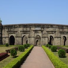
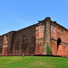
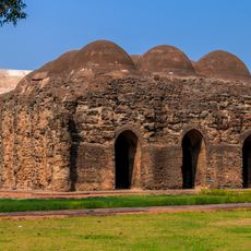
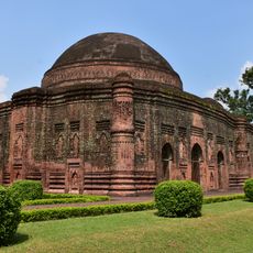
Gaur served as the capital of the Bengal Sultanate from the 13th to the 16th century and attracted merchants from Persia and Central Asia. Pandua functioned as a second power center, and both cities declined after epidemics and political upheaval in the 16th century.

Gombhira performers wear wooden masks and deliver songs that reflect daily concerns and social themes during village gatherings. Jute artisans craft rope, cloth, and decorative items using techniques passed down through generations, and their products appear in markets throughout the area.

English Bazar serves as the main railway station with connections to Kolkata and other major cities in eastern India. Intercity buses run regularly from central bus terminals and link smaller towns throughout the area.

Fazli mangoes ripen in late summer and often weigh more than 2.2 pounds (1 kilogram) per fruit. The old mosques and tombs in Gaur display decorative brickwork created by interlocking stones without mortar.

The community of curious travelers

AroundUs brings together thousands of curated places, local tips, and hidden gems, enriched daily by 60,000 contributors worldwide.

Start exploring
Location
Capital city
Malda
Shares border with
Katihar district, Murshidabad district, Dakshin Dinajpur district, Uttar Dinajpur district, Sahebganj district, Naogaon District, Chapai Nawabganj
GPS coordinates
25.00000,88.15000
Latest update
December 12, 2025 23:09
« Malda district - Administrative district in West Bengal, India » is provided by Around Us (aroundus.com). Images and texts are derived from Wikimedia project under a Creative Commons license. You are allowed to copy, distribute, and modify copies of this page, under the conditions set by the license, as long as this note is clearly visible.

Discover hidden gems everywhere you go!

From secret cafés to breathtaking viewpoints, skip the crowded tourist spots and find places that match your style. Our app makes it easy with voice search, smart filtering, route optimization, and insider tips from travelers worldwide. Download now for the complete mobile experience.

Around Us App Screenshot

A unique approach to discovering new places

Le Figaro

All the places worth exploring

France Info

A tailor-made excursion in just a few clicks

20 Minutes

Around Us
Travel Guide & Maps
Download

Send to your phone

QR Code
1

Open the camera app on your mobile.

2

Point at the QR code with your camera. A notification will appear.

3

Tap the notification to open the link.