Enable Location

We need your location to show you interesting places around you

Discover nearby places

Find interesting locations and hidden gems around you

Precise directions

Get accurate directions and distances to places

Your location is never shared with other users. It's only used when you tap the location button.

Cima di Entrelor

Log in to your account

Start exploring — it's free

Trusted by 61,510 travelers worldwide

Continue with Google
Continue with Apple
or

We will send you a code to connect

By continuing, you accept our Terms and Conditions and our Privacy Policy

Check your inbox

We've sent a pincode in your inbox. Please enter the code below.

Cima di Entrelor

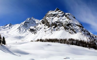
Cima di Entrelor, Alpine summit in Aosta Valley, Italy

Description

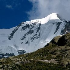
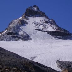
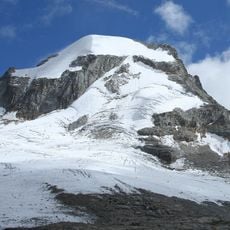
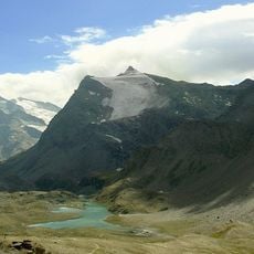
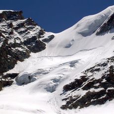
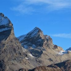
Cima di Entrelor is an Alpine summit in Aosta Valley that rises to 3,430 meters (11,250 feet) and forms the northern point of a ridge between two neighboring valleys. The peak presents a challenging climb with varied terrain including glaciated sections and steep rock faces.

History

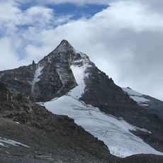
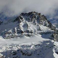
The first recorded ascent occurred in 1877 when two mountaineers established the North Arête route that climbers still use today. The peak has since become a recognized destination for experienced Alpine climbers seeking technical challenges.

Culture

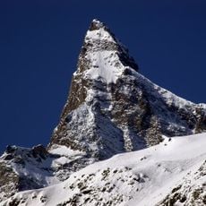
The mountain stands within the Italian Alpine territory where local communities maintain strong connections to mountaineering and winter sports traditions.

Practical

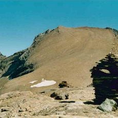
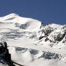
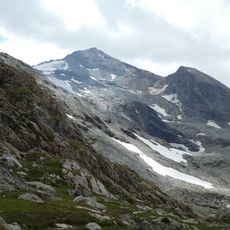
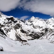
The climb begins from lower elevations around 2000 meters and follows marked paths through high meadows before reaching the glacier section. Proper Alpine gear including crampons and ice axes is essential, as the route demands previous mountaineering experience and solid rock climbing skills.

Did you know?

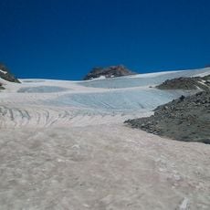
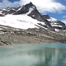
The ascent crosses the Glacier of Percià, a technically demanding section featuring crevasses and ice formations that challenge even experienced climbers. This glacial passage is what distinguishes the route from many other Alpine climbs in the region.

Location
Elevation above the sea
3,430 m
GPS coordinates
45.52951,7.15075
Latest update
December 14, 2025 20:01

AroundUs brings together thousands of curated places, local tips, and hidden gems, enriched daily by 60,000 contributors worldwide. Discover all places nearby (Aosta Valley).

« Cima di Entrelor - Alpine summit in Aosta Valley, Italy » is provided by Around Us (aroundus.com). Images and texts are derived from Wikimedia project under a Creative Commons license. You are allowed to copy, distribute, and modify copies of this page, under the conditions set by the license, as long as this note is clearly visible.

Discover hidden gems everywhere you go!

From secret cafés to breathtaking viewpoints, skip the crowded tourist spots and find places that match your style. Our app makes it easy with voice search, smart filtering, route optimization, and insider tips from travelers worldwide. Download now for the complete mobile experience.

Around Us App Screenshot

A unique approach to discovering new places

Le Figaro

All the places worth exploring

France Info

A tailor-made excursion in just a few clicks

20 Minutes

Around Us
Travel Guide & Maps
Download

Send to your phone

QR Code
1

Open the camera app on your mobile.

2

Point at the QR code with your camera. A notification will appear.

3

Tap the notification to open the link.