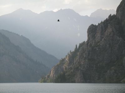
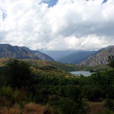
Lake Sary-Chelek, Alpine lake in Jalal-Abad Region, Kyrgyzstan.
Description
Lake Sary-Chelek sits in the Chatkal mountain range at roughly 1873 meters elevation and stretches about 7.5 kilometers in length. The water displays shades of green and blue depending on light and weather conditions throughout the day.
History
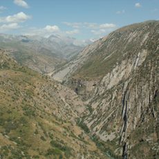
The lake formed through geological processes and earthquakes that created natural dams in Tian Shan valleys. These events shaped the water basin millions of years ago, making it one of the region's oldest mountain lakes.
Culture
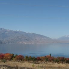
The name comes from Kyrgyz words meaning yellow vessel, reflecting how the water appears under certain light. Local beekeeping traditions remain important to communities around the lake and shape daily life in the region.
Practical
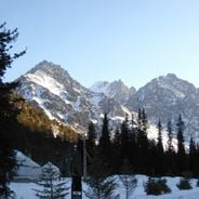
The best time to visit is between May and October when water temperatures are warmer and mountain roads become accessible. The remote location requires careful preparation, suitable gear, and familiarity with high-altitude conditions.
Did you know?
The lake ranks among the deepest alpine bodies of water in Central Asia and shelters over 1000 plant species within its protected reserve. This biological wealth makes it a significant site for conservation work and scientific research across the region.
AroundUs brings together thousands of curated places, local tips, and hidden gems, enriched daily by 60,000 contributors worldwide. Discover all places nearby (Jalal-Abad Region).
Aksu-Zhabagly Nature Reserve
117.2 km
Toktogul Reservoir
76.7 km
Sary-Chelek Nature Reserve
4.6 km
Akyrtas
118.5 km
Tekturmas Mausoleum
118 km
Manas Ordo
78.4 kmPadyshata State Nature Reserve
36.7 km
Mount Adelung
85.6 km
Аулие-Ата
121 km
Kali Yunus Bath
120.7 km
Church of St. Archangel Michael in Namangan 1894
102.9 km
Church of St. Archangel Michael in Namangan 1952
101.1 km
Chust natural monument
109.3 km
Shah Fazil Mausoleum
57.6 km
Ak-Kur
102.4 km
Rodnik Kara-Bulak (tubud sa Kirgistan, Jalal-Abad oblast, lat 41,17, long 72,69)
101.6 km
Rodnik Sasyk-Bulak (tubud sa Kirgistan, Jalal-Abad oblast, lat 41,14, long 72,81)
110.1 km
Akkurgan
101.4 km
Rodnik Burzhu-Bulak
65.1 km
Rodnik Kyzyl-Alma
75.2 km
Rodnik Kara-Suu
47.6 km
Rodnik Sasyk-Bulak (tubud sa Kirgistan, Jalal-Abad oblast, lat 41,25, long 72,90)
106.7 km
Rodnik Kara-Bulak (tubud sa Kirgistan, Jalal-Abad oblast, lat 41,61, long 71,99)
32.3 km
Rodnik Kosh-Bulak
76.9 km
Rodnik Ak-Tash (tubud sa Kirgistan, Jalal-Abad oblast)
77.6 km
Rodnik Kayragach-Bulak
98.8 km
Manasskiy Rayon
99.6 km
Rodnik Tashbulak (tubud sa Kirgistan, Talas)
79.2 kmDiscover hidden gems everywhere you go!
From secret cafés to breathtaking viewpoints, skip the crowded tourist spots and find places that match your style. Our app makes it easy with voice search, smart filtering, route optimization, and insider tips from travelers worldwide. Download now for the complete mobile experience.
A unique approach to discovering new places❞
— Le Figaro
All the places worth exploring❞
— France Info
A tailor-made excursion in just a few clicks❞
— 20 Minutes