Enable Location

We need your location to show you interesting places around you

Discover nearby places

Find interesting locations and hidden gems around you

Precise directions

Get accurate directions and distances to places

Your location is never shared with other users. It's only used when you tap the location button.

Badulla District

Log in to your account

Start exploring — it's free

Trusted by 60,665 travelers worldwide

Continue with Google
Continue with Apple
or

We will send you a code to connect

By continuing, you accept our Terms and Conditions and our Privacy Policy

Check your inbox

We've sent a pincode in your inbox. Please enter the code below.

Badulla District

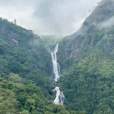
Badulla District, Administrative district in Uva Province, Sri Lanka

Description

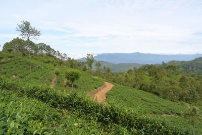
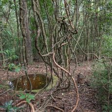
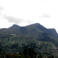
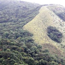
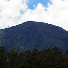
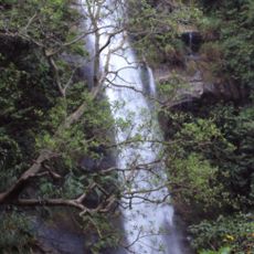
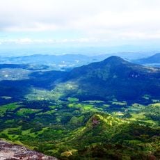
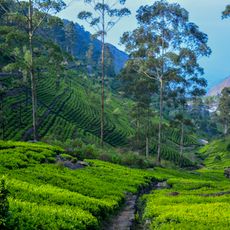
Badulla District is an administrative area in Uva Province that covers hilly terrain planted with tea and agricultural crops. The landscape divides naturally into upper and lower elevations, with small towns and villages nestled throughout the valleys and slopes.

History

The district became a regional administrative center during British colonial rule when infrastructure expanded. Development focused on establishing tea plantations and building road and rail connections.

Culture

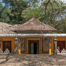
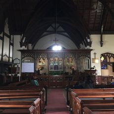
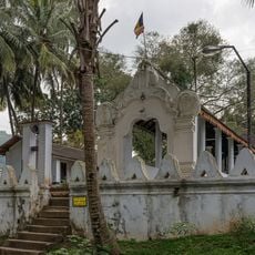
The Muthiyangana Temple sits in the district capital as a center of worship and local gathering. In the surrounding villages, daily life moves around agricultural work and tea harvesting, with people maintaining traditional practices passed down through generations.

Practical

The district connects to major cities via railway and road networks, with journeys from Colombo taking around five to six hours. Public buses and private transport are readily available for exploring towns and countryside throughout the region.

Did you know?

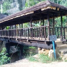
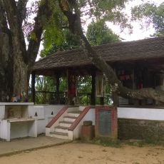
The wooden Bogoda Bridge near Hali-Ela dates from the 16th century and stands as one of the few remaining structures of its kind in the region. It was built using traditional carpentry techniques without nails or modern fasteners.

Location
Capital city
Badulla
GPS coordinates
6.98472,81.05639
Latest update
December 7, 2025 19:31

AroundUs brings together thousands of curated places, local tips, and hidden gems, enriched daily by 60,000 contributors worldwide. Discover all places nearby (Uva Province).

« Badulla District - Administrative district in Uva Province, Sri Lanka » is provided by Around Us (aroundus.com). Images and texts are derived from Wikimedia project under a Creative Commons license. You are allowed to copy, distribute, and modify copies of this page, under the conditions set by the license, as long as this note is clearly visible.

Discover hidden gems everywhere you go!

From secret cafés to breathtaking viewpoints, skip the crowded tourist spots and find places that match your style. Our app makes it easy with voice search, smart filtering, route optimization, and insider tips from travelers worldwide. Download now for the complete mobile experience.

Around Us App Screenshot

A unique approach to discovering new places

Le Figaro

All the places worth exploring

France Info

A tailor-made excursion in just a few clicks

20 Minutes

Around Us
Travel Guide & Maps
Download

Send to your phone

QR Code
1

Open the camera app on your mobile.

2

Point at the QR code with your camera. A notification will appear.

3

Tap the notification to open the link.