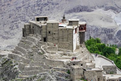
Baltit Fort, Fort in Karimabad, Pakistan
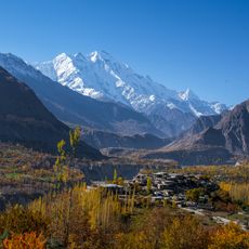
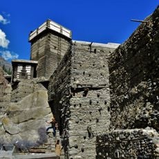
Baltit Fort is a fortified complex perched on a steep slope at 2438 meters above the Hunza Valley in northern Pakistan. The structure consists of multi-story timber and stone buildings with flat roofs, narrow staircases, and small windows that face the surrounding mountains.
The foundations date back to the 8th century when local rulers built the first defenses here. In the 15th century, craftsmen from Baltistan arrived and rebuilt the complex in the style of their home region, giving it the form seen today.
The name Baltit comes from the old ties between this region and neighboring Baltistan, which shaped the building methods here. Visitors today notice the carved wooden balconies and projecting chambers that overlook the valley and once served as living quarters for the ruling family.
The rooms are arranged on several levels linked by narrow wooden stairs, so sturdy footwear is helpful here. Arriving early in the morning often means clearer mountain views and less crowding in the tight passageways.
The royal kitchen still holds original iron cooking pots and bellows that were used for centuries. Some traditional musical instruments from this collection are still played during local festivals today.
The community of curious travelers
AroundUs brings together thousands of curated places, local tips, and hidden gems, enriched daily by 60,000 contributors worldwide.