Bilibino

Log in to your account

AroundUs is a community-driven map of interesting places, built by curious explorers like you. It grows with every review, story, and photo you share.
Connect to save your favorite spots, contribute locations, and create personalized routes.
By continuing, you accept our Terms and Conditions and our Privacy Policy
Add to collection
Map
Suggest a change
Share

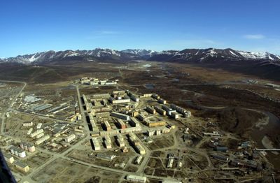
Bilibino, Administrative center in Chukotka Autonomous Okrug, Russia

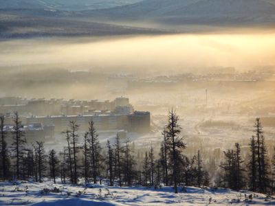
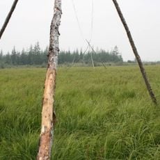
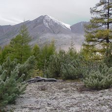
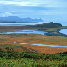
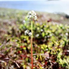
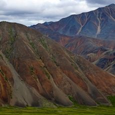
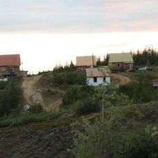
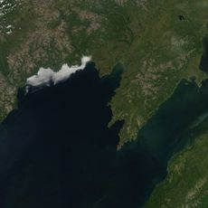
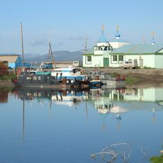
Bilibino is a mining settlement in the easternmost part of Chukotka, where the Karalveyem and Bolshoy Keperveyem rivers meet. The town sits at 274 meters elevation, surrounded by treeless tundra and low hills that turn green during the short summer and freeze solid through the long winter months.

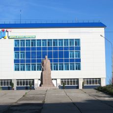
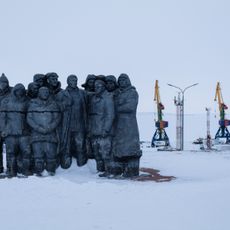
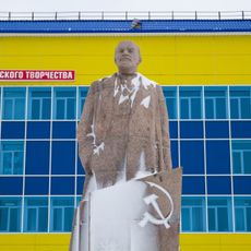
The discovery of gold veins in the early 1950s brought miners and engineers to this remote area, and a small settlement formed around the mining operations. In 1993 the place officially became a town, after the economy shifted toward the nearby nuclear plant built decades earlier.

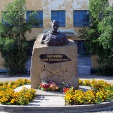
The name honors geologist Yuri Bilibin, who mapped gold deposits across this region during the early 1930s. Today Russian, Ukrainian, Chukchi and Even residents live together here, adapted to the rhythms and demands of Arctic life.

The local Keperveyem Airport offers connections to larger towns, while road traffic operates mainly in summer when routes thaw. Most supplies and goods arrive during the short warm months, and visitors should prepare for cold, windy weather and long nights through the winter season.

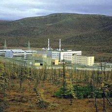
The local nuclear plant supplies power to the entire region and has operated for decades as the northernmost facility of its kind on Earth. Operators now work on plans to replace the aging reactors with smaller modular units better suited to extreme conditions.

Location: Билибино шәһәр җирлеге

Inception: 1955

Elevation above the sea: 274 m

Website: http://bilchao.ru

GPS coordinates: 68.05000,166.45000

Latest update: December 5, 2025 16:37

Photos
Around this place
Show the full map
Zapovednik Wrangel Island
Russian Federation

Zapovednik Wrangel Island

612.1 km
Akademik Lomonosov
Russian Federation

Akademik Lomonosov

241 km
Pleistocene Park
Russian Federation

Pleistocene Park

209.2 km
Bilibino Nuclear Power Plant
Russian Federation

Bilibino Nuclear Power Plant

3.7 km
Peak Pobeda, Sakha
Russian Federation

Peak Pobeda, Sakha

952.7 km
Herald Island
Russian Federation

Herald Island

779.4 km
Kolyma Mountains
Russian Federation

Kolyma Mountains

825.1 km
Koryak Nature Reserve
Russian Federation

Koryak Nature Reserve

917.6 km
Trinity Cathedral (Anadyr)
Russian Federation

Trinity Cathedral (Anadyr)

614.9 km
Pegtymel Petroglyphs
Russian Federation

Pegtymel Petroglyphs

363 km
Kytalyk National Park
Russian Federation

Kytalyk National Park

786.8 km
Momsky nature park
Russian Federation

Momsky nature park

910.4 km
Khatyrka meteorite
Russian Federation

Khatyrka meteorite

706.3 km
Lake Ozhogino
Russian Federation

Lake Ozhogino

809.8 km
Routan Islands
Russian Federation

Routan Islands

239.9 km
Bolschaja-Momskaja-Aufeis
Russian Federation

Bolschaja-Momskaja-Aufeis

934 km
Lake Bolshoye Morskoye
Russian Federation

Lake Bolshoye Morskoye

379.9 km
Northeast Science Station
Russian Federation

Northeast Science Station

220.7 km
Slavyanka Cove
Russian Federation

Slavyanka Cove

989.7 km
Историко-культурный комплекс Пловер
Russian Federation

Историко-культурный комплекс Пловер

989.7 km
Taygonos
Russian Federation

Taygonos

864 km
Sibir
Russian Federation

Sibir

845.9 km
Памятный знак в честь 250-летия Первой Камчатской экспедиции (Провидения)
Russian Federation

Памятный знак в честь 250-летия Первой Камчатской экспедиции (Провидения)

990.5 km
Дворец Пионеров (Анадырь)
Russian Federation

Дворец Пионеров (Анадырь)

615.2 km
Историко-этнографический памятник «Коса Святого Александра» (Анадырь)
Russian Federation

Историко-этнографический памятник «Коса Святого Александра» (Анадырь)

615.2 km
Мемориальный комплекс «Памятник первым Ревкомовцам» (Анадырь)
Russian Federation

Мемориальный комплекс «Памятник первым Ревкомовцам» (Анадырь)

614.3 km
Памятник В. И. Ленину (Анадырь)
Russian Federation

Памятник В. И. Ленину (Анадырь)

615.1 km
Памятник-бюст геологу Ю.А. Билибину (Билибино)
Russian Federation

Памятник-бюст геологу Ю.А. Билибину (Билибино)

481 m
Show the full map
Reviews

Visited this place? Tap the stars to rate it and share your experience / photos with the community! Try now! You can cancel it anytime.

« Bilibino - Administrative center in Chukotka Autonomous Okrug, Russia » is provided by Around Us (aroundus.com). Images and texts are derived from Wikimedia project under a Creative Commons license. You are allowed to copy, distribute, and modify copies of this page, under the conditions set by the license, as long as this note is clearly visible.

Discover hidden gems everywhere you go!

From secret cafés to breathtaking viewpoints, skip the crowded tourist spots and find places that match your style. Our app makes it easy with voice search, smart filtering, route optimization, and insider tips from travelers worldwide. Download now for the complete mobile experience.

Around Us App Screenshot

A unique approach to discovering new places

Le Figaro

All the places worth exploring

France Info

A tailor-made excursion in just a few clicks

20 Minutes