Enable Location

We need your location to show you interesting places around you

Discover nearby places

Find interesting locations and hidden gems around you

Precise directions

Get accurate directions and distances to places

Your location is never shared with other users. It's only used when you tap the location button.

Akushinsky District

Log in to your account

Start exploring — it's free

Trusted by 67,556 travelers worldwide

Continue with Google
Continue with Apple
or

We will send you a code to connect

By continuing, you accept our Terms and Conditions and our Privacy Policy

Check your inbox

We've sent a pincode in your inbox. Please enter the code below.

Akushinsky District
Discussion Reviews 1 Photos
12k Popularity

Akushinsky District, Municipal district in southern central Dagestan, Russia

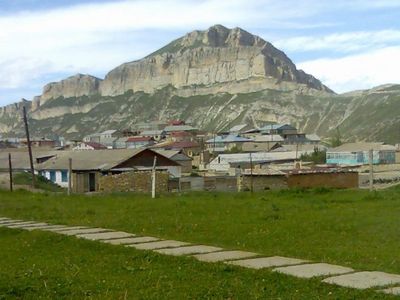
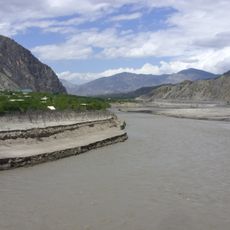
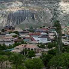
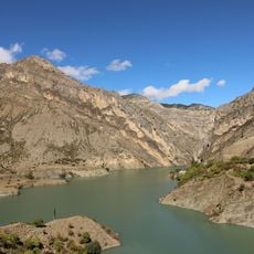
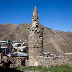
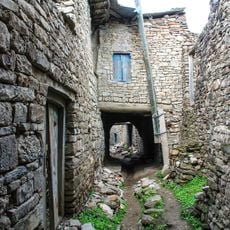
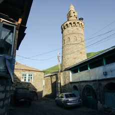
Akushinsky District is a municipal district in southern central Dagestan, extending across mountains and valleys managed by the village of Akusha as its administrative hub. The region comprises thirteen rural councils that oversee local governance and resource management throughout the area.

The district was established in 1934 within the Dagestan Autonomous Soviet Socialist Republic. After the Soviet Union dissolved in 1991, it became part of the independent Republic of Dagestan.

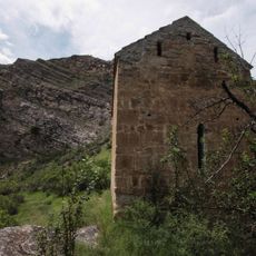
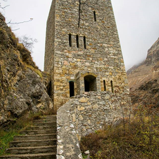
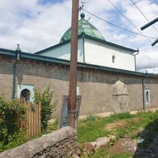
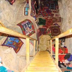
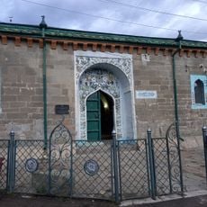
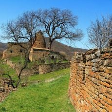
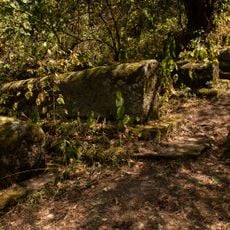
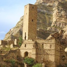
Local communities maintain customs through crafts, music, and celebrations that shape village life across the region. You can observe these traditions in everyday activities and how residents decorate their homes and shared spaces.

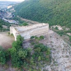
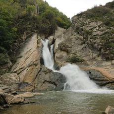
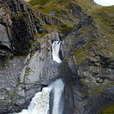
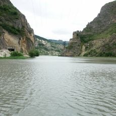
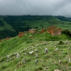
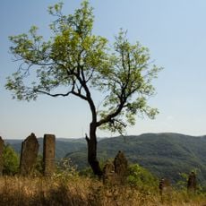
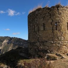
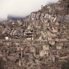
The terrain is mountainous and requires sturdy footwear for walking on uneven paths throughout the villages and surrounding areas. Plan visits during warmer months when mountain passes remain accessible and weather conditions are more favorable.

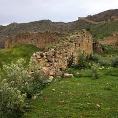
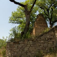
The region sustains traditional mountain farming and livestock breeding at high elevations, practices that have endured for generations. This ancient way of living remains visible in farmer methods and village organization across the landscape.

The community of curious travelers

AroundUs brings together thousands of curated places, local tips, and hidden gems, enriched daily by 60,000 contributors worldwide.

Start exploring
Location
Inception
September 1, 1934
Capital city
Akusha
Elevation above the sea
2,053 m
GPS coordinates
42.27806,47.33889
Latest update
December 7, 2025 20:47
Around this place
Gunib Fortress
Russian Federation

Gunib Fortress

34 km
Datuna Church
Russian Federation

Datuna Church

62.8 km
Khuchni Fortress
Russian Federation

Khuchni Fortress

61.8 km
Gimry tower
Russian Federation

Gimry tower

64.7 km
Khanagsky Waterfall
Russian Federation

Khanagsky Waterfall

59.4 km
Irganai Reservoir
Russian Federation

Irganai Reservoir

58.1 km
Khunzakh Fortress
Russian Federation

Khunzakh Fortress

59.4 km
Кумухская джума-мечеть
Russian Federation

Кумухская джума-мечеть

21.8 km
Пещера Дюрк
Russian Federation

Пещера Дюрк

58.2 km
Vodopad Chyrkhalyu
Russian Federation

Vodopad Chyrkhalyu

57.1 km
Gergebil Reservoir
Russian Federation

Gergebil Reservoir

32.3 km
Джума-мечеть (Кумух)
Russian Federation

Джума-мечеть (Кумух)

21.8 km
Крепостная стена (Гуниб)
Russian Federation

Крепостная стена (Гуниб)

34 km
Мечеть (Салта)
Russian Federation

Мечеть (Салта)

25.8 km
Мавзолей (Кала-Корейш)
Russian Federation

Мавзолей (Кала-Корейш)

32.8 km
Архитектурный комплекс села Амузги (Амузги)
Russian Federation

Архитектурный комплекс села Амузги (Амузги)

31.6 km
Кладбище уцмиев (Кала-Корейш)
Russian Federation

Кладбище уцмиев (Кала-Корейш)

32.8 km
Водохранилище (Гуниб)
Russian Federation

Водохранилище (Гуниб)

33.7 km
Арабское кладбище (Кара-корейш)
Russian Federation

Арабское кладбище (Кара-корейш)

32.9 km
Джума-мечеть (Кала-Корейш)
Russian Federation

Джума-мечеть (Кала-Корейш)

32.8 km
Джума-мечеть с минаретом (Рича)
Russian Federation

Джума-мечеть с минаретом (Рича)

58.9 km
Селение Корода (архитектурный комплекс) (Корода)
Russian Federation

Селение Корода (архитектурный комплекс) (Корода)

44.7 km
Оборонительная сторожевая башня (Гуниб)
Russian Federation

Оборонительная сторожевая башня (Гуниб)

34.1 km
Верхняя боевая башня (Кахиб)
Russian Federation

Верхняя боевая башня (Кахиб)

63 km
Museum in Buynaksk
Russian Federation

Museum in Buynaksk

63.5 km
Джума-мечеть с минаретом (Тпиг)
Russian Federation

Джума-мечеть с минаретом (Тпиг)

59.2 km
Селение Кахиб (старое) (Кахиб)
Russian Federation

Селение Кахиб (старое) (Кахиб)

62.9 km
Нижние ворота крепости (Гуниб)
Russian Federation

Нижние ворота крепости (Гуниб)

33.4 km
Show the full map
Reviews
Share your experience

No review yet

Discussions
Start a discussion...

No discussion yet

« Akushinsky District - Municipal district in southern central Dagestan, Russia » is provided by Around Us (aroundus.com). Images and texts are derived from Wikimedia project under a Creative Commons license. You are allowed to copy, distribute, and modify copies of this page, under the conditions set by the license, as long as this note is clearly visible.

Discover hidden gems everywhere you go!

From secret cafés to breathtaking viewpoints, skip the crowded tourist spots and find places that match your style. Our app makes it easy with voice search, smart filtering, route optimization, and insider tips from travelers worldwide. Download now for the complete mobile experience.

Around Us App Screenshot

A unique approach to discovering new places

Le Figaro

All the places worth exploring

France Info

A tailor-made excursion in just a few clicks

20 Minutes

Around Us
Travel Guide & Maps
Download

Send to your phone

QR Code
1

Open the camera app on your mobile.

2

Point at the QR code with your camera. A notification will appear.

3

Tap the notification to open the link.