Enable Location

We need your location to show you interesting places around you

Discover nearby places

Find interesting locations and hidden gems around you

Precise directions

Get accurate directions and distances to places

Your location is never shared with other users. It's only used when you tap the location button.

Tuti Island

Log in to your account

Start exploring — it's free

Trusted by 63,104 travelers worldwide

Continue with Google
Continue with Apple
or

We will send you a code to connect

By continuing, you accept our Terms and Conditions and our Privacy Policy

Check your inbox

We've sent a pincode in your inbox. Please enter the code below.

Tuti Island
Discussion Reviews 1 Photos 1 Collections
5.6k Popularity

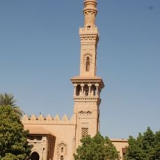
Tuti Island, River island at the convergence of White Nile and Blue Nile, Sudan.

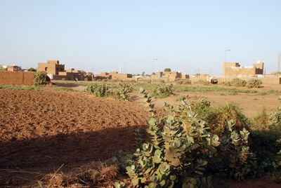
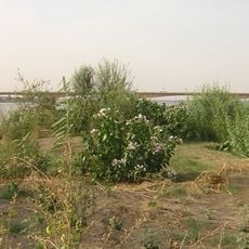
Tuti Island is a river island where the White Nile and Blue Nile meet, with grasslands and crop fields forming its main features. The land includes citrus orchards and narrow paths used by donkeys and small vehicles for getting around.

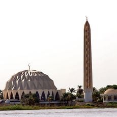
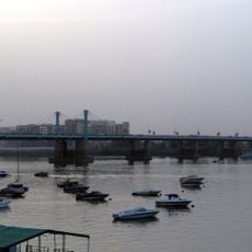
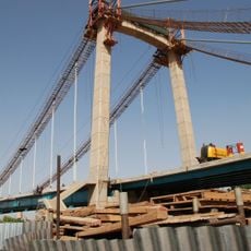
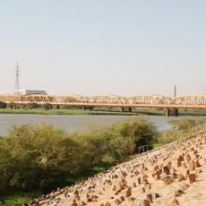
Settlement started in the late 15th century and grew into a farming village that kept its agricultural character through the years. A bridge completed in 2008 changed how the island connects to nearby cities.

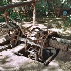
The people living here maintain farming practices passed down through generations, shaping how the island looks and functions today. Their work shows how a community keeps its way of life even as the city grows around it.

The island can be reached by bridge from the surrounding cities, making entry and exit straightforward. It is small enough to explore on foot or by using local transportation.

The island supplies Khartoum with fruit and vegetables using farming methods passed down over many generations. This role as a food source for the city is often overlooked compared to its location at the river junction.

The community of curious travelers

AroundUs brings together thousands of curated places, local tips, and hidden gems, enriched daily by 60,000 contributors worldwide.

Start exploring
GPS coordinates
15.61918,32.50550
Latest update
December 21, 2025 16:05
Photography locations in Sudan

Sudan offers photographers a substantial mix of ancient monuments, desert formations and river landscapes. The country contains more than 200 pyramids at Meroe, Nuri and El-Kurru that differ markedly from their Egyptian counterparts. These Nubian structures rise from the desert with few visitors...

Reviews
Share your experience

No review yet

Discussions
Start a discussion...

No discussion yet

« Tuti Island - River island at the convergence of White Nile and Blue Nile, Sudan » is provided by Around Us (aroundus.com). Images and texts are derived from Wikimedia project under a Creative Commons license. You are allowed to copy, distribute, and modify copies of this page, under the conditions set by the license, as long as this note is clearly visible.

Discover hidden gems everywhere you go!

From secret cafés to breathtaking viewpoints, skip the crowded tourist spots and find places that match your style. Our app makes it easy with voice search, smart filtering, route optimization, and insider tips from travelers worldwide. Download now for the complete mobile experience.

Around Us App Screenshot

A unique approach to discovering new places

Le Figaro

All the places worth exploring

France Info

A tailor-made excursion in just a few clicks

20 Minutes

Around Us
Travel Guide & Maps
Download

Send to your phone

QR Code
1

Open the camera app on your mobile.

2

Point at the QR code with your camera. A notification will appear.

3

Tap the notification to open the link.