Dnipro-Donbas Canal, Water canal system in Dnipropetrovsk and Kharkiv Oblasts, Ukraine.
The Dnipro-Donbas Canal is a water transport system spanning roughly 263 kilometers that connects the Dnipro River to the Siverskyi Donets River. The network uses channels, pumping stations, and reservoirs to move water across regions where natural supply is limited.
Construction started in 1969 to address industrial water demands in the region, with the first section opening in 1981. The project grew out of the need to better distribute natural water resources between industrial and agricultural areas across eastern Ukraine.
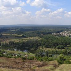
The canal's visible infrastructure, including pipelines and pumping stations, has become woven into the region's landscape and daily life. It enables the farming and industry that supports communities across eastern Ukraine.
The system crosses multiple counties and is only accessible to visitors at specific points such as stations and viewing areas. The best time to visit is late spring through early fall, when weather is stable and the infrastructure is easy to observe.
The system uses five aqueducts to overcome a height difference of about 68 meters between the Kamianske Reservoir and Krasnopavlivka Reservoir. This engineering solution made it possible to move water across difficult terrain and reach areas that would otherwise lack sufficient supply.
The community of curious travelers
AroundUs brings together thousands of curated places, local tips, and hidden gems, enriched daily by 60,000 contributors worldwide.