Chest opened
+${chestReward.xp} XP
Explorer
NOUVEAU ×${chestReward.collectible.quantity}
tapez pour fermer
Chest locked

Open chests in the app

Around Us is built for your phone — chests unlock when you walk, explore and capture nearby places.

Enable Location

We need your location to show you interesting places around you

Discover nearby places

Find interesting locations and hidden gems around you

Precise directions

Get accurate directions and distances to places

Your location is never shared with other users. It's only used when you tap the location button.

Fire Island National Seashore

Log in to your account

Start exploring — it's free

Trusted by 72,876 travelers worldwide

Continue with Google
Continue with Apple
or

We will send you a code to connect

By continuing, you accept our Terms and Conditions and our Privacy Policy

Check your inbox

We've sent a pincode in your inbox. Please enter the code below.

Fire Island National Seashore
Discussion Reviews 1 Photos
11.3k Popularity

Fire Island National Seashore, National seashore in Suffolk County, United States.

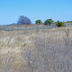
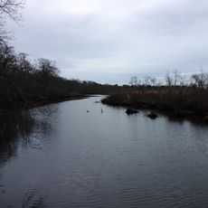
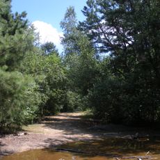
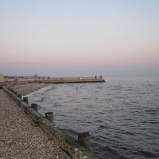
Fire Island National Seashore is a protected coastal area featuring sandy beaches, maritime forests, and dunes stretched along a barrier island between Long Island and the Atlantic. The landscape shows how wind and water have shaped the terrain over time.

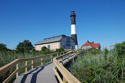
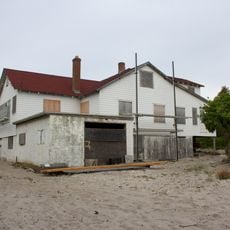
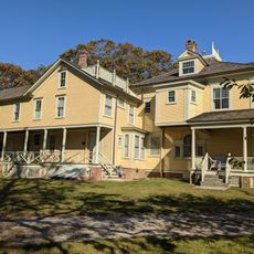
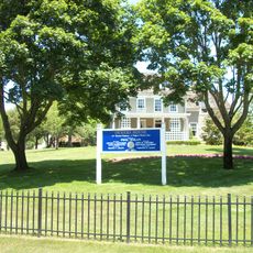
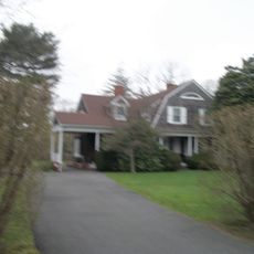
The area became a protected national seashore in 1964, bringing two important historic sites under federal care: the William Floyd Estate and the Fire Island Lighthouse built in the mid-1800s. These places show how people have inhabited and used this coastline for generations.

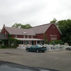
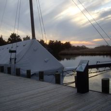
The communities scattered across the island each have their own character, with Cherry Grove and Fire Island Pines serving as social gathering spots for visitors and residents. The way people live here reflects a strong connection to the water and seasonal rhythms of coastal life.

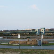
Most of the seashore is not accessible by private car, so ferries from Long Island communities are the main way to reach the island. Planning ahead helps since ferry schedules change with the seasons and weather.

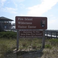
The Otis Pike Fire Island High Dune Wilderness covers over 1,000 acres and stands as the only federally designated wilderness area in New York State. This protected forest offers a rare chance to find completely undeveloped coastal habitat in a heavily populated region.

The community of curious travelers

AroundUs brings together thousands of curated places, local tips, and hidden gems, enriched daily by 60,000 contributors worldwide.

Start exploring
Location
GPS coordinates
40.69639,-72.98278
Latest update
December 8, 2025 13:42
Around this place
Heckscher State Park
United States of America

Heckscher State Park

15.1 km
Bayport - Blue Point High School
United States of America

Bayport - Blue Point High School

8 km
Gateway Playhouse
United States of America

Gateway Playhouse

8.5 km
Wertheim National Wildlife Refuge
United States of America

Wertheim National Wildlife Refuge

12.6 km
Otis Pike Fire Island High Dune Wilderness
United States of America

Otis Pike Fire Island High Dune Wilderness

4.9 km
Patchogue Theatre
United States of America

Patchogue Theatre

8.1 km
Bayport Aerodrome
United States of America

Bayport Aerodrome

9.1 km
Sayville National Wildlife Refuge
United States of America

Sayville National Wildlife Refuge

11.8 km
Carrington House
United States of America

Carrington House

8.9 km
Smith Point Bridge
United States of America

Smith Point Bridge

10.7 km
Sandspit Park Beach & Marina
United States of America

Sandspit Park Beach & Marina

6.3 km
United States of America

Shorefront Park

6.2 km
Priscilla
United States of America

Priscilla

9.9 km
John Ellis Roosevelt Estate
United States of America

John Ellis Roosevelt Estate

8.9 km
Long Island Maritime Museum
United States of America

Long Island Maritime Museum

9.9 km
Modesty
United States of America

Modesty

10 km
Patchogue-Medford Library
United States of America

Patchogue-Medford Library

8.1 km
Cherry Grove Community House and Theatre
United States of America

Cherry Grove Community House and Theatre

10 km
United States of America

Harold H. Malkmes Wildlife Education and Ecology Center

12.3 km
Bellport Village Historic District
United States of America

Bellport Village Historic District

7.9 km
United States of America

Swan Lake Park

8.3 km
Mascot Dock
United States of America

Mascot Dock

6.1 km
Bellport Academy
United States of America

Bellport Academy

7.5 km
Robert Hawkins Homestead
United States of America

Robert Hawkins Homestead

14.6 km
Rudolph Oyster House
United States of America

Rudolph Oyster House

9.9 km
Smith-Rourke House
United States of America

Smith-Rourke House

7.3 km
Jacob Ockers House
United States of America

Jacob Ockers House

12.8 km
Joseph Wood House
United States of America

Joseph Wood House

9 km
Show the full map
Reviews
Share your experience

No review yet

Discussions
Start a discussion...

No discussion yet

« Fire Island National Seashore - National seashore in Suffolk County, United States » is provided by Around Us (aroundus.com). Images and texts are derived from Wikimedia project under a Creative Commons license. You are allowed to copy, distribute, and modify copies of this page, under the conditions set by the license, as long as this note is clearly visible.

Discover hidden gems everywhere you go!

From secret cafés to breathtaking viewpoints, skip the crowded tourist spots and find places that match your style. Our app makes it easy with voice search, smart filtering, route optimization, and insider tips from travelers worldwide. Download now for the complete mobile experience.

Around Us App Screenshot

A unique approach to discovering new places

Le Figaro

All the places worth exploring

France Info

A tailor-made excursion in just a few clicks

20 Minutes

Around Us
Travel Guide & Maps
Download

Send to your phone

QR Code
1

Open the camera app on your mobile.

2

Point at the QR code with your camera. A notification will appear.

3

Tap the notification to open the link.