Calloway County

Log in to your account

AroundUs is a community-driven map of interesting places, built by curious explorers like you. It grows with every review, story, and photo you share.
Connect to save your favorite spots, contribute locations, and create personalized routes.
Continue with Google
Continue with Apple
Continue with X
Continue with Facebook
Continue with email
By continuing, you accept our Terms and Conditions and our Privacy Policy
Create an account
Add to collection
Map
Suggest a change
Share

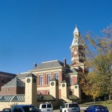
Calloway County, County in western Kentucky, United States.

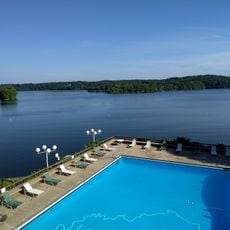
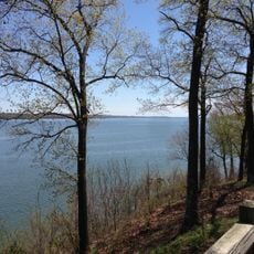
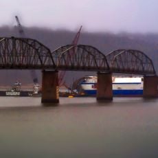
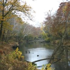
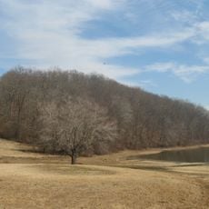
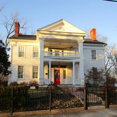
Calloway County is an administrative division in western Kentucky spanning roughly 386 square miles (1,000 square kilometers). The landscape consists of farmland, residential communities, and water bodies including sections of Kentucky Lake.

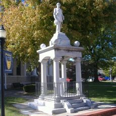
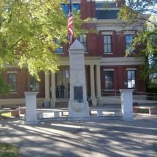
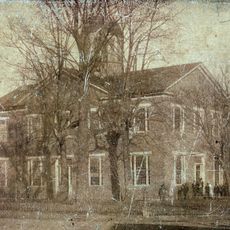
The county was established in 1821 and named after Colonel Richard Callaway, an early settler in Kentucky. Callaway helped found Boonesborough, one of the first European settlements in the region during the colonial expansion period.

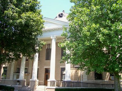
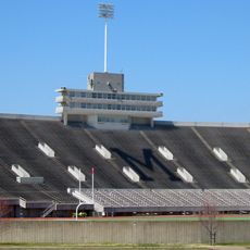
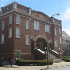
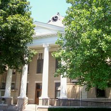
Murray State University shapes life in the county seat through educational programs and academic events that draw people together. The campus and student community influence daily rhythms and social activities across the region.

The county maintains essential services including an Enhanced 911 emergency system for all areas. Newcomers and visitors should be aware of local regulations, particularly regarding alcohol sales that vary between incorporated and unincorporated zones.

Despite its classification as a moist county, local law prohibits alcohol sales across most of the area. Only within Murray's city limits can businesses legally sell alcoholic beverages, creating a distinct contrast with surrounding jurisdictions.

Location: Kentucky

Inception: December 19, 1821

Capital city: Murray

Shares border with: Marshall County, Trigg County, Stewart County, Henry County, Graves County

Website: http://callowaycounty-ky.gov

GPS coordinates: 36.62000,-88.27000

Latest update: December 7, 2025 19:24

Photos
Around this place
Land Between the Lakes National Recreation Area
United States of America

Land Between the Lakes National Recreation Area

31.6 km
Fort Donelson
United States of America

Fort Donelson

39.6 km
Eiffel Tower
United States of America

Eiffel Tower

37.2 km
CFSB Center
United States of America

CFSB Center

4.5 km
Lake Barkley State Resort Park
United States of America

Lake Barkley State Resort Park

39.8 km
Kenlake State Resort Park
United States of America

Kenlake State Resort Park

19.4 km
Confederate Monument in Murray
United States of America

Confederate Monument in Murray

3.1 km
Roy Stewart Stadium
United States of America

Roy Stewart Stadium

4.3 km
Eggner's Ferry Bridge
United States of America

Eggner's Ferry Bridge

21.6 km
Kentucky Dam Village State Resort Park
United States of America

Kentucky Dam Village State Resort Park

43.1 km
Wooldridge Monuments
United States of America

Wooldridge Monuments

35.7 km
Clarks River National Wildlife Refuge
United States of America

Clarks River National Wildlife Refuge

31 km
Cherokee State Park
United States of America

Cherokee State Park

19.5 km
Confederate Memorial in Mayfield
United States of America

Confederate Memorial in Mayfield

35.3 km
Mt. Zion Church and Cemetery
United States of America

Mt. Zion Church and Cemetery

34.4 km
Confederate Memorial Gates in Mayfield
United States of America

Confederate Memorial Gates in Mayfield

35.6 km
Mayfield Downtown Commercial District
United States of America

Mayfield Downtown Commercial District

35.3 km
First Baptist Church
United States of America

First Baptist Church

3.1 km
First Christian Church
United States of America

First Christian Church

3.1 km
Henry County Courthouse
United States of America

Henry County Courthouse

35.7 km
Robert E. Lee School
United States of America

Robert E. Lee School

35.4 km
Porter House
United States of America

Porter House

36.1 km
Edwin S. Diuguid House
United States of America

Edwin S. Diuguid House

3.2 km
Thomas Lawson House
United States of America

Thomas Lawson House

42.8 km
West Paris Historic District
United States of America

West Paris Historic District

35.6 km
Calloway County Courthouse
United States of America

Calloway County Courthouse

3.1 km
Paris Commercial Historic District
United States of America

Paris Commercial Historic District

35.7 km
Pete Lyles House
United States of America

Pete Lyles House

39.8 km
Show the full map
Reviews

Visited this place? Tap the stars to rate it and share your experience / photos with the community! Try now! You can cancel it anytime.

« Calloway County - County in western Kentucky, United States » is provided by Around Us (aroundus.com). Images and texts are derived from Wikimedia project under a Creative Commons license. You are allowed to copy, distribute, and modify copies of this page, under the conditions set by the license, as long as this note is clearly visible.

Discover hidden gems everywhere you go!

From secret cafés to breathtaking viewpoints, skip the crowded tourist spots and find places that match your style. Our app makes it easy with voice search, smart filtering, route optimization, and insider tips from travelers worldwide. Download now for the complete mobile experience.

Around Us App Screenshot

A unique approach to discovering new places

Le Figaro

All the places worth exploring

France Info

A tailor-made excursion in just a few clicks

20 Minutes