·

Enable Location

We need your location to show you interesting places around you

Discover nearby places

Find interesting locations and hidden gems around you

Precise directions

Get accurate directions and distances to places

Your location is never shared with other users. It's only used when you tap the location button.

Johnson County

Log in to your account

Start exploring — it's free

Trusted by 62,749 travelers worldwide

Continue with Google
Continue with Apple
or

We will send you a code to connect

By continuing, you accept our Terms and Conditions and our Privacy Policy

Check your inbox

We've sent a pincode in your inbox. Please enter the code below.

Johnson County, Administrative division in northeastern Tennessee, United States.

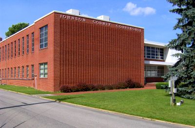
Johnson County is an administrative division in northeastern Tennessee with Mountain City as its administrative center. The county serves as the hub for government services, educational facilities, and commercial activity in the region.

The county was formed in 1836 from Carter County and named after Thomas Johnson, an early settler along the Doe River. This creation was part of the development of the Appalachian region during early American expansion.

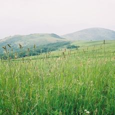
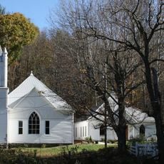
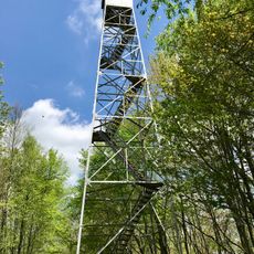
The county keeps alive Appalachian music traditions and local craftsmanship through regular gatherings and everyday practices in its communities. These customs form an important part of how people spend their time together throughout the year.

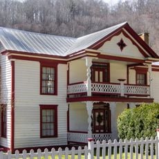
Mountain City provides a central location for accessing government services and local facilities. Visitors should be aware this is a small rural community with more limited services compared to larger urban centers.

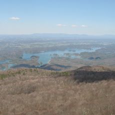
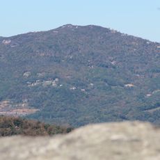
The county borders three states, a rare geographic position in the region. This placement at the intersection has shaped how the area developed and looks today.

The community of curious travelers

AroundUs brings together thousands of curated places, local tips, and hidden gems, enriched daily by 60,000 contributors worldwide.

Start exploring
Location
Inception
1836
Capital city
Mountain City
Shares border with
Ashe County, Avery County, Washington County, Grayson County, Watauga County, Carter County, Sullivan County
GPS coordinates
36.46000,-81.86000
Latest update
December 7, 2025 10:06
Around this place
Kidd Brewer Stadium
United States of America

Kidd Brewer Stadium

31.8 km
Watauga Lake
United States of America

Watauga Lake

19.1 km
South Holston Lake
United States of America

South Holston Lake

21.6 km
United States of America

North Carolina–Tennessee–Virginia Corners

21.7 km
Whitetop Mountain
United States of America

Whitetop Mountain

30.2 km
George M. Holmes Convocation Center
United States of America

George M. Holmes Convocation Center

32.3 km
Elk Knob State Park
United States of America

Elk Knob State Park

22.1 km
Beech Mountain
United States of America

Beech Mountain

30.7 km
United States of America

Howard Knob

30.4 km
Daniel Boone Hotel
United States of America

Daniel Boone Hotel

31.3 km
Moonlite Drive-In
United States of America

Moonlite Drive-In

29.2 km
Heartwood – The Southwest Virginia Artisan Gateway
United States of America

Heartwood – The Southwest Virginia Artisan Gateway

29.4 km
Valle Crucis Episcopal Mission
United States of America

Valle Crucis Episcopal Mission

30 km
United States of America

Whitetop Mountain

30.4 km
Mont Calm
United States of America

Mont Calm

29.3 km
Jones House
United States of America

Jones House

31.2 km
Cove Creek High School
United States of America

Cove Creek High School

22.9 km
United States of America

Whitetop Laurel

23.8 km
Butler House
United States of America

Butler House

5.4 km
United States Post Office
United States of America

United States Post Office

31 km
Worth's Chapel
United States of America

Worth's Chapel

21.4 km
John Smith Miller House
United States of America

John Smith Miller House

28 km
Ward Family House
United States of America

Ward Family House

23.9 km
Lackey Field
United States of America

Lackey Field

32.3 km
John W. Tucker House
United States of America

John W. Tucker House

28.3 km
Miller Homestead
United States of America

Miller Homestead

27.4 km
Kettlefoot Fire Lookout Tower
United States of America

Kettlefoot Fire Lookout Tower

3.7 km
Horn in the West Amphitheatre
United States of America

Horn in the West Amphitheatre

32.7 km
Show the full map
Administrative divisions
« Johnson County - Administrative division in northeastern Tennessee, United States » is provided by Around Us (aroundus.com). Images and texts are derived from Wikimedia project under a Creative Commons license. You are allowed to copy, distribute, and modify copies of this page, under the conditions set by the license, as long as this note is clearly visible.

Discover hidden gems everywhere you go!

From secret cafés to breathtaking viewpoints, skip the crowded tourist spots and find places that match your style. Our app makes it easy with voice search, smart filtering, route optimization, and insider tips from travelers worldwide. Download now for the complete mobile experience.

Around Us App Screenshot

A unique approach to discovering new places

Le Figaro

All the places worth exploring

France Info

A tailor-made excursion in just a few clicks

20 Minutes

Around Us
Travel Guide & Maps
Download

Send to your phone

QR Code
1

Open the camera app on your mobile.

2

Point at the QR code with your camera. A notification will appear.

3

Tap the notification to open the link.