Enable Location

We need your location to show you interesting places around you

Discover nearby places

Find interesting locations and hidden gems around you

Precise directions

Get accurate directions and distances to places

Your location is never shared with other users. It's only used when you tap the location button.

Whiteclay

Log in to your account

Start exploring — it's free

Trusted by 69,452 travelers worldwide

Continue with Google
Continue with Apple
or

We will send you a code to connect

By continuing, you accept our Terms and Conditions and our Privacy Policy

Check your inbox

We've sent a pincode in your inbox. Please enter the code below.

Discussion Reviews 1 Photos
24k Popularity

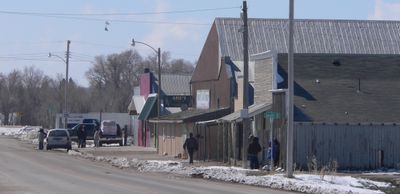
Whiteclay, Census-designated place near Pine Ridge Indian Reservation, Nebraska, United States.

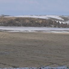
Whiteclay is a small settlement in Sheridan County located near the Pine Ridge Indian Reservation. The community sits in a flat region and today is defined largely by its proximity to the reservation and its relationship with the local Oglala Sioux population.

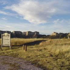
The area was established in 1882 as a buffer zone and was drastically reduced by President Theodore Roosevelt's executive order in 1904. This change had far-reaching effects on how the settlement developed and its relationship to the nearby reservation.

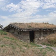
The place holds deep ties to the Oglala Sioux Tribe, who call this area Makȟásaŋ in the Lakota language. Visitors can sense this connection through the local heritage and the community's ongoing relationship with the nearby reservation.

The settlement is very small and requires local orientation to understand its geographic connections to the reservation. Good preparation for weather and distances is important, as the region is sparsely populated.

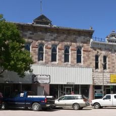
The community was for many years an economic hub for alcohol sales in the region before all four retail establishments closed in 2017. This dramatic shift marked a turning point in the settlement's economic structure and story.

The community of curious travelers

AroundUs brings together thousands of curated places, local tips, and hidden gems, enriched daily by 60,000 contributors worldwide.

Start exploring
Location
Elevation above the sea
1,004 m
GPS coordinates
42.99693,-102.55461
Latest update
December 20, 2025 13:18
Around this place
Fort Robinson
United States of America

Fort Robinson

83 km
Wounded Knee National Historic Landmark
United States of America

Wounded Knee National Historic Landmark

22.4 km
Toadstool Geologic Park
United States of America

Toadstool Geologic Park

85.1 km
United States of America

Spade Ranch

85.8 km
Angostura Reservoir
United States of America

Angostura Reservoir

79.3 km
Chadron State Park
United States of America

Chadron State Park

49.6 km
Pine Ridge National Recreation Area
United States of America

Pine Ridge National Recreation Area

62.3 km
Bordeaux Trading Post
United States of America

Bordeaux Trading Post

35.8 km
Camp Sheridan
United States of America

Camp Sheridan

22.3 km
Lacreek National Wildlife Refuge
United States of America

Lacreek National Wildlife Refuge

79.6 km
Angostura Dam
United States of America

Angostura Dam

81.3 km
Trailside Museum of Natural History at Fort Robinson State Park
United States of America

Trailside Museum of Natural History at Fort Robinson State Park

83 km
Mari Sandoz High Plains Heritage Center
United States of America

Mari Sandoz High Plains Heritage Center

41.5 km
Governor Leslie Jensen House
United States of America

Governor Leslie Jensen House

88.5 km
Fort Robinson State Park
United States of America

Fort Robinson State Park

84 km
Dawes County Courthouse
United States of America

Dawes County Courthouse

65.9 km
Chadron Commercial Historic District
United States of America

Chadron Commercial Historic District

40.8 km
Plains Theatre
United States of America

Plains Theatre

31.9 km
Inland Theater
United States of America

Inland Theater

69.5 km
Crites Hall
United States of America

Crites Hall

41.3 km
Sheridan County Courthouse
United States of America

Sheridan County Courthouse

32 km
Sparks Hall
United States of America

Sparks Hall

41.3 km
Miller Hall
United States of America

Miller Hall

39.3 km
Chadron Public Library
United States of America

Chadron Public Library

40.9 km
Edna Work Hall
United States of America

Edna Work Hall

41.4 km
Lee and Gottliebe Fritz House
United States of America

Lee and Gottliebe Fritz House

35.7 km
Fort Robinson Museum & History Center
United States of America

Fort Robinson Museum & History Center

82.9 km
Wounded Knee cemetery
United States of America

Wounded Knee cemetery

22.4 km
Show the full map
Reviews
Share your experience

No review yet

Discussions
Start a discussion...

No discussion yet

« Whiteclay - Census-designated place near Pine Ridge Indian Reservation, Nebraska, United States » is provided by Around Us (aroundus.com). Images and texts are derived from Wikimedia project under a Creative Commons license. You are allowed to copy, distribute, and modify copies of this page, under the conditions set by the license, as long as this note is clearly visible.

Discover hidden gems everywhere you go!

From secret cafés to breathtaking viewpoints, skip the crowded tourist spots and find places that match your style. Our app makes it easy with voice search, smart filtering, route optimization, and insider tips from travelers worldwide. Download now for the complete mobile experience.

Around Us App Screenshot

A unique approach to discovering new places

Le Figaro

All the places worth exploring

France Info

A tailor-made excursion in just a few clicks

20 Minutes

Around Us
Travel Guide & Maps
Download

Send to your phone

QR Code
1

Open the camera app on your mobile.

2

Point at the QR code with your camera. A notification will appear.

3

Tap the notification to open the link.