Enable Location

We need your location to show you interesting places around you

Discover nearby places

Find interesting locations and hidden gems around you

Precise directions

Get accurate directions and distances to places

Your location is never shared with other users. It's only used when you tap the location button.

Shenandoah National Park

Log in to your account

Start exploring — it's free

Trusted by 62,505 travelers worldwide

Continue with Google
Continue with Apple
or

We will send you a code to connect

By continuing, you accept our Terms and Conditions and our Privacy Policy

Check your inbox

We've sent a pincode in your inbox. Please enter the code below.

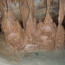
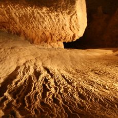
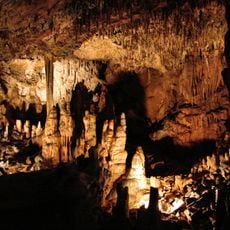
Shenandoah National Park, National park in Virginia, United States.

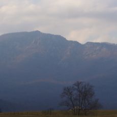
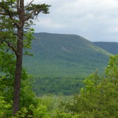
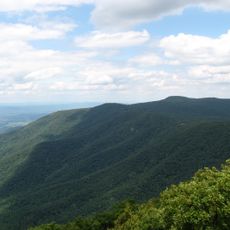
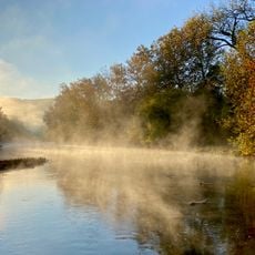
Shenandoah National Park is a national park in Virginia that runs along the crest of the Blue Ridge Mountains. The landscape consists of forested slopes with hardwood trees, rocky summits, and valleys through which small rivers flow.

The United States Congress established the park in late 1935 after purchasing land that had previously been farmed. Workers from the Civilian Conservation Corps built paths, shelters, and roads in the following years.

The name Shenandoah likely comes from an indigenous language and has been interpreted to mean something like "daughter of the stars" or "river through the spruces". Today rangers lead guided walks and visitors stop at wayside exhibits that explain how people lived in these mountains before the park was created.

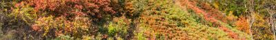
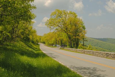
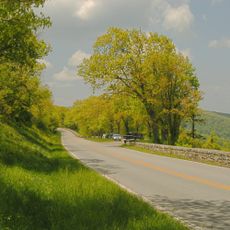
Skyline Drive is the main road running through the park and provides access to overlooks, trailheads, and campgrounds. In autumn the changing leaf colors draw many visitors, while in winter some sections may close due to snow.

A section of the Appalachian Trail runs through the park, linking it to a long-distance footpath that extends across multiple states. Wildlife such as black bears and white-tailed deer live in the forests and are sometimes spotted along roads and trails.

The community of curious travelers

AroundUs brings together thousands of curated places, local tips, and hidden gems, enriched daily by 60,000 contributors worldwide.

Start exploring
Location
Inception
December 26, 1935
Operator
National Park Service
GPS coordinates
38.53330,-78.35000
Latest update
December 15, 2025 00:24
Around this place
Luray Caverns
United States of America

Luray Caverns

18.7 km
Skyline Drive
United States of America

Skyline Drive

9.8 km
Montpelier
United States of America

Montpelier

38.3 km
Old Rag Mountain
United States of America

Old Rag Mountain

3.7 km
The Rotunda
United States of America

The Rotunda

57 km
National Radio Astronomy Observatory
United States of America

National Radio Astronomy Observatory

57.2 km
Rapidan Camp
United States of America

Rapidan Camp

7.7 km
The Great Stalacpipe Organ
United States of America

The Great Stalacpipe Organ

18.7 km
Barboursville
United States of America

Barboursville

41.7 km
Shenandoah Caverns
United States of America

Shenandoah Caverns

34.4 km
Endless Caverns
United States of America

Endless Caverns

29.2 km
Mirador
United States of America

Mirador

65.6 km
United States of America

Skyline Caverns

42.4 km
Grand Caverns
United States of America

Grand Caverns

52.1 km
Brown College at Monroe Hill
United States of America

Brown College at Monroe Hill

57.2 km
Massanutten Waterpark
United States of America

Massanutten Waterpark

34.6 km
Klöckner Stadium
United States of America

Klöckner Stadium

56 km
Albert and Shirley Small Special Collections Library
United States of America

Albert and Shirley Small Special Collections Library

57 km
New Market Battlefield State Historical Park
United States of America

New Market Battlefield State Historical Park

31.4 km
Thomas Jefferson
United States of America

Thomas Jefferson

56.9 km
Memorial Gymnasium
United States of America

Memorial Gymnasium

56.9 km
Meems Bottom Covered Bridge
United States of America

Meems Bottom Covered Bridge

33.8 km
Thornton Gap
United States of America

Thornton Gap

14.5 km
Farmington
United States of America

Farmington

55 km
Shenandoah River Raymond R. "Andy" Guest Jr. State Park
United States of America

Shenandoah River Raymond R. "Andy" Guest Jr. State Park

36.1 km
Stony Man Mountain
United States of America

Stony Man Mountain

7.4 km
Seven Bends State Park
United States of America

Seven Bends State Park

37.8 km
The Aviator
United States of America

The Aviator

57 km
Show the full map
« Shenandoah National Park - National park in Virginia, United States » is provided by Around Us (aroundus.com). Images and texts are derived from Wikimedia project under a Creative Commons license. You are allowed to copy, distribute, and modify copies of this page, under the conditions set by the license, as long as this note is clearly visible.

Discover hidden gems everywhere you go!

From secret cafés to breathtaking viewpoints, skip the crowded tourist spots and find places that match your style. Our app makes it easy with voice search, smart filtering, route optimization, and insider tips from travelers worldwide. Download now for the complete mobile experience.

Around Us App Screenshot

A unique approach to discovering new places

Le Figaro

All the places worth exploring

France Info

A tailor-made excursion in just a few clicks

20 Minutes

Around Us
Travel Guide & Maps
Download

Send to your phone

QR Code
1

Open the camera app on your mobile.

2

Point at the QR code with your camera. A notification will appear.

3

Tap the notification to open the link.