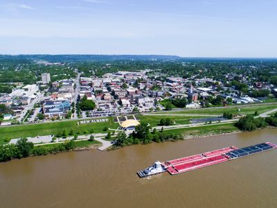
New Albany, County seat in Floyd County, Indiana, United States.
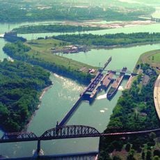
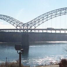
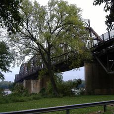
New Albany is a city in Floyd County, Indiana, situated along the Ohio River and serving as the county seat. The city connects to surrounding areas through state highways and contains residential neighborhoods alongside commercial areas that make up its downtown.
The city was founded in 1813 and grew into a major settlement along the river. Over time, it became established as Floyd County's administrative center, shaping the development of the surrounding region.
Small businesses and family-owned shops form the backbone of daily life here, shaping how residents spend their time and where they gather. Walking through town, you notice how these local enterprises define the character of the place and how much the community depends on them.
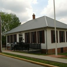
City offices provide information and services for visitors seeking details about local government and community resources. Visiting during weekdays gives you better access to staff who can answer questions and point you toward what you want to see.
The city has developed the South Monon Freedom Trail and Ohio River Greenway, which offer residents and visitors pathways for walking and enjoying outdoor spaces. These newer projects quietly connect different parts of town while opening access to the riverfront that was previously less visited.
Location: Floyd County
Inception: 1813
Elevation above the sea: 137 m
Shares border with: Floyds Knobs
Website: http://cityofnewalbany.com
GPS coordinates: 38.30190,-85.82140
Latest update: December 6, 2025 21:24
Falls of the Ohio National Wildlife Conservation Area
5.6 km
McAlpine Locks and Dam
3.7 km
Sherman Minton Bridge
2.6 km
Kentucky & Indiana Terminal Bridge
2.7 km
Culbertson Mansion
1.9 km
Derby Dinner Playhouse
6.3 km
Town Clock Church
2 km
Squire Earick House
3.4 km
United States Marine Hospital of Louisville
4.7 km
Scribner House
2.1 km
Portland Museum
4.7 km
New Albany National Cemetery
1.4 km
Carnegie Center for Art & History
1.7 km
New Albany Downtown Historic District
1.9 km
Lapping Park
6 km
St. Anthony Roman Catholic Church, Rectory, Convent, and School
5.6 km
Division Street School
1.7 km
Woodbine
2.9 km
Montgomery Street School
4.4 km
Cedar Bough Place Historic District
1.1 km
Theodore Roosevelt Elementary School
5.9 km
Shelby Place Historic District
1 km
River Run Water Park
1.9 km
DePauw Avenue Historic District
979 m
East Spring Street Historic District
1.6 km
William Young House
2.3 km
Hedden's Grove Historic District
1.5 km
Old Clarksville Site
4.3 kmReviews
Visited this place? Tap the stars to rate it and share your experience / photos with the community! Try now! You can cancel it anytime.
Discover hidden gems everywhere you go!
From secret cafés to breathtaking viewpoints, skip the crowded tourist spots and find places that match your style. Our app makes it easy with voice search, smart filtering, route optimization, and insider tips from travelers worldwide. Download now for the complete mobile experience.
A unique approach to discovering new places❞
— Le Figaro
All the places worth exploring❞
— France Info
A tailor-made excursion in just a few clicks❞
— 20 Minutes