Floyd County

Log in to your account

AroundUs is a community-driven map of interesting places, built by curious explorers like you. It grows with every review, story, and photo you share.
Connect to save your favorite spots, contribute locations, and create personalized routes.
By continuing, you accept our Terms and Conditions and our Privacy Policy
Add to collection
Map
Suggest a change
Share

Floyd County, Administrative division in southern Indiana, United States.
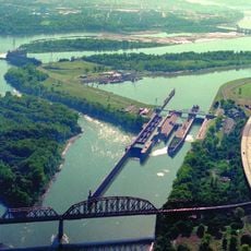
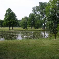
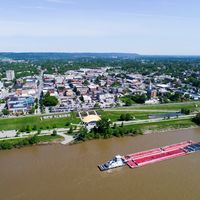
Floyd County spans across multiple townships including Franklin, Georgetown, Greenville, and Lafayette, with the Ohio River forming its southern boundary.

The territory was officially established as Floyd County on January 2, 1819, named after Colonel John Floyd of Kentucky who served in the War of 1812.

The Clark/Floyd Counties Convention and Tourism Bureau organizes regional events that showcase the traditions and heritage of the local communities throughout the year.
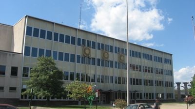
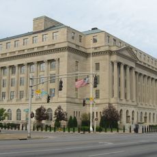
The county administration operates from 2524 Corydon Pike in New Albany, offering services through various departments including health, recreation, and public safety.

State highways 64, 265, 150, 111, 311, and 62 intersect within Floyd County, creating a transportation network that connects its communities to neighboring regions.

Location: Indiana

Inception: January 2, 1819

Capital city: New Albany

Shares border with: Clark County, Jefferson County, Harrison County, Washington County

Website: http://floydcounty.in.gov

GPS coordinates: 38.32000,-85.90000

Latest update: March 21, 2025 21:36

Around this place
Show the full map
Churchill Downs
United States of America

Churchill Downs

17.3 km
Louisville Slugger Museum & Factory
United States of America

Louisville Slugger Museum & Factory

13.8 km
Falls of the Ohio National Wildlife Conservation Area
United States of America

Falls of the Ohio National Wildlife Conservation Area

12.7 km
Frazier History Museum
United States of America

Frazier History Museum

13.7 km
McAlpine Locks and Dam
United States of America

McAlpine Locks and Dam

10.5 km
Sherman Minton Bridge
United States of America

Sherman Minton Bridge

8.2 km
Union Station
United States of America

Union Station

14.1 km
Kentucky Science Center
United States of America

Kentucky Science Center

13.9 km
Kentucky & Indiana Terminal Bridge
United States of America

Kentucky & Indiana Terminal Bridge

9.5 km
Culbertson Mansion
United States of America

Culbertson Mansion

8.5 km
St. James Court Art Show
United States of America

St. James Court Art Show

15.6 km
Fourteenth Street Bridge
United States of America

Fourteenth Street Bridge

13.1 km
St. James-Belgravia Historic District
United States of America

St. James-Belgravia Historic District

15.6 km
32nd Indiana Monument
United States of America

32nd Indiana Monument

13.7 km
Louisville Falls Fountain
United States of America

Louisville Falls Fountain

11 km
Town Clock Church
United States of America

Town Clock Church

8.1 km
Squire Earick House
United States of America

Squire Earick House

9.8 km
United States Marine Hospital of Louisville
United States of America

United States Marine Hospital of Louisville

11.5 km
Scribner House
United States of America

Scribner House

7.9 km
Gene Snyder United States Courthouse
United States of America

Gene Snyder United States Courthouse

14.5 km
Chickasaw Park
United States of America

Chickasaw Park

10.5 km
Portland Museum
United States of America

Portland Museum

11.4 km
New Albany National Cemetery
United States of America

New Albany National Cemetery

8.5 km
Proof on Main
United States of America

Proof on Main

14 km
Carnegie Center for Art & History
United States of America

Carnegie Center for Art & History

7.8 km
Basil Doerhoefer House
United States of America

Basil Doerhoefer House

10.1 km
New Albany Downtown Historic District
United States of America

New Albany Downtown Historic District

7.9 km
Lapping Park
United States of America

Lapping Park

11.4 km
Show the full map

Reviews

Visited this place? Tap the stars to rate it and share your experience / photos with the community! Try now! You can cancel it anytime.

Administrative divisions
« Floyd County: Administrative division in southern Indiana, United States » is provided by Around Us (aroundus.com). Images and texts are derived from Wikimedia project under a Creative Commons license. You are allowed to copy, distribute, and modify copies of this page, under the conditions set by the license, as long as this note is clearly visible.

Discover hidden gems everywhere you go!

From secret cafés to breathtaking viewpoints, skip the crowded tourist spots and find places that match your style. Our app makes it easy with voice search, smart filtering, route optimization, and insider tips from travelers worldwide. Download now for the complete mobile experience.

Around Us App Screenshot

A unique approach to discovering new places

Le Figaro

All the places worth exploring

France Info

A tailor-made excursion in just a few clicks

20 Minutes