Chest opened
+${chestReward.xp} XP
Explorer
NOUVEAU ×${chestReward.collectible.quantity}
tapez pour fermer
Chest locked

Open chests in the app

Around Us is built for your phone — chests unlock when you walk, explore and capture nearby places.

Enable Location

We need your location to show you interesting places around you

Discover nearby places

Find interesting locations and hidden gems around you

Precise directions

Get accurate directions and distances to places

Your location is never shared with other users. It's only used when you tap the location button.

Olentangy River

Log in to your account

Start exploring — it's free

Trusted by 72,891 travelers worldwide

Continue with Google
Continue with Apple
or

We will send you a code to connect

By continuing, you accept our Terms and Conditions and our Privacy Policy

Check your inbox

We've sent a pincode in your inbox. Please enter the code below.

Olentangy River
Discussion Reviews 1 Photos
13.5k Popularity

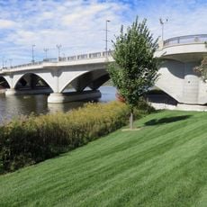
Olentangy River, River in central Ohio, United States.

The Olentangy River is a waterway in central Ohio that flows through two counties, characterized by steep shale banks. The streambed passes through a network of ravines where dark shale formations and ironstone concretions appear in the exposed rock layers.

The river was originally called Whetstone River before lawmakers changed its name in 1833. The new name comes from an indigenous language and reflects the geological features that defined the region.

The waterway's name originates from the shale deposits lining its banks, which Native Americans used for tool-making and sharpening. This geological feature shaped how local people understood and valued the river for generations.

Multiple locations along the waterway offer access for paddling and water activities in the middle sections. Visitors should consider current conditions and seasonal water levels, as these affect what activities are possible.

The riverbed contains large ironstone nodules within the shale layers that sometimes protrude above the water level during high flow. These distinctive formations took millions of years to develop and have influenced water patterns throughout the river's history.

The community of curious travelers

AroundUs brings together thousands of curated places, local tips, and hidden gems, enriched daily by 60,000 contributors worldwide.

Start exploring
Location
GPS coordinates
39.96504,-83.01698
Latest update
December 7, 2025 20:26
Around this place
Ohio Penitentiary
United States of America

Ohio Penitentiary

610 m
Central High School
United States of America

Central High School

1 km
Union Station arch
United States of America

Union Station arch

886 m
Scioto Mile
United States of America

Scioto Mile

1.3 km
Statue of Christopher Columbus
United States of America

Statue of Christopher Columbus

1.2 km
AEP Building
United States of America

AEP Building

954 m
Columbus City Hall
United States of America

Columbus City Hall

1.2 km
William Green Building
United States of America

William Green Building

1.2 km
Three Nationwide Plaza
United States of America

Three Nationwide Plaza

1.2 km
Discovery Bridge
United States of America

Discovery Bridge

1.1 km
The Condominiums at North Bank Park
United States of America

The Condominiums at North Bank Park

607 m
United States of America

77 North Front Street

1.1 km
Battelle Riverfront Park
United States of America

Battelle Riverfront Park

1 km
Michael B. Coleman Government Center
United States of America

Michael B. Coleman Government Center

1.2 km
Gen. William Henry Harrison Headquarters
United States of America

Gen. William Henry Harrison Headquarters

510 m
Genoa Park
United States of America

Genoa Park

1.1 km
Joseph P. Kinneary United States Courthouse
United States of America

Joseph P. Kinneary United States Courthouse

1 km
Holy Family Church
United States of America

Holy Family Church

491 m
Flowing Kiss
United States of America

Flowing Kiss

635 m
Alexander Park
United States of America

Alexander Park

846 m
Columbus Firefighters Memorial
United States of America

Columbus Firefighters Memorial

1.1 km
Sullivant Land Office
United States of America

Sullivant Land Office

486 m
Beacon Building
United States of America

Beacon Building

1.3 km
West Side Spiritualist Church
United States of America

West Side Spiritualist Church

741 m
Jaeger Machine Company Office Building
United States of America

Jaeger Machine Company Office Building

169 m
National Veterans Memorial and Museum
United States of America

National Veterans Memorial and Museum

829 m
Ohio Moline Plow Building
United States of America

Ohio Moline Plow Building

1.2 km
The Harrison House
United States of America

The Harrison House

512 m
Show the full map
Reviews
Share your experience

No review yet

Discussions
Start a discussion...

No discussion yet

« Olentangy River - River in central Ohio, United States » is provided by Around Us (aroundus.com). Images and texts are derived from Wikimedia project under a Creative Commons license. You are allowed to copy, distribute, and modify copies of this page, under the conditions set by the license, as long as this note is clearly visible.

Discover hidden gems everywhere you go!

From secret cafés to breathtaking viewpoints, skip the crowded tourist spots and find places that match your style. Our app makes it easy with voice search, smart filtering, route optimization, and insider tips from travelers worldwide. Download now for the complete mobile experience.

Around Us App Screenshot

A unique approach to discovering new places

Le Figaro

All the places worth exploring

France Info

A tailor-made excursion in just a few clicks

20 Minutes

Around Us
Travel Guide & Maps
Download

Send to your phone

QR Code
1

Open the camera app on your mobile.

2

Point at the QR code with your camera. A notification will appear.

3

Tap the notification to open the link.