Chest opened
+${chestReward.xp} XP
Explorer
NOUVEAU ×${chestReward.collectible.quantity}
tapez pour fermer
Chest locked

Open chests in the app

Around Us is built for your phone — chests unlock when you walk, explore and capture nearby places.

Enable Location

We need your location to show you interesting places around you

Discover nearby places

Find interesting locations and hidden gems around you

Precise directions

Get accurate directions and distances to places

Your location is never shared with other users. It's only used when you tap the location button.

Lake Helen

Log in to your account

Start exploring — it's free

Trusted by 72,879 travelers worldwide

Continue with Google
Continue with Apple
or

We will send you a code to connect

By continuing, you accept our Terms and Conditions and our Privacy Policy

Check your inbox

We've sent a pincode in your inbox. Please enter the code below.

Lake Helen
Discussion Reviews 1 Photos
3.2k Popularity

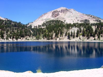
Lake Helen, Glacial lake in Shasta County, United States.

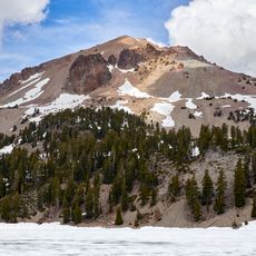
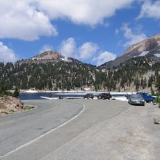
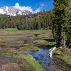
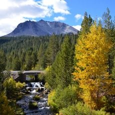
Lake Helen is a glacial lake sitting at roughly 8,000 feet (2,400 m) elevation near the base of Lassen Peak within Lassen Volcanic National Park in northern California. The water is a deep blue color and stays extremely cold throughout the year.

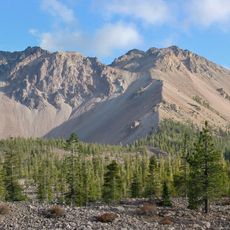
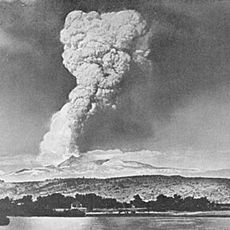
The lake formed during the last ice age, when glaciers carved out the terrain around Lassen Peak and left behind a natural basin. Indigenous peoples of the region used the area as a food source and held it in spiritual regard long before European settlers arrived.

The lake is named after Helen Tanner Brodt, an early woman climber who ascended Lassen Peak in the 19th century. Visitors who arrive in summer often find others standing at the shoreline trying to photograph the volcano reflected on the water surface.

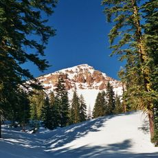
The lake sits right alongside the main park road, making it easy to reach on foot from the parking area. Weather at this elevation can shift fast, so bringing a warm layer is a good idea even on sunny summer days.

The lake often stays frozen under a thick sheet of ice well into July, making it one of the last spots in the park to thaw each year. Winter snowshoers use the frozen surface as a landmark when traveling through the snow-covered terrain.

The community of curious travelers

AroundUs brings together thousands of curated places, local tips, and hidden gems, enriched daily by 60,000 contributors worldwide.

Start exploring
Location
GPS coordinates
40.46860,-121.51000
Latest update
March 3, 2026 13:56
Around this place
Lassen Peak
United States of America

Lassen Peak

2.2 km
Mount Tehama
United States of America

Mount Tehama

4.9 km
Geothermal areas in Lassen Volcanic National Park
United States of America

Geothermal areas in Lassen Volcanic National Park

1.4 km
Chaos Crags
United States of America

Chaos Crags

6.3 km
Drakesbad Guest Ranch
United States of America

Drakesbad Guest Ranch

9.4 km
Nobles Emigrant Trail
United States of America

Nobles Emigrant Trail

11.3 km
Loomis Museum
United States of America

Loomis Museum

8.8 km
Lassen Volcanic National Park Highway Historic District
United States of America

Lassen Volcanic National Park Highway Historic District

3.6 km
Warner Valley Ranger Station
United States of America

Warner Valley Ranger Station

11.2 km
Manzanita Lake Naturalist's Services Historic District
United States of America

Manzanita Lake Naturalist's Services Historic District

8.7 km
Summit Lake Ranger Station
United States of America

Summit Lake Ranger Station

7.8 km
Hot Rock
United States of America

Hot Rock

7.6 km
Discovery Center
United States of America

Discovery Center

8.8 km
Sulphur Works
United States of America

Sulphur Works

3.1 km
Loomis Ranger Station
United States of America

Loomis Ranger Station

8.7 km
Seismograph Building
United States of America

Seismograph Building

8.8 km
Kohm Yah-mah-nee Visitor Center
United States of America

Kohm Yah-mah-nee Visitor Center

4 km
Bumpass Hell
United States of America

Bumpass Hell

1.4 km
Manzanita Ranger Residence
United States of America

Manzanita Ranger Residence

9.3 km
Lassen Peak Trailhead
United States of America

Lassen Peak Trailhead

767 m
Chaos Jumbles
United States of America

Chaos Jumbles

8.3 km
Lassen Volcanic Center
United States of America

Lassen Volcanic Center

2.6 km
Kings Creek
United States of America

Kings Creek

14.5 km
Mather Plaque in Lassen Volcanic National Park
United States of America

Mather Plaque in Lassen Volcanic National Park

8.8 km
Hat Creek Culvert
United States of America

Hat Creek Culvert

5.9 km
Summit Lake North Campground
United States of America

Summit Lake North Campground

7.8 km
Lost Creek Group Campground
United States of America

Lost Creek Group Campground

10.4 km
Manzanita Kiosk
United States of America

Manzanita Kiosk

9.3 km
Show the full map
Reviews
Share your experience

No review yet

Discussions
Start a discussion...

No discussion yet

« Lake Helen - Glacial lake in Shasta County, United States » is provided by Around Us (aroundus.com). Images and texts are derived from Wikimedia project under a Creative Commons license. You are allowed to copy, distribute, and modify copies of this page, under the conditions set by the license, as long as this note is clearly visible.

Discover hidden gems everywhere you go!

From secret cafés to breathtaking viewpoints, skip the crowded tourist spots and find places that match your style. Our app makes it easy with voice search, smart filtering, route optimization, and insider tips from travelers worldwide. Download now for the complete mobile experience.

Around Us App Screenshot

A unique approach to discovering new places

Le Figaro

All the places worth exploring

France Info

A tailor-made excursion in just a few clicks

20 Minutes

Around Us
Travel Guide & Maps
Download

Send to your phone

QR Code
1

Open the camera app on your mobile.

2

Point at the QR code with your camera. A notification will appear.

3

Tap the notification to open the link.