Enable Location

We need your location to show you interesting places around you

Discover nearby places

Find interesting locations and hidden gems around you

Precise directions

Get accurate directions and distances to places

Your location is never shared with other users. It's only used when you tap the location button.

U.S. Route 1 in Massachusetts

Log in to your account

Start exploring — it's free

Trusted by 65,157 travelers worldwide

Continue with Google
Continue with Apple
or

We will send you a code to connect

By continuing, you accept our Terms and Conditions and our Privacy Policy

Check your inbox

We've sent a pincode in your inbox. Please enter the code below.

U.S. Route 1 in Massachusetts
Discussion Reviews 1 Photos 1 Collections
16k Popularity

U.S. Route 1 in Massachusetts, section of U.S. Highway in Massachusetts, United States

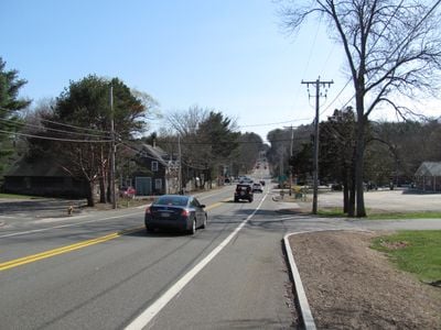
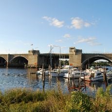
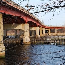
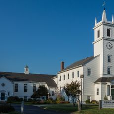
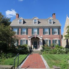
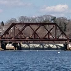
U.S. Route 1 in Massachusetts is a long road running from the Rhode Island border to the New Hampshire border, passing through dozens of towns along the way. It crosses Boston over major bridges, including the Leonard P. Zakim Bunker Hill Memorial Bridge and the Tobin Bridge, and shifts between wide modern lanes and older stretches lined with local shops and small buildings.

The road started in 1805 as the Newburyport Turnpike, built for stagecoaches and mail carriers, and was paved and numbered NE 1 in 1926 before joining the U.S. Route system in 1928. From the 1950s through the 1990s, it was rerouted and modernized several times as Interstate highways took over much of the long-distance traffic it once carried.

The road is known for its colorful roadside signs and themed restaurants that date back to the mid-20th century and still attract visitors today. Driving along it, you can spot traces of an American travel culture built around family outings and casual roadside entertainment.

The road shifts between fast highway sections and slower town stretches, so it helps to adjust your pace depending on where you are. Parking is available throughout, from street spots in residential areas to larger lots near restaurants and roadside stops.

Near Saugus, a large orange dinosaur statue once stood outside the Hilltop Steakhouse, a restaurant also known for its glowing neon cactus sign visible from the road. The restaurant has since closed, but many locals still remember these landmarks as a normal part of growing up in the area.

The community of curious travelers

AroundUs brings together thousands of curated places, local tips, and hidden gems, enriched daily by 60,000 contributors worldwide.

Start exploring
Location
Inception
1926
Part of
U.S. Route 1
GPS coordinates
41.81246,-71.35848
Latest update
March 3, 2026 10:14
Following the trails of Joël Dicker's novels: the places that inspired his thrillers

Joël Dicker's thrillers take place in real locations spread between Switzerland and the East Coast of America.

Around this place
Crook Point Bascule Bridge
United States of America

Crook Point Bascule Bridge

2.5 km
Iway
United States of America

Iway

3.6 km
India Point Park
United States of America

India Point Park

2.9 km
Washington Bridge
United States of America

Washington Bridge

2.5 km
Henderson Bridge
United States of America

Henderson Bridge

2.5 km
Nelson W. Aldrich House
United States of America

Nelson W. Aldrich House

3.4 km
United States of America

Wayland Square

3.1 km
Rumford Chemical Works and Mill House Historic District
United States of America

Rumford Chemical Works and Mill House Historic District

3 km
Squantum Association
United States of America

Squantum Association

2.8 km
India Point Railroad Bridge
United States of America

India Point Railroad Bridge

2.5 km
Phillip Walker House
United States of America

Phillip Walker House

2 km
United States of America

Bold Point

2.7 km
World War I Memorial
United States of America

World War I Memorial

1.3 km
Newman Congregational Church
United States of America

Newman Congregational Church

3.3 km
James Dennis House
United States of America

James Dennis House

2.6 km
Oddfellows' Hall
United States of America

Oddfellows' Hall

2 km
Boston and Providence Railroad Bridge
United States of America

Boston and Providence Railroad Bridge

2.5 km
Wayland Historic District
United States of America

Wayland Historic District

3.1 km
Blackstone Park Historic District
United States of America

Blackstone Park Historic District

3 km
Return Sludge Pumping Station, Fields Point Sewage Treatment Plant
United States of America

Return Sludge Pumping Station, Fields Point Sewage Treatment Plant

3.2 km
Fuller Rock Light
United States of America

Fuller Rock Light

2.7 km
Stimson Avenue Historic District
United States of America

Stimson Avenue Historic District

3.5 km
Sassafras Point Light
United States of America

Sassafras Point Light

3.1 km
Chemical Building, Fields Point Sewage Treatment Plant
United States of America

Chemical Building, Fields Point Sewage Treatment Plant

3.3 km
Washington Park Sewage Pumping Station
United States of America

Washington Park Sewage Pumping Station

3.5 km
Omega Pond Railroad Bridge
United States of America

Omega Pond Railroad Bridge

3.1 km
Nathaniel Daggett House
United States of America

Nathaniel Daggett House

2.8 km
Hope-Power-Cooke Streets Historic District
United States of America

Hope-Power-Cooke Streets Historic District

3.6 km
Show the full map
Reviews
Share your experience

No review yet

Discussions
Start a discussion...

No discussion yet

« U.S. Route 1 in Massachusetts - section of U.S. Highway in Massachusetts, United States » is provided by Around Us (aroundus.com). Images and texts are derived from Wikimedia project under a Creative Commons license. You are allowed to copy, distribute, and modify copies of this page, under the conditions set by the license, as long as this note is clearly visible.

Discover hidden gems everywhere you go!

From secret cafés to breathtaking viewpoints, skip the crowded tourist spots and find places that match your style. Our app makes it easy with voice search, smart filtering, route optimization, and insider tips from travelers worldwide. Download now for the complete mobile experience.

Around Us App Screenshot

A unique approach to discovering new places

Le Figaro

All the places worth exploring

France Info

A tailor-made excursion in just a few clicks

20 Minutes

Around Us
Travel Guide & Maps
Download

Send to your phone

QR Code
1

Open the camera app on your mobile.

2

Point at the QR code with your camera. A notification will appear.

3

Tap the notification to open the link.