Enable Location

We need your location to show you interesting places around you

Discover nearby places

Find interesting locations and hidden gems around you

Precise directions

Get accurate directions and distances to places

Your location is never shared with other users. It's only used when you tap the location button.

Susquehannock State Park

Log in to your account

Start exploring — it's free

Trusted by 62,370 travelers worldwide

Continue with Google
Continue with Apple
or

We will send you a code to connect

By continuing, you accept our Terms and Conditions and our Privacy Policy

Check your inbox

We've sent a pincode in your inbox. Please enter the code below.

Susquehannock State Park

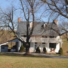
Susquehannock State Park, State park in Drumore Township, Pennsylvania, US.

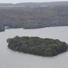
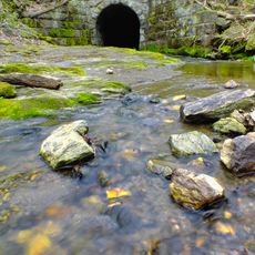
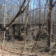
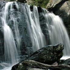
Susquehannock State Park is a protected area covering 225 acres with forest trails and multiple viewpoints overlooking the Susquehanna River. The landscape alternates between dense woodlands and open vistas along high cliffs that rise directly from the shoreline.

The park was established in 1965 by the Pennsylvania Department of Conservation and Natural Resources to preserve natural areas near Lancaster County. Its creation reflects a broader effort to protect this important river landscape for future generations.

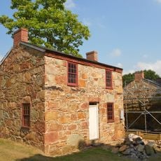
The park takes its name from the Susquehannock people, who engaged in trade with European settlers across this region. Visitors walking through the area encounter remnants of this indigenous heritage woven into the local landscape.

The park has marked hiking trails at different difficulty levels and parking areas at the main entrance. Visitors should wear sturdy footwear and be prepared for uneven terrain and steep drop-offs near the viewpoints.

Hawk Point Overlook offers unobstructed river views from about 116 meters (380 feet) above the water. On clear days, visitors can observe the shifting colors and movement of the water from this exceptionally high vantage point.

The community of curious travelers

AroundUs brings together thousands of curated places, local tips, and hidden gems, enriched daily by 60,000 contributors worldwide.

Start exploring
Location
Inception
1965
GPS coordinates
39.81170,-76.29140
Latest update
December 11, 2025 18:04
Around this place
Safe Harbor Dam
United States of America

Safe Harbor Dam

14.9 km
Conowingo Bridge
United States of America

Conowingo Bridge

16.4 km
Norman Wood Bridge
United States of America

Norman Wood Bridge

2.8 km
Baumgardener's Covered Bridge
United States of America

Baumgardener's Covered Bridge

13.2 km
Robert Fulton Birthplace
United States of America

Robert Fulton Birthplace

11.2 km
Safe Harbor Bridge
United States of America

Safe Harbor Bridge

14.9 km
Colemanville Covered Bridge
United States of America

Colemanville Covered Bridge

10.6 km
Lime Valley Covered Bridge
United States of America

Lime Valley Covered Bridge

17.3 km
Indian Steps Cabin
United States of America

Indian Steps Cabin

9.2 km
Muddy Creek Forks Historic District
United States of America

Muddy Creek Forks Historic District

15.7 km
White Rock Forge Covered Bridge
United States of America

White Rock Forge Covered Bridge

17.3 km
Wildfell
United States of America

Wildfell

18.9 km
McCalls Ferry Farm
United States of America

McCalls Ferry Farm

5.7 km
Coulsontown Cottages Historic District
United States of America

Coulsontown Cottages Historic District

9.8 km
Duncan Island
United States of America

Duncan Island

8.3 km
Holtwood Environmental Preserve
United States of America

Holtwood Environmental Preserve

3.4 km
Delta Trestle Bridge, Maryland and Pennsylvania Railroad
United States of America

Delta Trestle Bridge, Maryland and Pennsylvania Railroad

9.8 km
Guinston United Presbyterian Church
United States of America

Guinston United Presbyterian Church

17.3 km
Berkley Crossroads Historic District
United States of America

Berkley Crossroads Historic District

18.1 km
Whiteford-Cardiff Historic District
United States of America

Whiteford-Cardiff Historic District

11.4 km
Mill Green Historic District
United States of America

Mill Green Historic District

16.7 km
United States of America

Rigbie House

18.5 km
Kirks Mills Historic District
United States of America

Kirks Mills Historic District

17 km
Gray Gables
United States of America

Gray Gables

18.6 km
Delta Historic District
United States of America

Delta Historic District

10.3 km
1719 Museum
United States of America

1719 Museum

18.9 km
Joshua Lowe House
United States of America

Joshua Lowe House

15.7 km
Kilgore Falls
United States of America

Kilgore Falls

17.6 km
Show the full map
« Susquehannock State Park - State park in Drumore Township, Pennsylvania, US » is provided by Around Us (aroundus.com). Images and texts are derived from Wikimedia project under a Creative Commons license. You are allowed to copy, distribute, and modify copies of this page, under the conditions set by the license, as long as this note is clearly visible.

Discover hidden gems everywhere you go!

From secret cafés to breathtaking viewpoints, skip the crowded tourist spots and find places that match your style. Our app makes it easy with voice search, smart filtering, route optimization, and insider tips from travelers worldwide. Download now for the complete mobile experience.

Around Us App Screenshot

A unique approach to discovering new places

Le Figaro

All the places worth exploring

France Info

A tailor-made excursion in just a few clicks

20 Minutes

Around Us
Travel Guide & Maps
Download

Send to your phone

QR Code
1

Open the camera app on your mobile.

2

Point at the QR code with your camera. A notification will appear.

3

Tap the notification to open the link.