Chest opened
+${chestReward.xp} XP
Explorer
NOUVEAU ×${chestReward.collectible.quantity}
tapez pour fermer
Chest locked

Open chests in the app

Around Us is built for your phone — chests unlock when you walk, explore and capture nearby places.

Enable Location

We need your location to show you interesting places around you

Discover nearby places

Find interesting locations and hidden gems around you

Precise directions

Get accurate directions and distances to places

Your location is never shared with other users. It's only used when you tap the location button.

Skillman

Log in to your account

Start exploring — it's free

Trusted by 72,881 travelers worldwide

Continue with Google
Continue with Apple
or

We will send you a code to connect

By continuing, you accept our Terms and Conditions and our Privacy Policy

Check your inbox

We've sent a pincode in your inbox. Please enter the code below.

Discussion Reviews 1 Photos
14.5k Popularity

Skillman, Census-designated place in Montgomery Township, New Jersey, United States

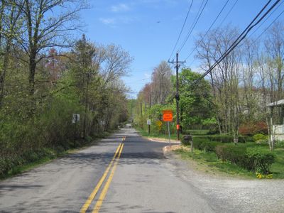
Skillman is a residential community in Montgomery Township, New Jersey, spread across approximately 1.5 square kilometers. The area features homes and open spaces at an elevation of about 42 meters, serving as part of the broader regional landscape.

The settlement was named after Joseph A. Skillman, who supplied mules for railroad construction during the 1870s. This work led to the establishment of a train station that helped the area develop.

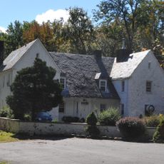
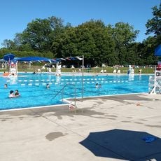
The Otto Kaufman Community Center serves as a central meeting place where residents gather for local events and programs throughout the year. People come here to connect with neighbors and participate in activities that bring the community together.

The area uses ZIP code 08558, which covers parts of Montgomery Township beyond just this location. This postal code is helpful to know when sending mail or packages to the region.

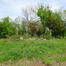
A former state hospital for epilepsy patients once occupied about 100 acres in the area. The facility had its own dairy, laundry operations, and even a movie theater for residents and staff.

The community of curious travelers

AroundUs brings together thousands of curated places, local tips, and hidden gems, enriched daily by 60,000 contributors worldwide.

Start exploring
Elevation above the sea
42 m
GPS coordinates
40.42820,-74.71230
Latest update
December 7, 2025 20:21
Around this place
Delaware and Raritan Canal
United States of America

Delaware and Raritan Canal

7.1 km
Highfields
United States of America

Highfields

4.7 km
Sourland Mountain
United States of America

Sourland Mountain

4.4 km
Sourland Mountain Preserve
United States of America

Sourland Mountain Preserve

4.8 km
Herrontown Woods Arboretum
United States of America

Herrontown Woods Arboretum

8.3 km
Tusculum
United States of America

Tusculum

7.8 km
Maybury Hill
United States of America

Maybury Hill

9 km
Witherspoon Street School for Colored Children
United States of America

Witherspoon Street School for Colored Children

9.4 km
Donald Grant Herring Estate
United States of America

Donald Grant Herring Estate

6.5 km
Mountain Avenue Historic District
United States of America

Mountain Avenue Historic District

8.6 km
Neshanic Mills
United States of America

Neshanic Mills

9 km
Joseph Stout House
United States of America

Joseph Stout House

3.5 km
Neshanic Station Lenticular Truss Bridge
United States of America

Neshanic Station Lenticular Truss Bridge

9.1 km
Rocky Hill Historic District
United States of America

Rocky Hill Historic District

7.1 km
Dirck Gulick House
United States of America

Dirck Gulick House

2.9 km
Mount Zion African Methodist Episcopal Church
United States of America

Mount Zion African Methodist Episcopal Church

1.4 km
Jeremiah Vandyke House
United States of America

Jeremiah Vandyke House

6.2 km
Reformed Dutch Church of Blawenburg
United States of America

Reformed Dutch Church of Blawenburg

2.5 km
River Road Historic Rural District
United States of America

River Road Historic Rural District

8 km
Ichabod Leigh House
United States of America

Ichabod Leigh House

6.4 km
Bridgepoint Historic District
United States of America

Bridgepoint Historic District

5.4 km
Maplewood
United States of America

Maplewood

2.9 km
Community Park Pool
United States of America

Community Park Pool

8.6 km
Neshanic Reformed Church
United States of America

Neshanic Reformed Church

7.8 km
Clover Hill Reformed Church
United States of America

Clover Hill Reformed Church

8.9 km
Blawenburg Historic District
United States of America

Blawenburg Historic District

2.4 km
Griggstown Historic District
United States of America

Griggstown Historic District

8.3 km
Clover Hill Historic District
United States of America

Clover Hill Historic District

8.9 km
Show the full map
Reviews
Share your experience

No review yet

Discussions
Start a discussion...

No discussion yet

« Skillman - Census-designated place in Montgomery Township, New Jersey, United States » is provided by Around Us (aroundus.com). Images and texts are derived from Wikimedia project under a Creative Commons license. You are allowed to copy, distribute, and modify copies of this page, under the conditions set by the license, as long as this note is clearly visible.

Discover hidden gems everywhere you go!

From secret cafés to breathtaking viewpoints, skip the crowded tourist spots and find places that match your style. Our app makes it easy with voice search, smart filtering, route optimization, and insider tips from travelers worldwide. Download now for the complete mobile experience.

Around Us App Screenshot

A unique approach to discovering new places

Le Figaro

All the places worth exploring

France Info

A tailor-made excursion in just a few clicks

20 Minutes

Around Us
Travel Guide & Maps
Download

Send to your phone

QR Code
1

Open the camera app on your mobile.

2

Point at the QR code with your camera. A notification will appear.

3

Tap the notification to open the link.