Enable Location

We need your location to show you interesting places around you

Discover nearby places

Find interesting locations and hidden gems around you

Precise directions

Get accurate directions and distances to places

Your location is never shared with other users. It's only used when you tap the location button.

Big Bushkill Creek

Log in to your account

Start exploring — it's free

Trusted by 61,833 travelers worldwide

Continue with Google
Continue with Apple
or

We will send you a code to connect

By continuing, you accept our Terms and Conditions and our Privacy Policy

Check your inbox

We've sent a pincode in your inbox. Please enter the code below.

Big Bushkill Creek

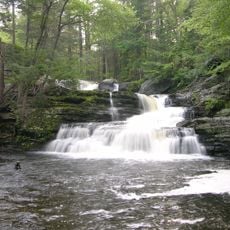
Big Bushkill Creek, Tributary stream in Pocono Mountains, Pennsylvania, US

Description

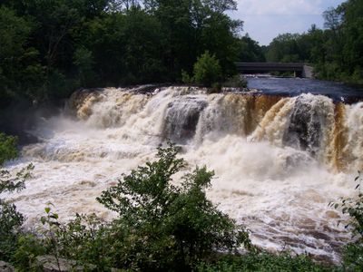
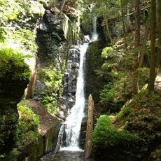
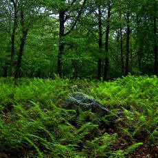
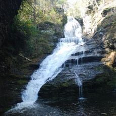
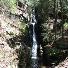
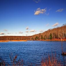
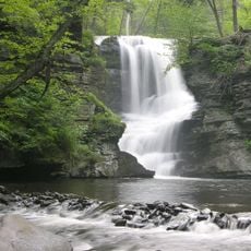
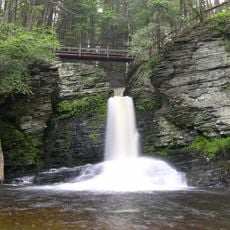
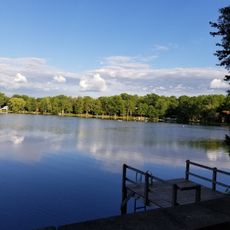
Big Bushkill Creek is a tributary in the Pocono Mountains that flows through Pike and Monroe Counties from Pecks Pond to the Delaware River. The stream winds through forest areas and creates diverse habitats for multiple fish species and aquatic life.

History

The creek developed as a natural drainage system within the Pocono region and adapted over time to local geological conditions. Scientific study of its ecosystem intensified during the 20th century, providing ongoing data about water quality and aquatic populations.

Culture

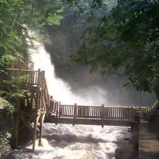
The waterway forms an essential part of the Resica Falls Scout Reservation, where generations of scouts experience outdoor education and learn directly from the natural environment.

Practical

Visitors who fish need a Pennsylvania fishing license and trout permit for the creek, which holds brook, brown, and rainbow trout throughout its course. Access points are found along roads and marked trails that approach the stream, particularly in areas near the Scout Reservation.

Did you know?

The creek system receives water from thirteen named tributaries including Little Bush Kill, Sand Hill Creek, and Dancing Ridge Run, creating an expansive water network. These smaller feeder streams contribute significant flow during wet seasons and support the main creek's overall discharge.

Location
GPS coordinates
41.28080,-75.08720
Latest update
December 14, 2025 16:46

AroundUs brings together thousands of curated places, local tips, and hidden gems, enriched daily by 60,000 contributors worldwide. Discover all places nearby (Pennsylvania).

Around this place
Lake Wallenpaupack
United States of America

Lake Wallenpaupack

19.5 km
Bushkill Falls
United States of America

Bushkill Falls

19.3 km
Delaware Water Gap National Recreation Area
United States of America

Delaware Water Gap National Recreation Area

20.3 km
Promised Land State Park
United States of America

Promised Land State Park

10.1 km
Dingmans Falls
United States of America

Dingmans Falls

17.2 km
Dingman's Ferry Bridge
United States of America

Dingman's Ferry Bridge

20.2 km
Silverthread Falls
United States of America

Silverthread Falls

17.7 km
Delaware State Forest
United States of America

Delaware State Forest

18.7 km
Fulmer Falls
United States of America

Fulmer Falls

15.1 km
Deer Leap Falls
United States of America

Deer Leap Falls

15.2 km
Van Campen's Inn
United States of America

Van Campen's Inn

20.8 km
Lacawac
United States of America

Lacawac

20.5 km
Marie Zimmermann Farm
United States of America

Marie Zimmermann Farm

19.4 km
Factory Falls
United States of America

Factory Falls

15 km
Dingman's Ferry Dutch Reformed Church
United States of America

Dingman's Ferry Dutch Reformed Church

19.2 km
Patriotic Order Sons of America Washington Camp 422
United States of America

Patriotic Order Sons of America Washington Camp 422

20.9 km
Brodhead Farm
United States of America

Brodhead Farm

20.2 km
Nyce Farm
United States of America

Nyce Farm

20.4 km
Lord House
United States of America

Lord House

9.9 km
Bridge in Dreher Township
United States of America

Bridge in Dreher Township

20.4 km
Promised Land State Park Whittaker Lodge District
United States of America

Promised Land State Park Whittaker Lodge District

9.3 km
Palmyra Township Public Beach
United States of America

Palmyra Township Public Beach

20.3 km
Promised Land State Park-Bear Wallow Cabins
United States of America

Promised Land State Park-Bear Wallow Cabins

11.4 km
High Knob Fire Tower
United States of America

High Knob Fire Tower

3.8 km
Smith-Rosenkrans House
United States of America

Smith-Rosenkrans House

21.8 km
Peters Valley Historic District
United States of America

Peters Valley Historic District

21.7 km
Nyce-Depue Farm
United States of America

Nyce-Depue Farm

20.8 km
Deer Beach
United States of America

Deer Beach

20 km
Show the full map
« Big Bushkill Creek - Tributary stream in Pocono Mountains, Pennsylvania, US » is provided by Around Us (aroundus.com). Images and texts are derived from Wikimedia project under a Creative Commons license. You are allowed to copy, distribute, and modify copies of this page, under the conditions set by the license, as long as this note is clearly visible.

Discover hidden gems everywhere you go!

From secret cafés to breathtaking viewpoints, skip the crowded tourist spots and find places that match your style. Our app makes it easy with voice search, smart filtering, route optimization, and insider tips from travelers worldwide. Download now for the complete mobile experience.

Around Us App Screenshot

A unique approach to discovering new places

Le Figaro

All the places worth exploring

France Info

A tailor-made excursion in just a few clicks

20 Minutes

Around Us
Travel Guide & Maps
Download

Send to your phone

QR Code
1

Open the camera app on your mobile.

2

Point at the QR code with your camera. A notification will appear.

3

Tap the notification to open the link.