Enable Location

We need your location to show you interesting places around you

Discover nearby places

Find interesting locations and hidden gems around you

Precise directions

Get accurate directions and distances to places

Your location is never shared with other users. It's only used when you tap the location button.

Delaware State Forest

Log in to your account

Start exploring — it's free

Trusted by 66,551 travelers worldwide

Continue with Google
Continue with Apple
or

We will send you a code to connect

By continuing, you accept our Terms and Conditions and our Privacy Policy

Check your inbox

We've sent a pincode in your inbox. Please enter the code below.

Discussion Reviews 1 Photos
3.4k Popularity

Delaware State Forest, Protected forest area in Monroe and Pike Counties, Pennsylvania.

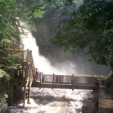
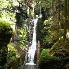
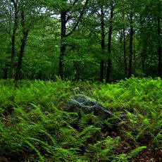
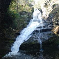
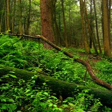
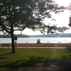
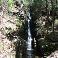
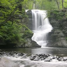
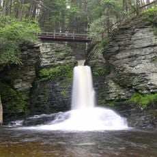
Delaware State Forest is a protected forest reserve spread across four counties in Pennsylvania, covering mixed woodland, wetlands, and natural lakes. Several distinct recreation areas are scattered throughout, each reachable by trail and offering a different setting, from open meadows to dense tree cover.

Heavy logging during the 1800s stripped much of this land bare, leaving behind a landscape that had little resemblance to the forest seen today. Pennsylvania began buying back these lands in 1897 as part of its first forest reserve program, slowly allowing the woodland to grow back.

The Pennsylvania Bureau of Forestry maintains the forest through ecosystem management, focusing on natural patterns while addressing local community requirements.

The forest can be reached by car through several entry points, each leading to a different part of the reserve with its own trails and lakes. From spring through fall the conditions are most comfortable, but weather in this part of Pennsylvania can change fast, so layered clothing is a good idea.

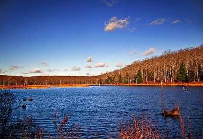
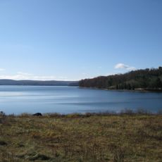
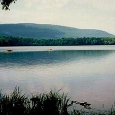
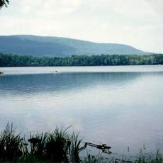
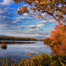
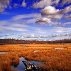
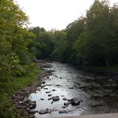
Bruce Lake Natural Area sits around a spring-fed glacial lake shaped by the last ice age, making it one of the few natural lakes of its kind in the region. Just nearby, Egypt Meadow Lake was built by the Civilian Conservation Corps in 1935, so two lakes that look alike actually have very different origins.

The community of curious travelers

AroundUs brings together thousands of curated places, local tips, and hidden gems, enriched daily by 60,000 contributors worldwide.

Start exploring
Location
Operator
Pennsylvania Bureau of Forestry
GPS coordinates
41.12330,-75.16640
Latest update
March 3, 2026 13:57
Around this place
Pocono Raceway
United States of America

Pocono Raceway

29.9 km
Lake Wallenpaupack
United States of America

Lake Wallenpaupack

32.8 km
Bushkill Falls
United States of America

Bushkill Falls

13.1 km
Delaware Water Gap National Recreation Area
United States of America

Delaware Water Gap National Recreation Area

21.4 km
Grey Towers National Historic Site
United States of America

Grey Towers National Historic Site

36.8 km
Promised Land State Park
United States of America

Promised Land State Park

21.5 km
Dingmans Falls
United States of America

Dingmans Falls

25.9 km
Stokes State Forest
United States of America

Stokes State Forest

31.7 km
Dingman's Ferry Bridge
United States of America

Dingman's Ferry Bridge

27.9 km
Camelback Mountain
United States of America

Camelback Mountain

18 km
Big Pocono State Park
United States of America

Big Pocono State Park

17.6 km
Camelbeach Waterpark
United States of America

Camelbeach Waterpark

17.8 km
Tobyhanna State Park
United States of America

Tobyhanna State Park

21.5 km
Swartswood State Park
United States of America

Swartswood State Park

29.7 km
Gouldsboro State Park
United States of America

Gouldsboro State Park

26.1 km
Pond Eddy Bridge
United States of America

Pond Eddy Bridge

45.6 km
United States of America

Tannersville Cranberry Bog

11.9 km
Silverthread Falls
United States of America

Silverthread Falls

26.3 km
Pahaquarry Copper Mine
United States of America

Pahaquarry Copper Mine

15 km
Kalahari Indoor Waterpark
United States of America

Kalahari Indoor Waterpark

19.3 km
Fulmer Falls
United States of America

Fulmer Falls

24.5 km
United States of America

St. Paul's Abbey

35.3 km
Deer Leap Falls
United States of America

Deer Leap Falls

24.5 km
Milford–Montague Toll Bridge
United States of America

Milford–Montague Toll Bridge

36.9 km
Minisink Archaeological Site
United States of America

Minisink Archaeological Site

15 km
Pocono Manor Historic District
United States of America

Pocono Manor Historic District

8.9 km
Flat Brook
United States of America

Flat Brook

27.7 km
Van Campen's Inn
United States of America

Van Campen's Inn

23.5 km
Show the full map
Reviews
Share your experience

No review yet

Discussions
Start a discussion...

No discussion yet

« Delaware State Forest - Protected forest area in Monroe and Pike Counties, Pennsylvania » is provided by Around Us (aroundus.com). Images and texts are derived from Wikimedia project under a Creative Commons license. You are allowed to copy, distribute, and modify copies of this page, under the conditions set by the license, as long as this note is clearly visible.

Discover hidden gems everywhere you go!

From secret cafés to breathtaking viewpoints, skip the crowded tourist spots and find places that match your style. Our app makes it easy with voice search, smart filtering, route optimization, and insider tips from travelers worldwide. Download now for the complete mobile experience.

Around Us App Screenshot

A unique approach to discovering new places

Le Figaro

All the places worth exploring

France Info

A tailor-made excursion in just a few clicks

20 Minutes

Around Us
Travel Guide & Maps
Download

Send to your phone

QR Code
1

Open the camera app on your mobile.

2

Point at the QR code with your camera. A notification will appear.

3

Tap the notification to open the link.